
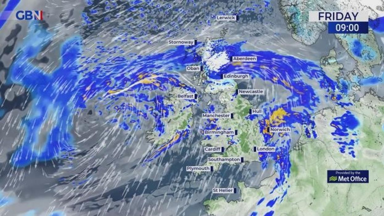


Very strong winds of up to 70mph and heavy snow is set to batter the UK today as Storm Kathleen causes chaos for Britons.
The Met Office warns that "rain, transient snow and unseasonably strong winds" will move towards the UK and Ireland from the southwest.
Yellow weather warnings for snow, wind and rain remain in place until 10pm on Saturday.
Snow landed in central and northern Scotland overnight as heavy rain sweeps in across southern Scotland.
Very strong winds of up to 70mph and heavy snow is set to batter the UK today as Storm Kathleen causes chaos for Britons
|WXCHARTS
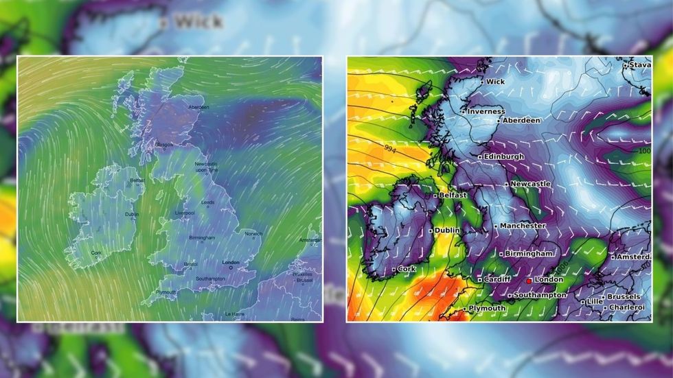
Severe gales are expected to hit Britain east and north on Friday as Storm Kathleen - the 11th named storm of this storm season - strikes.
Deputy Chief Meteorologist Christoph Almond said: "Gusts of 50 mph are expected quite widely on Saturday, while some exposed spots, particularly on the coast, will see 60 to 70 mph gusts with large waves also likely."
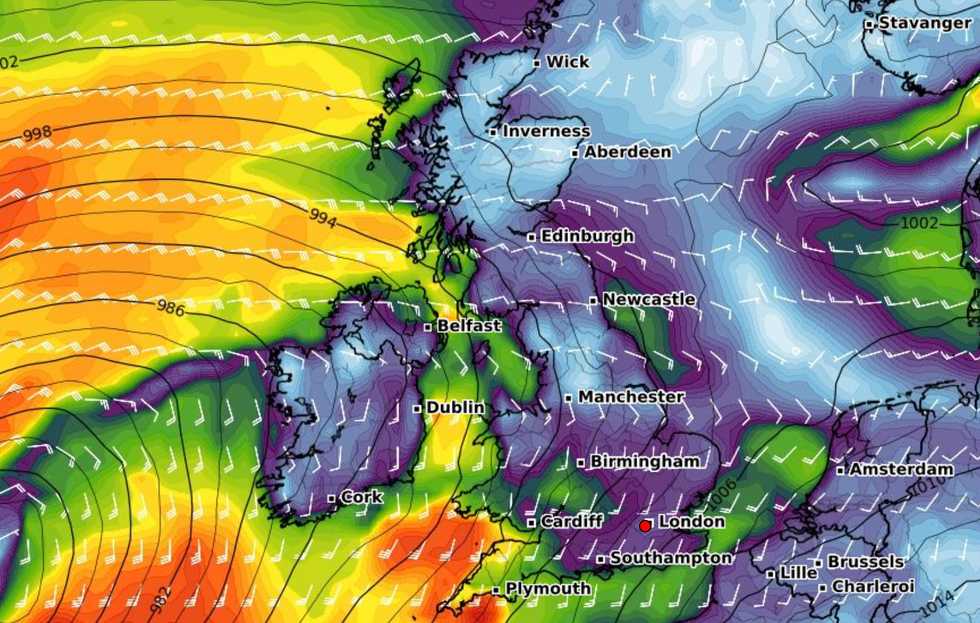
The area of low-pressure could also push more windy and rainy conditions on Saturday.
Weather experts suggest that very high winds will hit overnight on Friday and into Saturday - bringing gusts potentially in excess of 80mph in exposed parts of western Ireland initially, before gales spread.
LATEST DEVELOPMENTS:
The Met Office warns that "rain, transient snow and unseasonably strong winds" will move towards the UK and Ireland from the southwest
|WXCHARTS
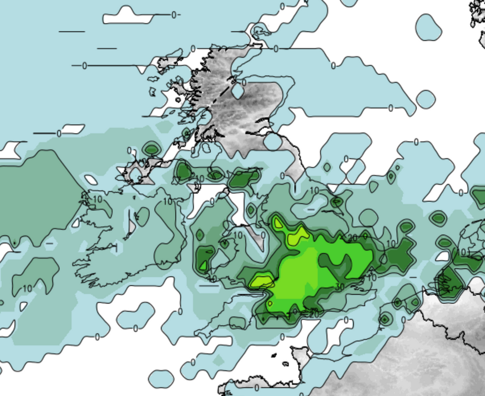
A storm map shows severe gales are set to hit Britain east and north on Friday
|Net Weather
Yellow weather warning for wind will remain in place across western Britain and Northern Ireland until Saturday night.
Net Weather forecaster, Paul Michaelwaite said: "The winds will stay strong in the west and especially the north of the UK through much of the remainder of the weekend as well, slowly becoming more limited to the far north, but perhaps taking until later on Monday to final clear away from Northern Scotland."
In contrast, high temperatures of up to 22C could be seen in parts of East Anglia and Southeast England over the weekend.
A Met Office spokesperson added: "As this area of low pressure moves north-eastwards, it will be drawing up unseasonably warm air from Iberia for a time.
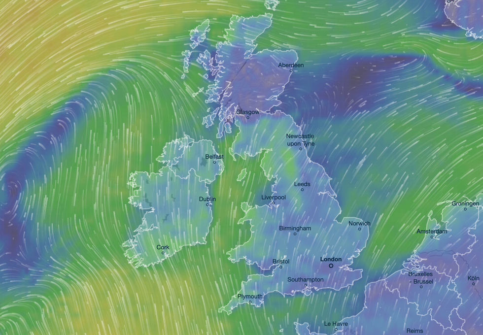
The area of low-pressure could also push more windy and rainy conditions on Saturday
|Ventusky
"This warm air will see temperatures rise across the UK, causing some areas to see values above 20°C for the first time this year.
"The locations likely to see the highest temperatures will be in parts of East Anglia and Southeast England where 21°C or 22°C is not out of the question briefly on Saturday."
Conditions are expected to settle next week with temperatures a little above average.