


Freakish heat powering the jet stream across the Continent threatens to keep Britain in the wash cycle through much of April.
Tropical air from the Middle East will clash with Polar air further north, opening the gates to a barrage of Atlantic weather systems.
Around seven low-pressure ‘cyclones’ could barrel into Britain through the coming weeks, according to forecasting models.
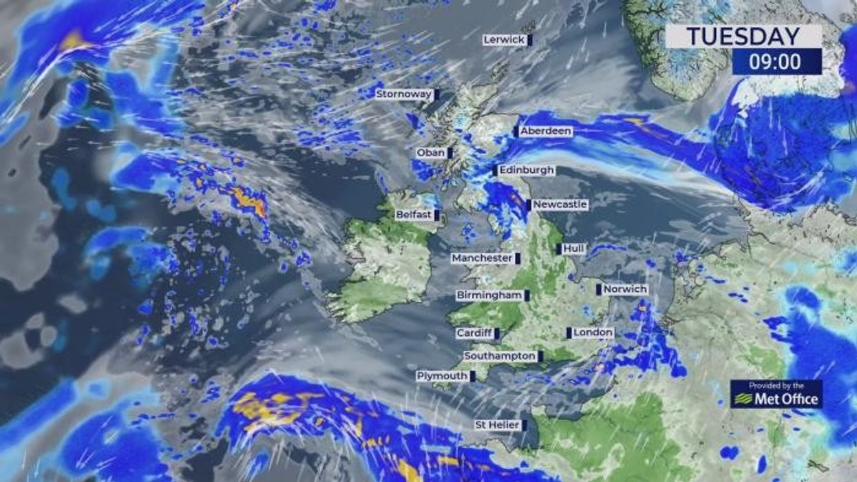
The UK’s rain woes show no sign of abating before the end of April as warnings mount to prepare for spring floods.
Jim Dale, meteorologist for British Weather Services, and social commentator, said: “We are under the influence of modified Polar air which is meeting sub-tropical air over Europe coming in from the Middle East, and this is driving the jet stream to create instability in the atmosphere.
“It is pulling bands of rain into Britain and will continue to do this for at least the next 10 days to two weeks.
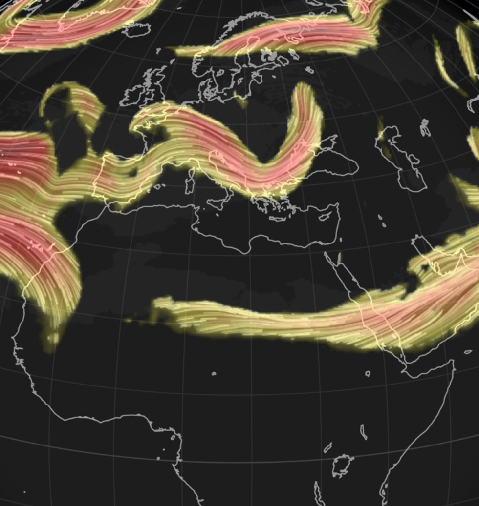
Jet stream dives across Britain
|NETWEATHER
“With this, there will be an ongoing risk of flooding as the water tables become saturated, and this could cause problems as we head through the season.”
Britain’s weather will be affected by unusual weather events as far off as Egypt and Libya, he said.
High pressure over the Middle East is pushing tropical air through the Continent and into colder air over western and northern Europe.
The collision of air masses vastly differing in temperature has shunted the jet stream and spawned Britain’s miserable spring outlook.
Dale said: “Air is coming out of Egypt and Libya and into Europe, and they are really starting to break records over there.
“In contrast, cooler air is coming over us, and this is turning the jet stream into a conveyor belt of unsettled weather systems.
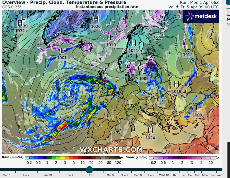
Lows head in off the Atlantic
|WX CHARTS
“This sets the scene for the pattern of weather over the UK for at least the next two weeks.”
Temperatures across southern and eastern Europe have hit near-record highs over the past weeks with the trend expected to continue.
A swerve in the jet stream across northern and western Europe along with high pressure over Greenland has encouraged cooler, damper conditions.Forecasters agree, Britons are likely to be keeping the brollies up through April with no sign of much change through the month.
Weather models show the jet whipping in around seven low-pressure systems through the month, each loaded with bands of heavy rain.
The Greenland High–a region of high pressure which has nudged the jet stream closer to Britain–shows signs of weakening through the end of the month, spelling better news for the UK.
Monthly predictions from Atmospheric G2 and The Weather Company suggest a pattern of persistent rain across Europe and Britain.
A spokesman said: “Precipitation forecasts are in good agreement for a very wet month across the mainland in April.
“As the summer progresses, the models suggest the wetter areas will lift farther north, with drier-than-normal conditions becoming established in the mainland.”
Persistent rain through the coming weeks will put parts of the country already drenched at an increased risk of spring flooding.
The Environment Agency currently has 95 flood alerts in force and two more serious flood warnings in the southwest.
A spokesman said: “The weather over the next two weeks will continue unsettled. “Groundwater levels are expected to continue rising steadily over the next week.
“Property flooding is expected and sewage systems may become inundated.”