


Heavy snow is set to hit the UK by the end of this month in a whiteout which could cover the entire country, forecasters have said.
The freeze, set to hit northern Scotland by the middle of next week, will work its way down the British Isles before smothering the south coast, according to MetDesk.
The forecast has been visualised in a series of foreboding maps which show rainfall making way for cold snaps and snow which will career across the UK and Ireland before touching down on continental Europe.
The first snows should dust north-west Scotland by February 21, and will continue in the north of the country for a few days before heading into northern England by the weekend.
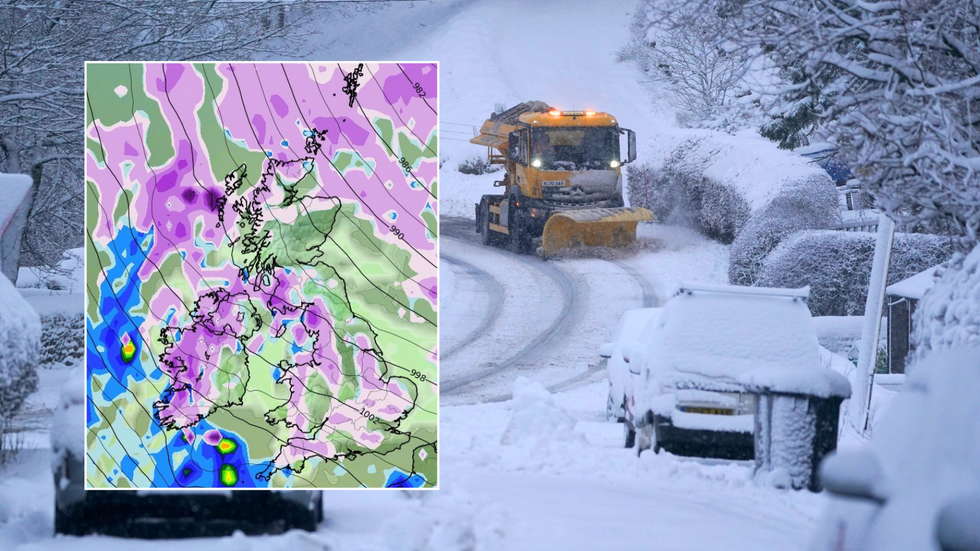
Foreboding maps show rainfall making way for cold snaps and snow across the UK
|PA/WXCharts
As the week continues, snows are expected to progress down Ireland and the east of the UK, with western Wales, Lancashire and even Cornwall waking up to the white stuff on Monday morning.
By mid-week, south Wales, the Midlands and southern England should see extended adverse weather, with a late wintry blast showering the areas with rain and heavier snow.
It’s still too soon for official warnings, but the Met Office has acknowledged the potential for snowfall as winter comes to a close.
Their long-range weather forecaster said: “During late February and early March, there is a higher-than-normal likelihood of northerly or easterly winds dominating, which would increase the chance of colder and drier than average conditions.
LATEST DEVELOPMENTS: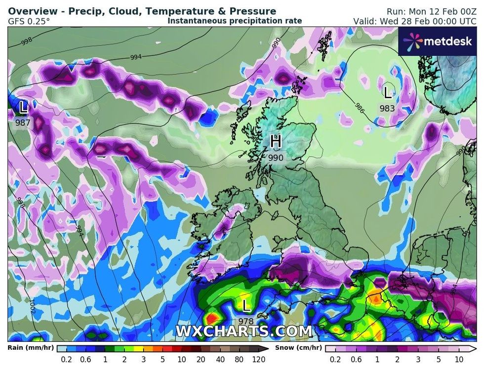
South Wales, the Midlands and southern England should see extended adverse weather by mid-week next week
|WXCharts
“Spells of milder and wetter weather are still likely to occur at times, especially in the south and southwest, with the potential for snow on the boundary between milder and colder air.”
The predictions come amid widespread snow disruption across Scotland, with amber alerts and school closures impacting Wales and the Midlands over the last few days.
Parents in Flintshire in Wales were furious after the county decided to shut all 88 of its schools, while travel warnings were issued throughout the region.
Last week, National Highways’ Amy Shaw said: “Freezing conditions bring hazards such as snow and ice, so take every possible step to understand your journey in advance and allow lots of extra time when travelling to prepare for the unexpected.
“It is therefore always important to plan ahead for your journey, check the weather forecasts, and if weather conditions become challenging, adjust your driving behaviour and take extra care.”
Met Office snow guidance tells those affected to prepare for reduced access to amenities and power cuts, and warns people to pack essentials if they risk being cut off by adverse conditions.
This latest Arctic blast follows significant storms across the UK – Storm Isha at the end of January left two men dead, tens of thousands without power, and grounded hundreds of flights.
Isha was swiftly followed by Storm Jocelyn, which saw hurricane-force winds batter the country in what was the tenth named storm since the UK season began in September.