


The UK is set to be hit with a wave of snowfall, with some places seeing up to 10 inches.
An Arctic blast is set to freeze the country and bring travel disruption as Amber weather warnings have been put in place.
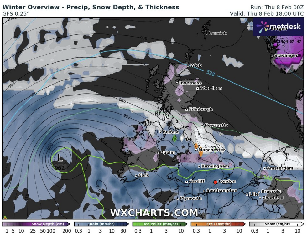
Up to 10 inches of snow could fall on higher ground in the Peak District and the southern Pennines, which are under an amber warning from noon until 6pm on Thursday.
Meanwhile Newcastle, the Scottish Borders, Dumfries and Galloway, central belt, Fife and Grampian are set to be covered by a snow and ice bomb.
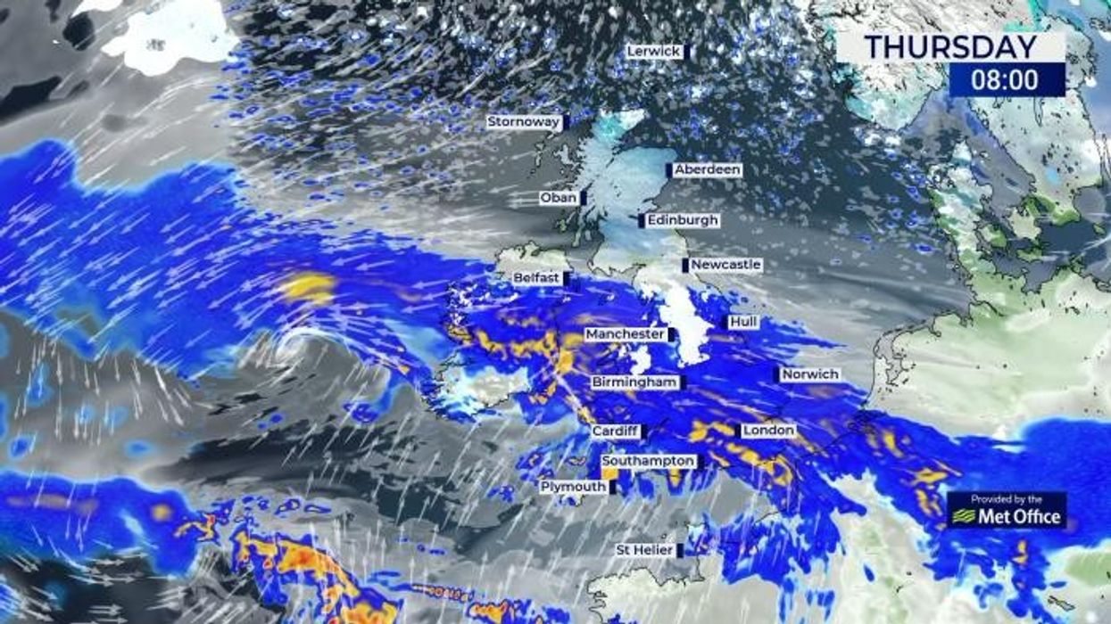
Snow is set to hit large parts of the UK today
|WXCharts.com
Met Office chief meteorologist Jason Kelly said: "Cold across most areas away from the south the UK, will be met by moisture-laden air spreading from the south.
"Where milder air encounters cold air, rain, sleet and snow will develop, bringing the risk of 2-5cm of snow in places, whilst some other areas see little or no snow.
"Over higher ground 5-10cm is likely, while locations above 200m within the Amber warning areas could see up to 25cm of snowfall. Snow here could drift in strong to gale force easterly winds.
"As the milder air from the south gradually pushes northwards the focus for wintry hazards also shifts northward with warnings issued for Scotland."
The freezing conditions are a result of an Arctic air mass pushing down over the UK colliding with a rain front moving north-east across England and Wales.
LATEST DEVELOPMENTS
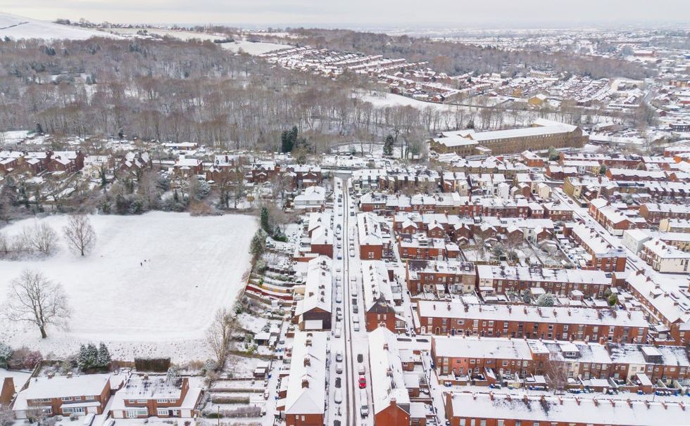
Large parts of the UK are set to see snowfall
|PA
One yellow rain warning covers much of southern England and south-east Wales. The warning started from 2am earlier today and lasts to 6am on Friday.
Another yellow snow and ice warnings covers southern and central Scotland from 6pm on Thursday to 3pm on Friday.
Meanwhile in Northern Ireland, the warning starts from 10am on Thursday until 6pm on Friday. Up to 3-4 inches of snow could fall in both Scotland and Northern Ireland
According to the Met Office temperatures fell to below zero in several places last night. The Lairg area of northern Scotland fell to -7c.
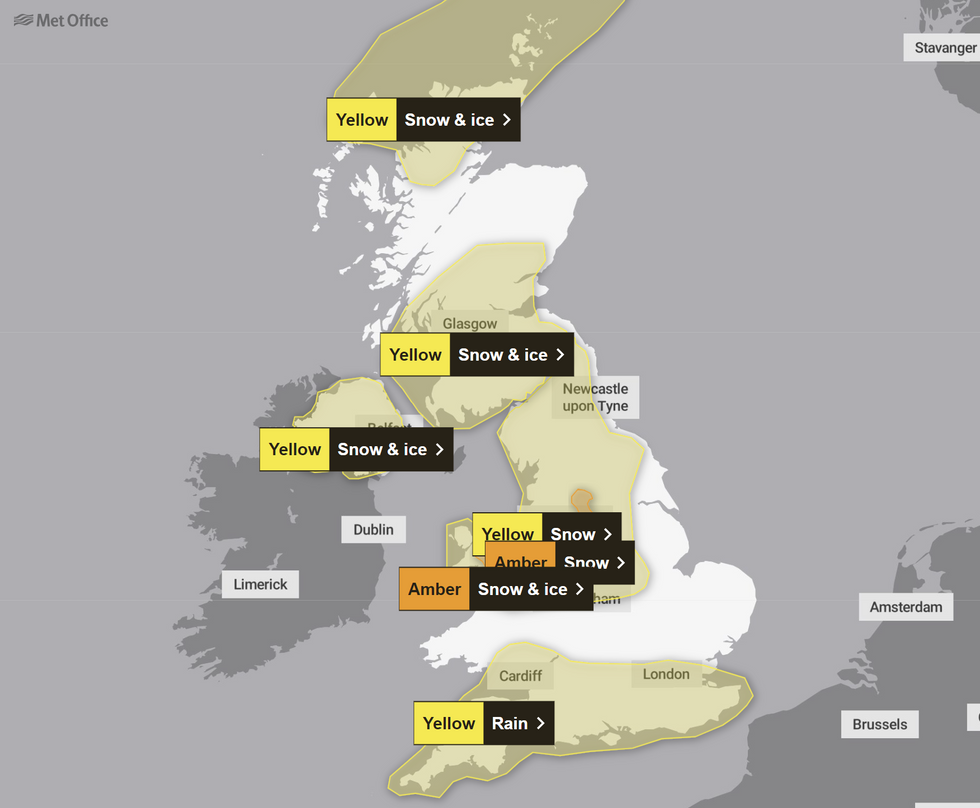
The weather alerts have been issued across the UK
|Met Office
There have also been warnings of potential disruption to travel throughout today.
National network manager at National Highways Amy Shaw said: "Freezing conditions bring hazards such as snow and ice, so take every possible step to understand your journey in advance and allow lots of extra time when travelling to prepare for the unexpected.
"It is therefore always important to plan ahead for your journey, check the weather forecasts, and if weather conditions become challenging, adjust your driving behaviour and take extra care."