
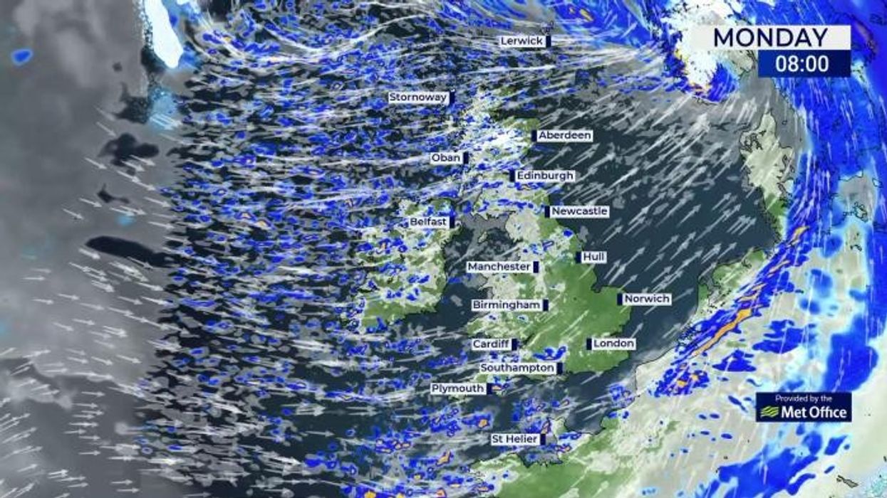


Storm Jocelyn is set to strike the UK just hours after Storm Isha hit with hurricane-force gales.
The Met Office has issued a yellow weather warning for wind on Tuesday and Wednesday, with an amber alert for wind on the northern coast of Scotland.
Storm Jocelyn is forecast to bring windy conditions right across the UK with northern areas likely to be worst affected.
It comes after Storm Isha has caused hundreds of flights to be diverted, some ending up more than 1,000 miles away due to pilots unable to land in the extreme conditions.
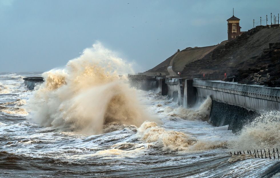
Storm hit the coast near Blackpool
|PA
The storm was named by Met Eireann and is the tenth named storm to hit the UK since the season began in September.
The record number of named storms in one year is when the Met Office began the practice in 2015/16, with Storm Katie being the eleventh and final storm of the season.
A warning is now in place from Tuesday at 6pm to the early hours of Wednesday morning.
According to WXCharts, there will be up to 5mm of rainfall an hour for much of the west coast of the UK, and snow in parts of Scotland.
LATEST DEVELOPMENTS
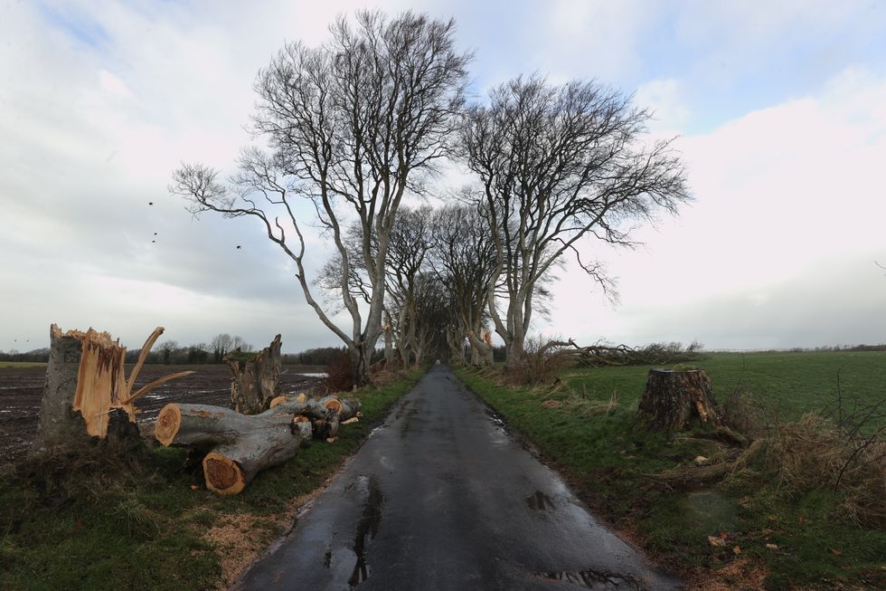
One of a number of trees in Northern Ireland made famous by the TV series Game Of Thrones that have been damaged and felled by Storm Isha
|PA
Flights were diverted all over the place to avoid the dangerous winds, and planes are believed to have ended up in Paris, Cologne in Germany and Budapest.
Met Office chief meteorologist Steve Willington, said: "Although this system will be a step down relative to Storm Isha, with the damage and clean up still underway, we could potentially see more impacts from Storm Jocelyn.
"Outbreaks of heavy rain on Tuesday could bring rainfall accumulations of 15 to 20 mm quite widely with 40 to 50 mm over higher ground in southwest Scotland, the Scottish Highlands and parts of northwest England.
"Wind gusts are expected to reach 55 to 65 mph across northwestern Scotland while there is potential for winds to gust to 75 to 80 mph in a few places, in particular exposed parts of the Western Isles and coastal northwest Scotland early on Wednesday morning."
Transport infrastriucture across Scotland and the north of England. Travellers are being encouraged to check ahead.
National operations manager for Resilience at Transport Scotland said: "The trunk road network is recovering well from the worst impacts of Storm Isha.
"Some roads and bridges do remain disrupted and so please continue to check before you travel until conditions improve and the clear-up is complete.
"Focus will soon shift to the next named storm, Jocelyn, for later this week, and preparations are already underway with rail, aviation and ferries colleagues to ensure we are as ready as we can be.