


The UK is set to bathe in a mini-heatwave for weeks, with the Met Office predicting that dry spells, sunshine and above-average temperatures will dominate the weather sphere.
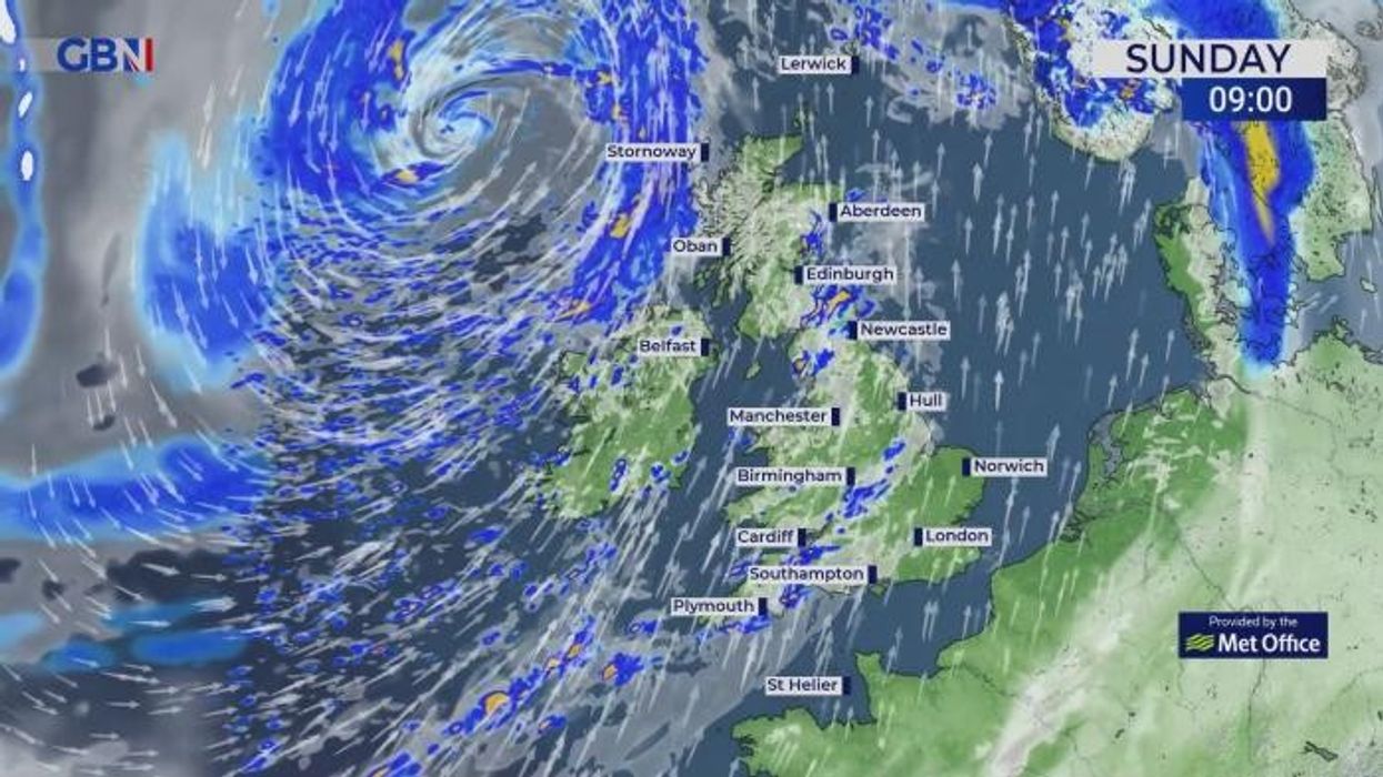
Britons currently suffering the effects of Storm Kathleen will be excited to learn that the cold, wet conditions experienced in March will soon be comfortably in the rear-view mirror.
Yellow weather warnings were issued across the west coast of England and Wales yesterday, with just one warning continuing this morning in Scotland.
However, Ireland suffered the worst battering with Met Eireann issuing an Orange wind warning yesterday as a low-pressure system collided with the jet stream.
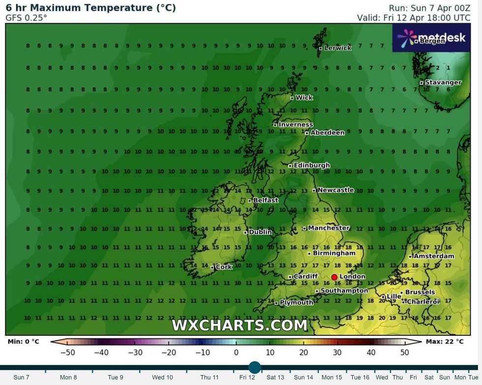
Temperatures will start to become warmer as we edge towards the end of the month
|WX Charts
Looking forward though, Britons should be starting to feel the first touches of summer as much of the UK is expected to experience sunshine and an extended dry spell.
According to the Met Office long-range forecasts for both mid-April (April 11 - 20) and early May, sunshine could dominate a lot of the UK, especially in the south and east.
The forecaster added that temperatures will most likely be “above normal for the period as a whole”.
The Met Office’s long-range forecast for April 11 to April 20 reads: “Southern and eastern areas are likely to have some decent drier spells of weather with some good sunshine at times.
LATEST DEVELOPMENTS: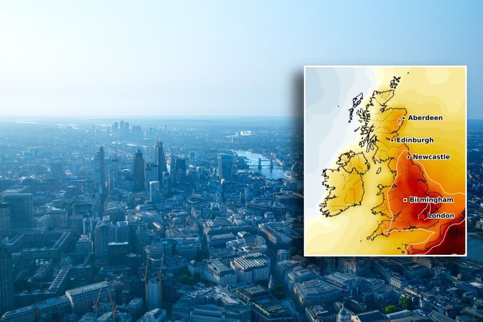
The south and east will see the best conditions as we approach May
|Getty Images/WX Charts
“Here, whilst some rain is still likely, this probably less heavy and much less frequent than recent weeks.
“Above average temperatures are most likely overall, although some cooler interludes are possible at times, especially in the north.”
The forecast for April 21 to May 5 then continued: “Through the second half of April and the beginning of May, there is no strong signal for any one weather pattern to dominate over another.
“As such, further rain and showers are likely at times, perhaps most-frequently in the north and northwest.
“There is also a reasonable chance of some drier and sunnier spells of weather, with these likely being more frequent towards the south and east.
“Temperatures most likely above normal for the period as a whole.”
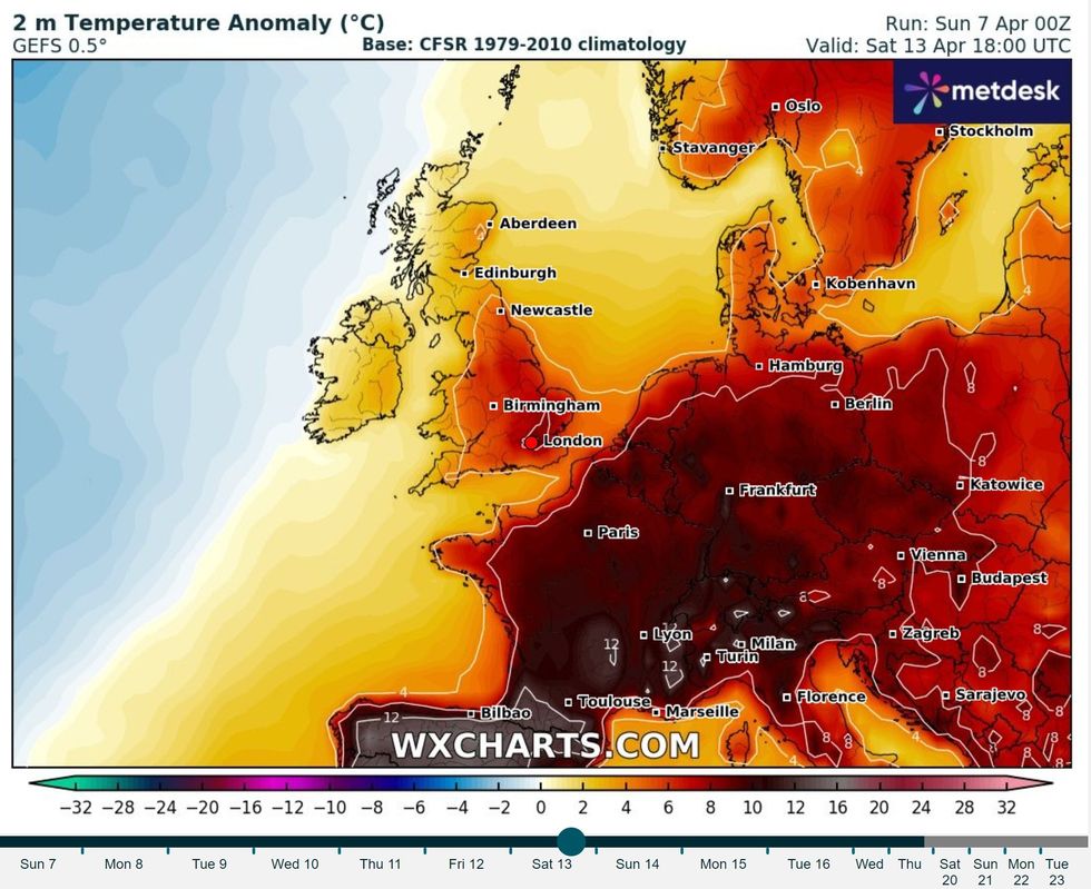
Temperature anomaly map shows above average conditions towards the middle of the month
|WX Charts
Netweather’s long-range forecast going up to the end of April added that the back end of April or early May could have warmer weather and could be less wet than normal.
Furthermore, “substantial warmth via southerly winds” could drive average temperatures up by one or two degrees.
Netweather’s forecast read: “There is a likelihood of more settled weather developing towards the end of April or into early May, probably with increased high pressure to the east and north-east, which has the potential to bring warm southerly and south-easterly winds in as well.
“There is some uncertainty over whether this change will set in during the back end of April or be delayed until early May, but there is a fair chance of this period becoming warmer and somewhat less wet relative to normal, especially towards the end of the period.
“Thus, nearer average rainfall and sunshine amounts look probable for this period, probably with temperatures a degree or two above the long-term average, although there is potential for more substantial warmth via southerly winds.”