
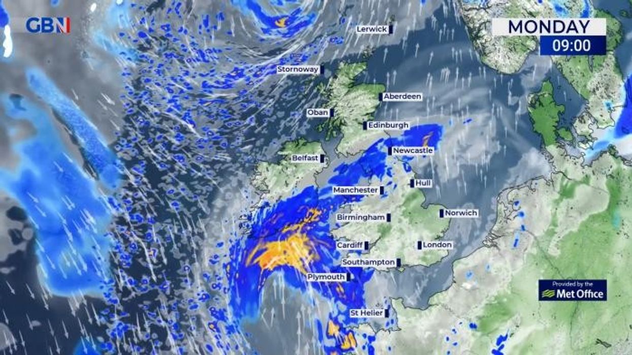


Powerful winds with a “danger to life” warning will batter parts of the UK today and tomorrow, just days before temperatures as high as 20C will scorch Britain.
The Met Office has issued two yellow wind warnings across the south coast, cautioning that strong gales and large coastal waves could result in disruption.
The weather office stated that “there is a small chance that injuries or danger to life could result from large waves and beach material being thrown onto sea fronts, coastal roads and properties - or from flying debris elsewhere”.
Power cuts could also occur, as well as buildings being damaged due to the strong winds, the weather office has warned.
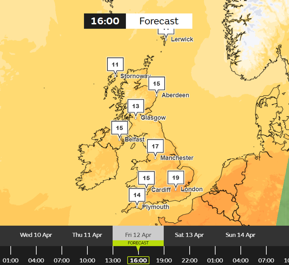
Parts of the UK will enjoy temperatures up to 20C over the weekend
|Met Office
The first warning begins at 4.00pm today and lasts until 6.00am tomorrow, and covers Cornwall, Devon, Isles of Scilly, Plymouth and Somerset.
Meanwhile, the second warning will come into effect at 9.00pm this evening and end 12 hours later. Affected areas include Brighton and Hove, Dorset, Hampshire, Isle of Wight, Kent, Portsmouth, and Southampton.
“A spell of strong onshore winds will affect parts of the England Channel coastline overnight Monday and Tuesday morning. Gusts will reach 45-55 mph just inland from the coast and potentially 65 mph for exposed coastal spots,” the Met Office said.
“Later on Tuesday morning, the wind will ease and the direction change to offshore.”
LATEST DEVELOPMENTS:
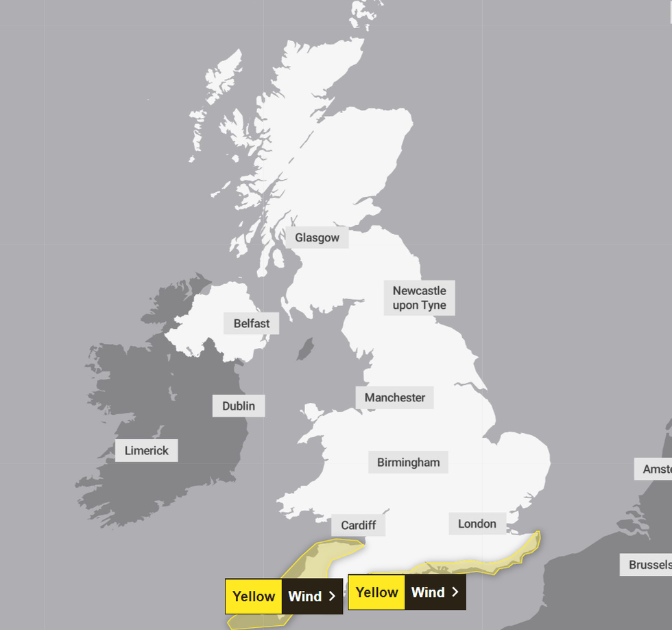
Two yellow wind warnings come into effect later today
|Met Office
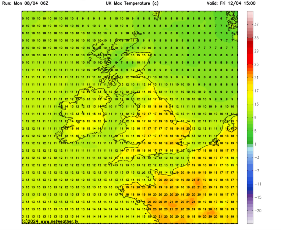
Highs of up to 20C are expected in parts of the UK during the weekend
|Netweather
Britons will be relieved to learn that the strong winds off the back of Storm Kathleen will soon subside and be replaced with a glorious 20C hot spell.
On April 12, highs in the twenties will be felt in the South and South East, with those in London, Norwich and Cambridge enjoying a particularly pleasant start to the weekend.
Those in the regions covered by the wind warnings will also enjoy a balmy Friday, with the mercury expected to be as high as 17C in certain areas.
The pleasant temperature will continue as the weekend progresses, with mercury only dropping by a degree on average, according to the latest Met Office and Netweather data.
And the hot spell shows no signs of stopping, with the Met Office predicting that dry spells, sunshine and above-average temperatures will dominate the weather sphere.

The pleasant temperature will continue as the weekend progresses
| PAAccording to their long-range forecasts for mid-April (April 11 - 20) sunshine could dominate a lot of the UK, especially in the south and east.
The forecaster added that temperatures will most likely be “above normal for the period as a whole”.
The Met Office’s long-range forecast for April 11 to April 20 reads: “Southern and eastern areas are likely to have some decent drier spells of weather with some good sunshine at times.
“Here, whilst some rain is still likely, this is probably less heavy and much less frequent than recent weeks.
“Above average temperatures are most likely overall, although some cooler interludes are possible at times, especially in the north.”