


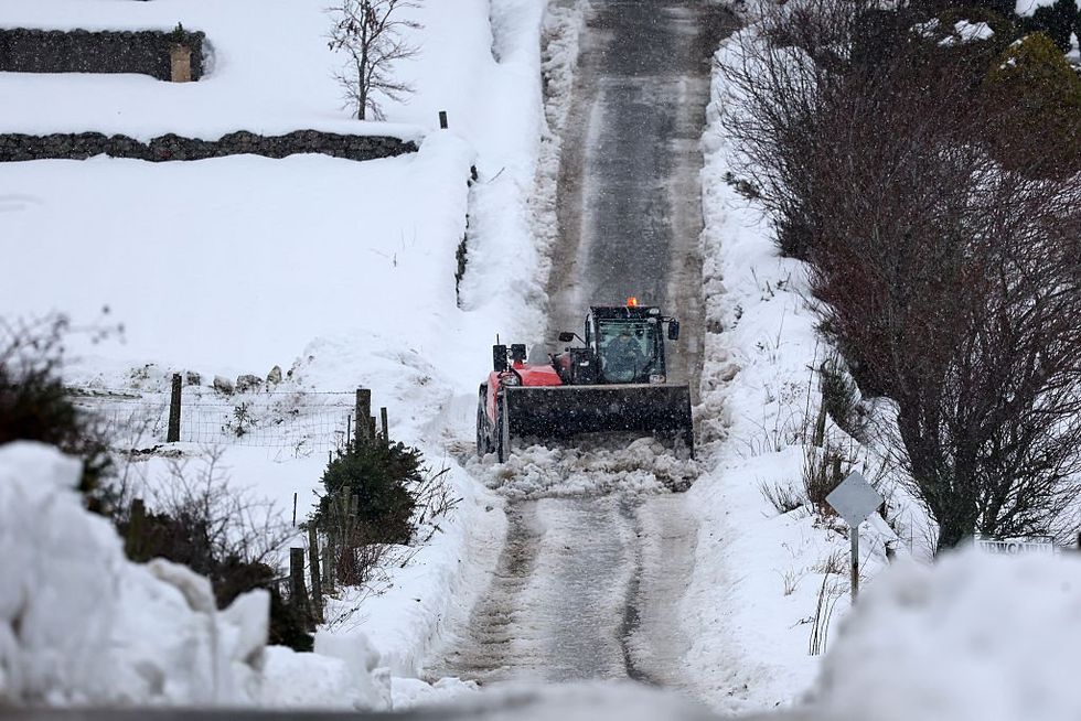
Britain is teetering on a "knife-edge" as Storm Goretti barrels in a triple-whammy assault of gales, blizzards and torrential rain.
Whipped up by a raging jet stream, the French-named storm will barrel across the UK tonight and tomorrow morning.
As it strengthens, it will pass the southern coast as meteorologists warn of travel disruption.
The Midlands, Wales and central England face inches of snow while heavy showers threaten the south.
TRENDING
Stories
Videos
Your Say
Met Office meteorologist Aidan McGivern said: “Storm Goretti deepens rapidly, and it collides with the cold air over the UK as it runs, most likely, along the south coast of the UK, but there are still some uncertainties about the exact track.
“This matters because the difference between the rain on the southern flank of the low and the snow on the northern flank of the low is on a knife edge.
“As the rain pushes in, it ends up as snow across the Midlands, mid- and south-Wales and perhaps the far north of Devon and Somerset.
“Then it is turning even colder across the Midlands, Wales and parts of the southwest, and there is extensive snow.”
Storm Goretti will unleash a triple-whammy assault of gales, blizzards and rain
|GETTY
Goretti, the first named storm of the year, will sweep in from the Atlantic today, deepening on a powerful jet stream.
As it hits Arctic air over the country this evening, rainfall will turn to snow.
The Met Office has warnings in force across southern and central England for "dangerous" conditions, triggering delays, road closures and power cuts.
The snow risk will continue into midday across the East and West Midlands, East Anglia, London and the southeast, North-West England, Wales, Yorkshire and the southwest.
LATEST DEVELOPMENTS
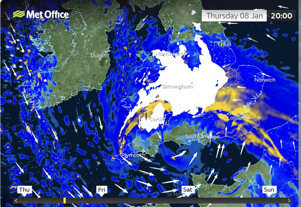
The Met Office has warnings in force across southern and central England for 'dangerous' conditions
|MET OFFICE
Mr McGivern said: “On Thursday morning, heavy rain moves into the southwest, then during the afternoon, as the rain is coming down, there is increasingly we see the snow.
“But the main disruptive snow is in Wales, the Midlands, northern England and East Anglia.
“On Friday night, the snow edges further east, but much of the time it is likely to be a mix of rain, sleet and hill snow for the far south and eastern England.”
Goretti has been described as a "multi-hazard event", delivering a combined assault of rain, sleet, wind and up to eight inches of snow.
It will arrive as Britain freezes in a stubborn cold spell, triggering temperatures of -12C.
Jim Dale, meteorologist for British Weather Services and co-author of ‘Surviving Extreme Weather’, said: “This low is deepening as it comes in from the Atlantic, and as it hits cold air, rain will turn to snow bringing a risk of widespread wintry showers through the end of the week.
“Britain will turn into a battleground as the Atlantic meets the Arctic air over the country, and this is the perfect recipe for disruptive snow.’
Temperatures will rise over the weekend as the Atlantic brews up another stormy weather system.
A Met Office spokesman said: “Arctic air returns for the start of Saturday, bringing dry, bright, and frosty conditions with icy patches.
“But the Atlantic isn’t finished yet, a third, larger area of low-pressure will move in over the weekend, taking a more northerly track and replacing the Arctic air with wind, rain, and much milder weather by Sunday.”
Our Standards: The GB News Editorial Charter