


Scientists have produced the most comprehensive map ever created of the terrain concealed beneath Antarctica's enormous ice sheet, revealing a rich landscape of mountains, canyons, valleys and plains.
The research team employed cutting-edge high-resolution satellite data combined with ice-flow perturbation analysis, a technique that deduces underground topography from surface characteristics.
Their work charted the entire continent, including regions never before surveyed.
Among the discoveries were more than 30,000 hills that had remained unknown until now, classified as terrain features rising at least 50 metres.
The findings were published this week in the journal Science.
Enhanced understanding of the bedrock landscape beneath the ice could prove vital for predicting how Antarctica's frozen mass responds to climate change, with earlier studies suggesting that rugged terrain such as jagged hillsides and peaks can slow ice sheet retreat.
Glaciologist Robert Bingham of the University of Edinburgh, who co-led the research, said: "Having the most accurate map of Antarctica's bed shape is crucial, because the shape of the bed is an important control on friction acting against ice flow, which in turn we need to include in numerical models that are used to project how rapidly Antarctica's ice will flow towards the ocean, melt and contribute to global sea-level rise."
The map unveiled a terrain of remarkable diversity, featuring everything from towering mountain ranges to vast flat plains, much like the varied landscapes found across other major landmasses.
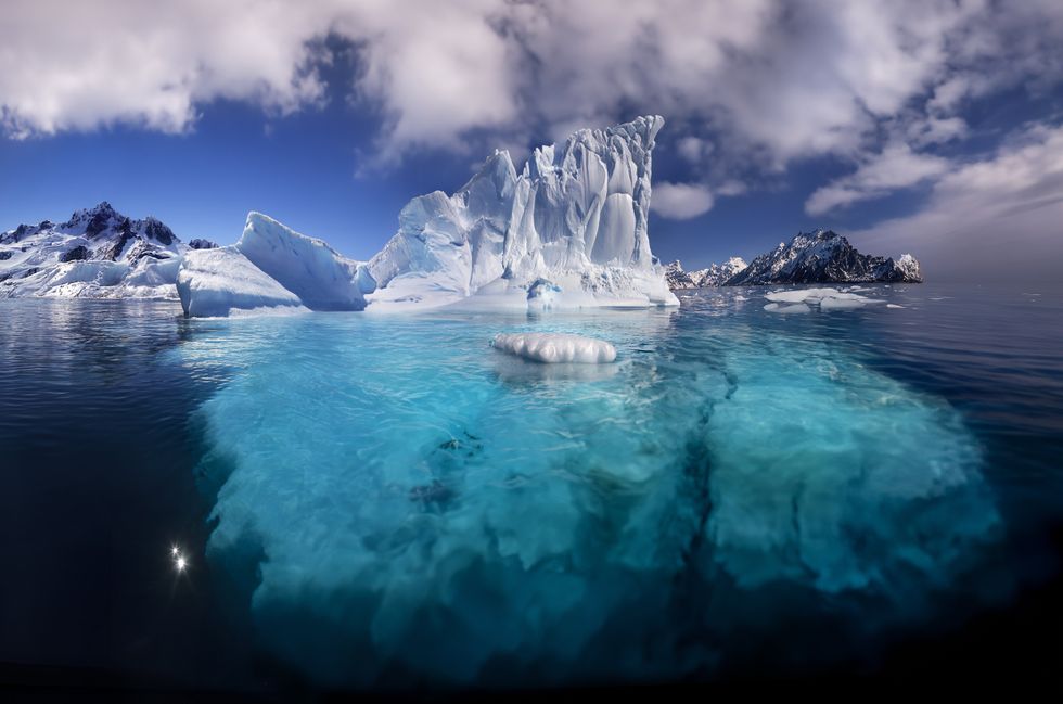
The Antarctica map unveiled a terrain of remarkable diversity, featuring everything from towering mountain ranges to vast flat plains
|GETTY
Antarctica spans an area roughly 40 per cent larger than Europe and half the size of Africa.
"Boring it is not," Bingham remarked of the hidden continent.
Particularly notable were plateaus carved by deep glacier valleys, terrain familiar to those who know the Scottish Highlands or Scandinavian landscapes.
Before this breakthrough, researchers noted that the Martian surface had been charted in greater detail than the ground lying beneath Antarctica's ice.
MORE INCREDIBLE SCIENCE DISCOVERIES
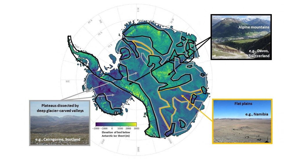
Antarctica's entire continent, including regions never before surveyed, have been mapped
|REUTERS
Conventional mapping methods relied on radar equipment carried by aircraft or pulled behind snowmobiles, but these surveys frequently left gaps of between five and 150 kilometres.
Glaciologist Helen Ockenden of the Institut des Geosciences de l'Environnement in France, who led the study, said: "This is really exciting because it allows us to combine the mathematics of how the ice flows with high-resolution satellite observations of the ice surface, and say what the landscape beneath the ice must look like everywhere across the whole continent, including in all those survey gaps."
The researchers hope their work will inform projections used by the UN Intergovernmental Panel on Climate Change.