


A stalled jet stream which is jamming storms off the Atlantic coast is threatening a monsoon deluge across Britain.
Swirling low-pressure vortices will dump up to six inches of rain in parts of the country this week, experts have warned.
Coastal regions are also braced for strong gales amid a battalion of cyclonic storms.
Winds pulling in from the south will keep temperatures high throughout the week.
TRENDING
Stories
Videos
Your Say
Met Office meteorologist Liam Eslick said: “Rain is potentially likely to be heavy at times, and disruption Is possible, particularly where it turns heavier across northeast England and southern Scotland.
“There is a heavy band across the southwest which is likely to bring some pretty blustery winds, and we could see some gale-force winds across coastal regions.
“But it is another mild day on Tuesday, with temperatures well-above what we would expect for the second week of November.
“As we go through the week, it is likely to be a disruptive week with plenty of wet weather to come.”
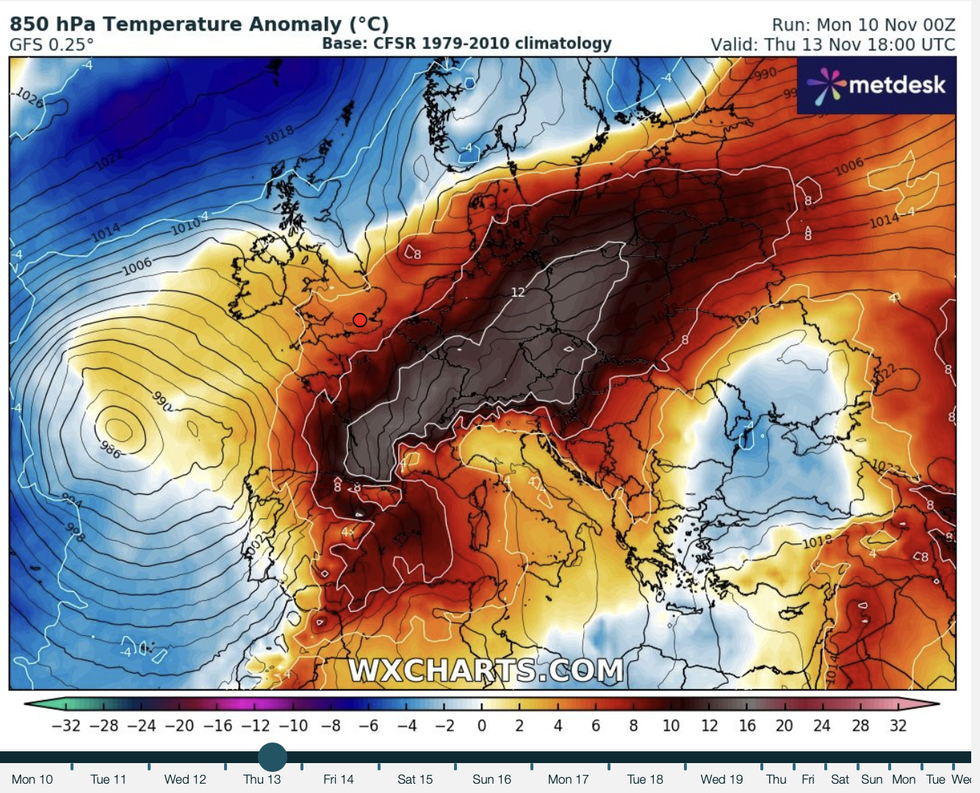
Winds pulling in from the south will keep temperatures high
|WXCHARTS
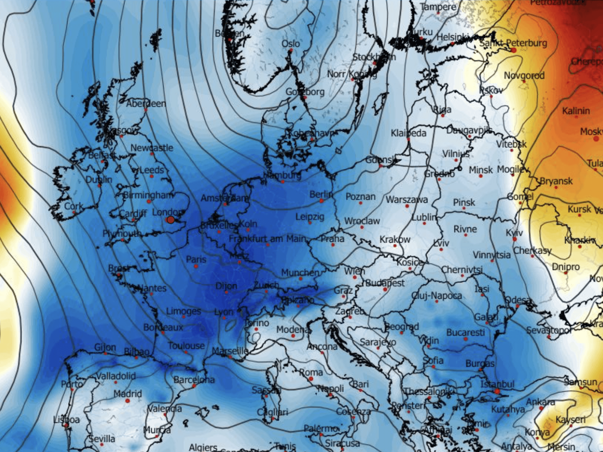
Autumn storms are usually strengthened and steered by a vigorous west-to-east "zonal" jet stream.
Currently, the jet is weaving and snaking in a "meridional" north-to-south direction.
One to the southwest threatens a particularly heavy downpour, as southwestern regions are warned of possible disruption.
Met Office meteorologist Alex Deakin said: “Recent runs of computer models are suggesting that a low to the southwest is going to become more dominant and push further rain across southern and western areas.
LATEST DEVELOPMENTS
Polar gales set to freeze Britain with -10C temperatures in first ‘significant snow’ of season
'Marine heatwave’ simmering British waters to drive blast of late-autumn warmth
Britain to be shrouded in 'anticyclonic gloom' as cold snap to plunge UK into single digits
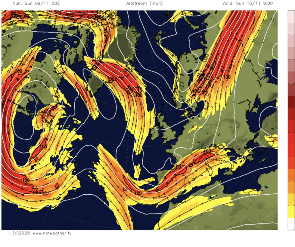
Autumn storms are usually strengthenedby a vigorous west-to-east 'zonal' jet stream
|NETWEATHER
“So, the big question mark is whether that low pushes further north or whether higher pressure builds from the north.
“With low pressure to the southwest, we will see further rain, and with a weak jet stream, weather patterns are going to be slow-moving.”
Mr Burkill added: “There are various areas of low pressure nearby, and there is going to be quite a bit of rain at times.
“ An area of low pressure is set to come into the UK as we go into Tuesday, and this is when we could see some heavy rain.”
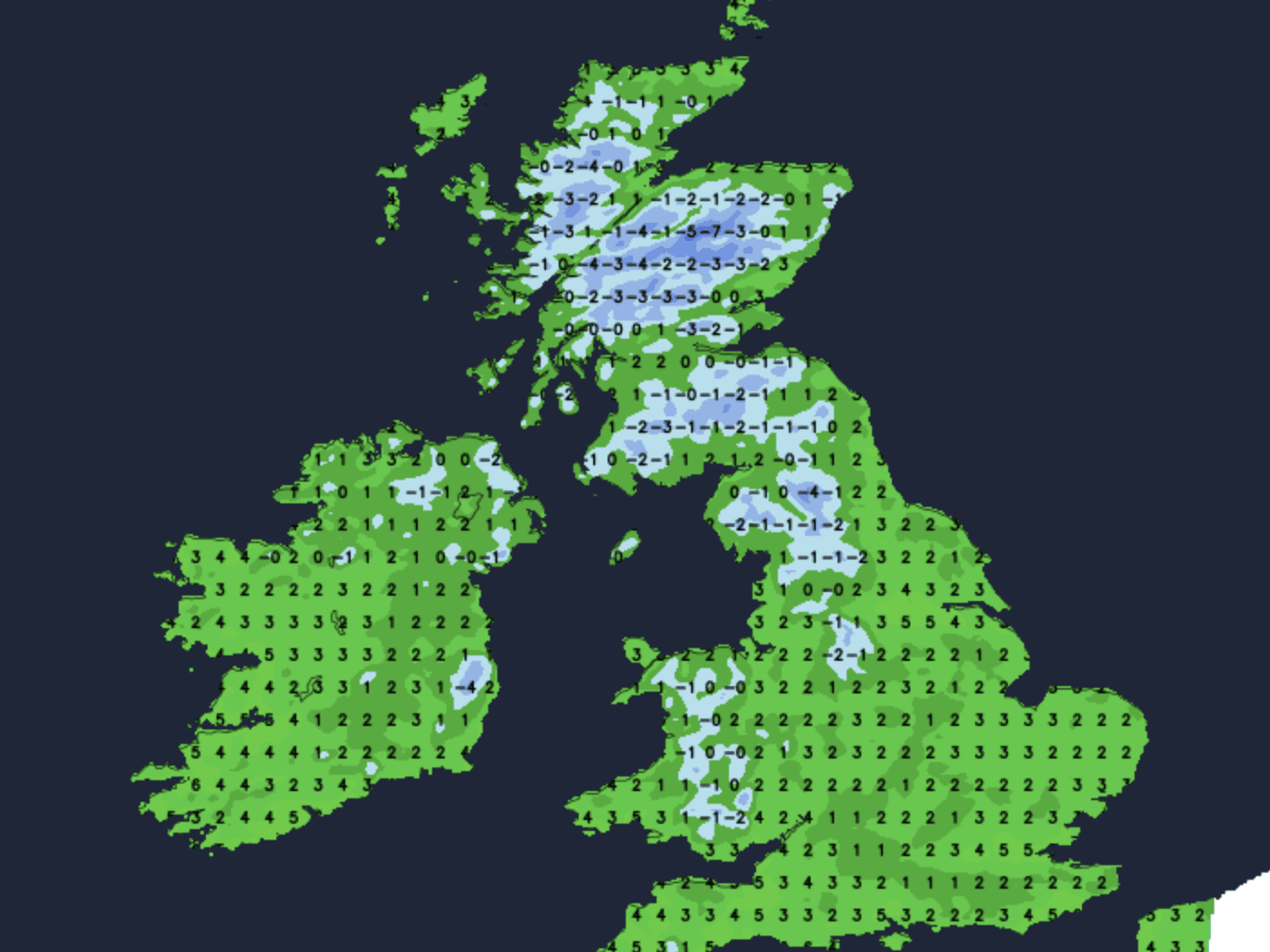
Flooding is a risk in the worst-hit regions where up to half a foot of rain could fall by mid-week.
Western and southwestern Britain faces the greatest risk of severe downpours.
Jim Dale, meteorologist for British Weather Services, said: “We could see up to six inches of rain in parts, with the west and the southwest most at risk.
“While there will be some wind, the rain is going to be the biggest hazard as we go through the week.”
The mercury will hover widely in the mid-teens, Mr Dale added, before plunging ahead of the weekend.
He said: “We are about to see the first proper plunge of the year, with snow over the hills and mountains of Scotland.
“Temperatures by the start of next week are likely to hit minus double figures.”
Our Standards: The GB News Editorial Charter