


A ‘marine heatwave’ simmering Atlantic waters off Britain's coast will help drive a blast of late-autumn warmth.
Temperatures across Britain will hover in the mid- to high-teens into mid-November — almost 10C above the monthly average.
Warm southerly winds put a sizzle into Bonfire Night, as forecasters promise the next week will bring a slight dip in temperatures.
Helping to push the mercury skywards are warmer-than-average sea surface temperatures in the Atlantic Ocean.
TRENDING
Stories
Videos
Your Say
Jim Dale, meteorologist for British Weather Services, said: “The ocean temperatures around the UK are still high, and this is going to be putting heat and energy into the atmosphere.
“As well as giving more power to storms when they develop, this anomaly will bring higher temperatures to the UK when winds come from the south or the west.
“This is a symptom of the changing climate and will continue to have an impact on the UK weather.”
Temperatures across Britain will hover in the mid- to high-teens into mid-November
|MET OFFICE
At the end of summer, Sea Surface Temperatures (SST) were around 1.5C higher than normal, according to the Met Office, who described a "significant marine heatwave".
Unusually hot weather, and the warmest summer recorded in the UK, rocketed ocean temperatures.
Waters to the south of the country experienced the biggest temperature leap, which is why southerly winds this week have made it feel more like spring.
Of the latest data released in summer, a Met Office spokesman said: “In the second half of June, anticyclonic conditions and a developing land heatwave, particularly over France and the southeast of the UK, led to renewed ocean warming.
LATEST DEVELOPMENTS
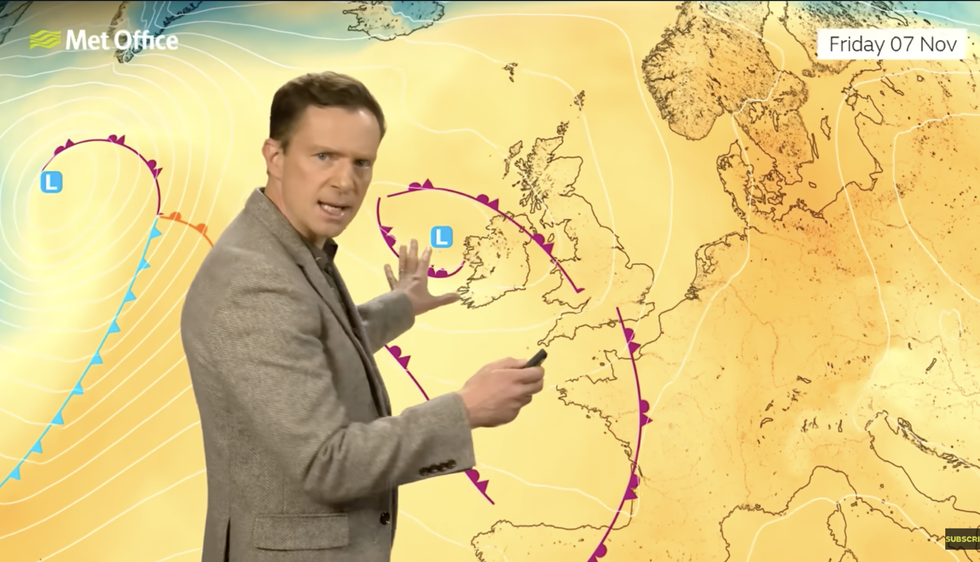
Low pressure to the west and high pressure to the east is funneling balmy gusts from the south
“Increased sunshine and weaker winds allowed sea surface temperatures to rise again, pushing the English Channel, Southern North Sea, and parts of the Celtic Sea back into a moderate to strong marine heatwave.
“Warmer seas can amplify land heatwaves by reducing the cooling effect of sea breezes and can fuel extreme rainfall events under the right atmospheric conditions.”
Temperatures this weekend will dip slightly as winds turn from southerly to westerly, experts say.
Low pressure to the west and high pressure to the east will help funnel balmy gusts from the south.
Met Office meteorologist Alex Deakin said: “It is very mild, but that will slowly change into the weekend, and we will lose the southerly wind and get more of a westerly breeze.
“But that isn’t coming in from a cold direction, and it is still bringing air in from a relatively warm Atlantic, so although temperatures will dip a little bit into the weekend, we won’t see a massive drop in the numbers.”
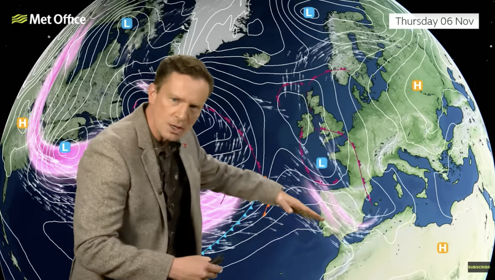
A waving and weakening jet stream will cause rain-bearing weather systems to stall over the country, Mr Deakin said.
While it will for most remain largely dry through the coming days, western regions could see showers, he added.
Mr Deakin said: “Generally, the jet stream is weakening as we head into next week, meaning the weather patterns are going to become more slow moving, and we are going to have a scrap between low pressure to the west and high pressure to the east.
“The most likely pressure pattern is low pressure to the west, high pressure to the east, and the winds coming in from the south, keeping things mild.
“It is going to turn a little cooler, but far from chilly, and there will be some rain around as that low heads into the west.”
Our Standards: The GB News Editorial Charter