


A huge snow blizzard dubbed ‘Winter Storm Tormund’ will plough across the US this week ‘taking down trees and power lines’.
Swaths of the country are facing Arctic conditions driven by 50mph gales as winter roars back for a crippling parting shot.
Tormund will unleash a double whammy of misery– an initial burst of rain, hail and tornadoes followed by a snow deluge.
The National Weather Service (NOAA) has warnings in force through the start of the week for a spectrum of weather hazards.
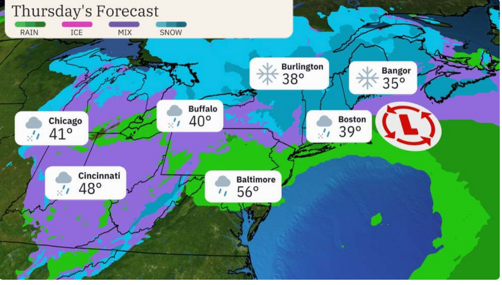
Thursday's forecast for parts of the Midwest and Northeast
|The Weather Channel
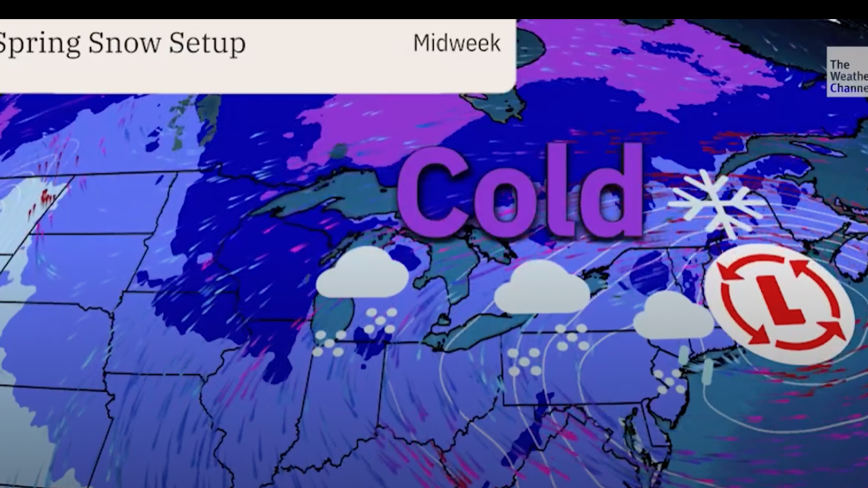
The ‘deep storm’ will shapeshift on its north-eastward track from a thunderous rain tempest into a churning snow blizzard.
Weather Channel meteorologist Chris Dolce said: “A spring snowstorm, which has been named Winter Storm Tormund by The Weather Channel, will track from the Great Lakes to the Northeast this week.
“Winter storm warnings have been issued in parts of the western and northern Great Lakes.
“Snow in parts of New England and upstate New York could be heavy enough to cause hazardous travel, tree damage and power outages.”
The extreme winter blast is being driven by a deep area of low pressure sweeping across the country.
Further south, the greatest hazard will be from strong winds, rain and the risk of tornado, before the storm unleashes snow further north.
A second low-pressure system off the Mid-Atlantic coast will add to the mayhem at the end of the week, experts warn.
LATEST DEVELOPMENTS:

Gusts of 50mph will strike later this week
|The Weather Channel
It will whip up 50mph winds with ‘significant snow accumulations’ threatening New York and Northern New England.
A Level-4 to level-5 warning of ‘moderate risk’ of severe thunderstorms on Wednesday has been issued by the US Storm Prediction Centre.
A spokesman for the NOAA said: “A deep storm over the Middle Mississippi and Ohio Valleys will move to Southern New England by Thursday.
“The system will produce a large, long-duration winter storm, producing gusty winds and late-season heavy snow across portions of the Great Lakes and the Northeast from Tuesday into Friday.
“The same storm will produce northeast snow and wind from Wednesday to Friday, while a secondary low-pressure development along the Mid-Atlantic coast will [bring] bringing heavy, wet snow and some sleet through Friday.”
Storm Tormund has been named by The Weather Channel after being deemed severe enough to produce significant impacts.
While winds are expected to hit 50mph along the coast with inland gusts of 20mph to 40mph.

Huge secondary low swirls off the east coast
|The Weather Channel
Onshore winds across eastern New England will clash with high tides bringing the added risk of coastal floods, experts warn.
A spokesperson for The Weather Channel said: “We are expecting snow across the upper Midwest and New England this week.
“A second low-pressure system off the east coast will bring heavy, wet snow, that could take down trees and power lines.
“In some spots, heavy snow and gusty winds will limit visibility, making driving dangerous, and it will be across higher elevations where the biggest snow totals are likely.”
Stormy conditions started to pick up after the Easter weekend, although the full onslaught is forecast from mid-week.
Jim Dale, US weather correspondent and co-author of ‘Surviving Extreme Weather’ said: “This is really going to get going around Wednesday.
“Central parts of the country will be affected first before it moves to the northeast on Thursday, and it has got venom on it.”