


Millions of Easter travellers face a storm ‘walloping’ as 80mph winds and hail downpours powered by a tropical surge batter America.
Warmth and moisture sweeping from the Gulf of Mexico will smash against a swath of cold air wedged over the US.
The collision point at the boundary of a cold front stalled over the country will provide ideal conditions for thunderstorms, tornadoes, hail and further snow.
Meteorologists warn of a post-Easter ‘severe thunderstorm outbreak’ and urge travellers to check forecasts before setting out.
Warmth and moisture sweeping from the Gulf of Mexico will smash against a swath of cold air wedged over the US
|NOAA
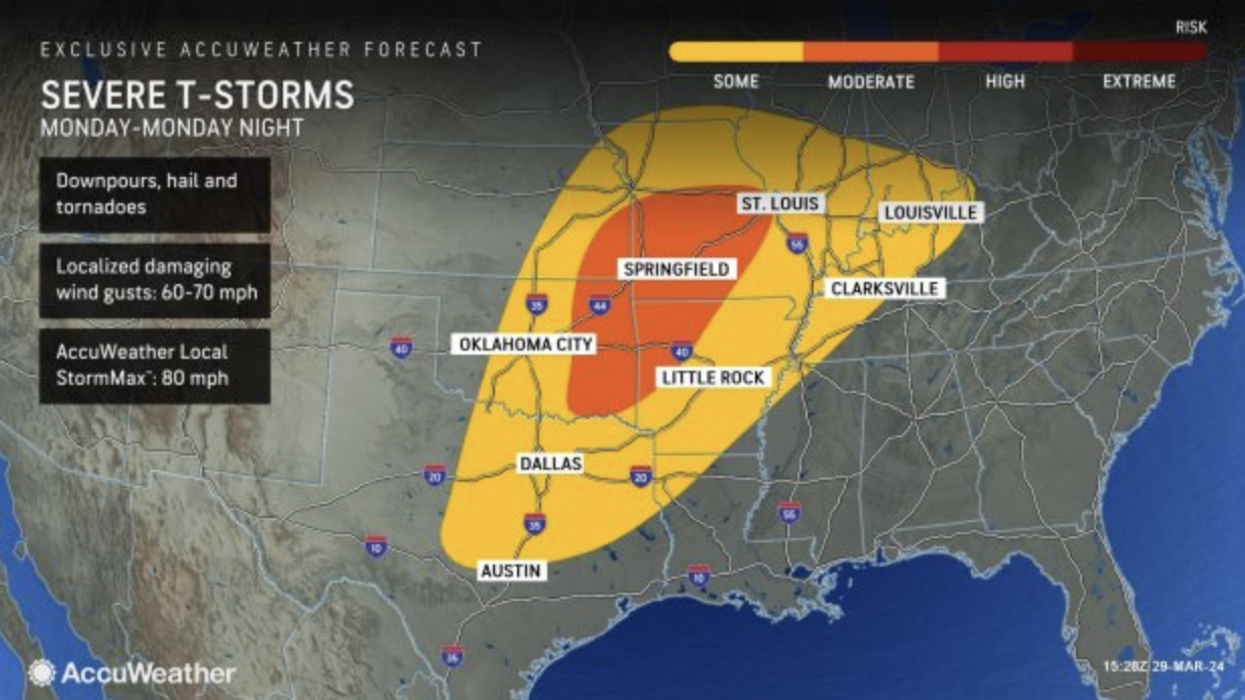
AccuWeather chief meteorologist Bernie Rayno said: “Some of the factors favouring the eruption of severe weather on Monday include a surge of moisture from the Gulf of Mexico and stiff winds in the lower part of the atmosphere.
“All modes of severe weather are possible, ranging from high winds and large hail to flash flooding and tornadoes.”
Eastern regions will fall into the firing line on Tuesday as storms charge through Mississippi, Alabama, Georgia, Tennessee, Kentucky, Indiana, Ohio, Pennsylvania, South Carolina, North Carolina, Virginia, and Maryland, a spokesman warned.
Atlanta, Nashville, Washington DC and Baltimore face damaging wind gusts and hail during the start of the week, they added.
They said: “Should the threat evolve to its full potential, there could be a significant severe weather outbreak on Monday with the risk of multiple, strong tornadoes.
“The severe weather threat will shift eastward on Tuesday.”
LATEST DEVELOPMENTS:
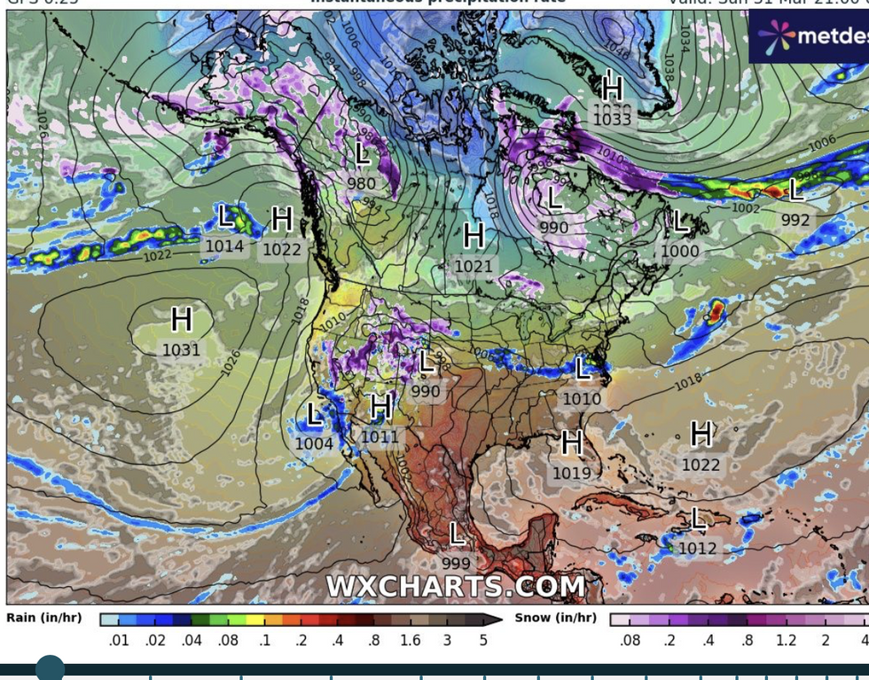
Storms move across the country
|WXCharts
Dangerous weather conditions will pick up through the week, hitting as millions of people head home after the Easter break.
Central regions will get the first hit as warm air sweeps up from the Gulf of Mexico creating a ‘venomous’ cocktail of weather misery.
Jim Dale, US weather correspondent and meteorologist for British Weather Services, said: “Warm and humid air coming up from the Gulf of Mexico will trigger very stormy conditions through the start of the week and into Tuesday and Wednesday.
“This is going to be a bit of a wallop, with central regions first at risk of powerful thunderstorms and tornadoes before the system moves eastwards.
“This system has got some venom and is an example of how instability arises when warm moist air meets with colder air along the frontal boundary.”
The National Weather Service (NOAA) has issued winter weather advisories across Nevada, Utah, Arizona and Wyoming.
Separate wind warnings are in force across New Mexico and Arizona as the risk of severe thunderstorms grows.
The NOAA warned of persistent lightning strikes, powerful gusts, hail and flooding from torrential downpours.
Further north, colder temperatures will trigger snow with heavy downpours possible in Wyoming, Nevada, Colorado, Utah, and Arizona.
A NOAA spokesperson said: “Showers and thunderstorms will produce heavy rain over parts of the Middle Mississippi and Ohio Valleys.
“The associated heavy rain will create mainly localised areas of flash flooding, with urban areas, roads, and small streams the most vulnerable.
“Moisture streamed inland due to the upper-level low off the Southern California Coast will aid in creating heavy snow over the higher elevations of Wyoming, Nevada, Colorado, Utah, and Arizona.”