


The UK is heading for a period of storms and wet weather, forecasters have warned, just days after the country enjoyed consistent 20C temperatures for the first time this year.
Much of England and Wales had basked in summery temperatures on Sunday, but data from the Met Office and MetDesk is pointing to a positively dour week in comparison.
Met Office maps show that much of the country will push the mid-to-high teens at best as the week continues, but bands of rain moving inland from the continent and Atlantic are due to darken skies and ramp-up muggy conditions.
There are no real temperature hotspots in the UK as the week continues - in general, London and parts of the south can expect 19C highs, while northern Scotland looks set for cooler climes of around 12-14C, but most of the country will hover at around 14-17C heading into the weekend.
The Met Office has warned of thundery showers as the week continues
|WXCharts/PA
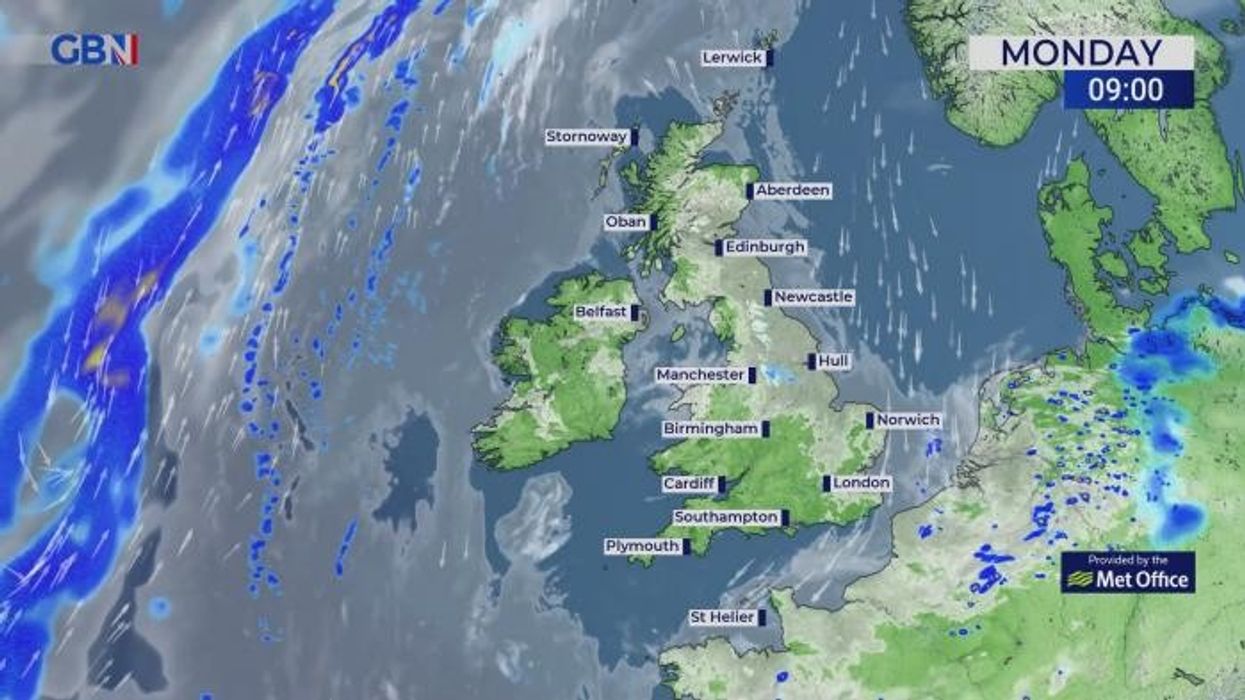
Most Britons can look forward to a dry Monday and Tuesday, though by Tuesday evening, easterly showers are set to pass from Lincolnshire, across the Northeast, and into Scotland.
That rain is part of a larger band sweeping in from northern Europe - and while it should just about steer clear of the east coast of England in the south, it's set to move inland and smother most of Scotland throughout Wednesday.
In the far north, that incoming rain from Europe is due to be swept aside by fast-moving westerly showers coming across the Atlantic on Thursday, effectively knocking it east into the North Sea and promising clearer skies in the Highlands and Islands.
Data from MetDesk promises a dry Friday, while this weekend, another band of easterly rain should work its way slowly across the UK and Ireland as temperatures remain in the high teens across the land.
MORE ON HEAT AND STORMS:
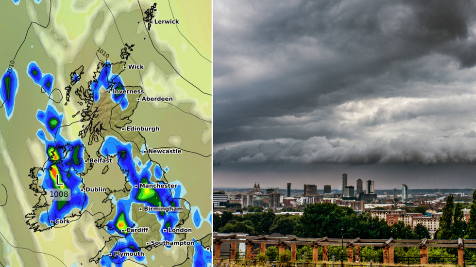
While this week should begin dryly, bands of rain from the east and west are set to pummel Scotland as the days go by
|Met Office
The Met Office's Tuesday forecast says: "Through Tuesday we will tend to see more cloud around, but there will still be plenty of sunny spells.
"Showers perhaps a little more widespread, some heavy and thundery."
While the forecaster's outlook for the end of the week says: "Low pressure could bring heavy rain in from the southeast on Wednesday and push northwards on Thursday.
"Tending to become drier and brighter by Friday. Generally cooler than of late."

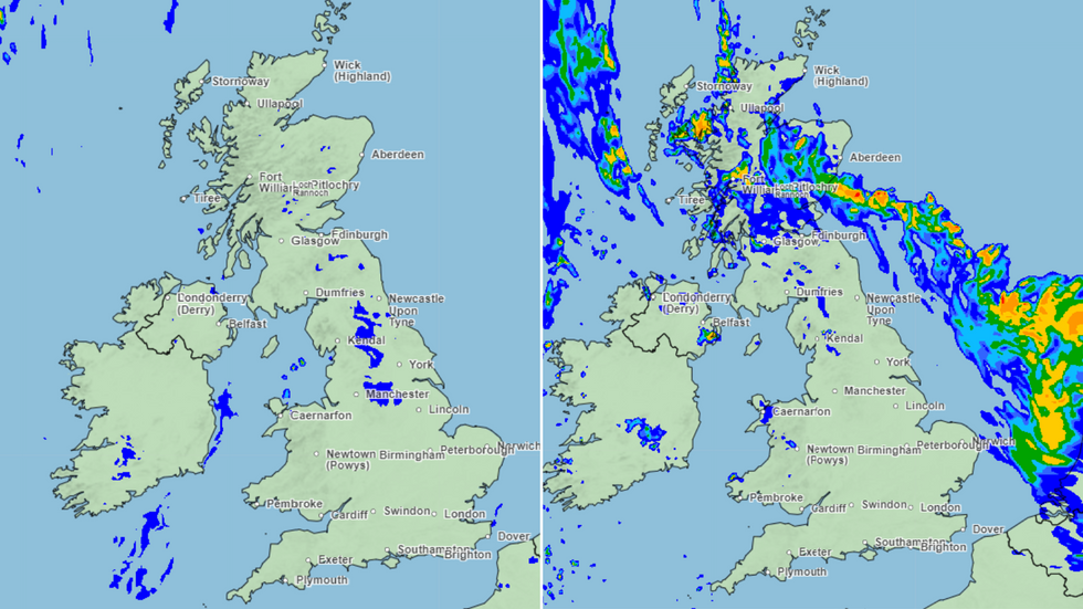
Weather maps for Tuesday night suggest heavy rain will lash the Midlands with possible thunderstorms
|WX charts
The forecast comes as 27 flood alerts are currently in place across Southern England, while the Environment Agency has warned of potential travel disruption across the next five days.
The Met Office's long-term forecast, which covers the period until June 2, says: "Most likely an unsettled start to the period with showers in the west and perhaps longer periods of rain in the northeast, although still some settled weather in between.
"Over the bank holiday weekend a band of rain likely to arrive from the west, becoming weaker as it moves east and becoming more showery in nature with scattered showers also following.
"Into the new week increasingly settled conditions more likely for most, though rain may threaten north-western areas whilst some southern or eastern areas occasionally less settled with showers more likely later in the period though there will be some sunshine between them, the best of this in south-western parts. Temperatures are likely to be a little above average, but some large spatial differences are likely."