
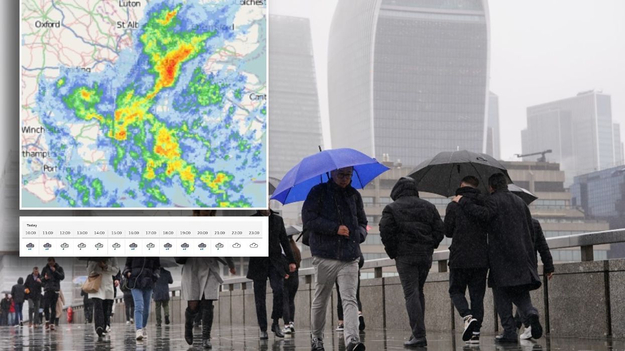


London is set to be lashed with as much as 14 hours of heavy rain as residents have been warned flooding is possible.
Although sunshine and warm weather is just around the corner, most of the UK is set for one final lashing before rain gives way to more sultry conditions.
From 8am through until around 9pm on Bank Holiday Monday, the capital is expected to receive a mixture of heavy rain and lighter showers.
Temperatures are expected to reach just 14C.
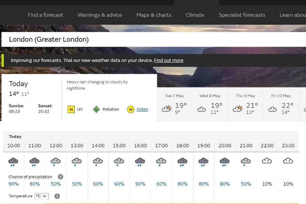
Met Office forecast: From 8am (10am pictured) until 9pm, London will be lashed with rain
|Met Office
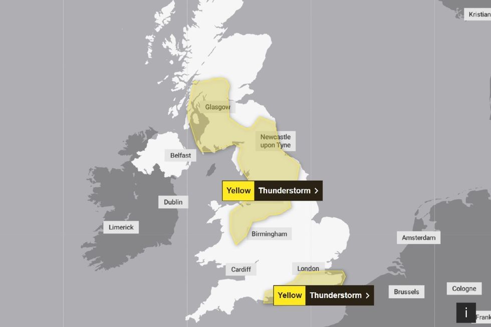
Met Office issues lightning storm warning 06 May 2024
|Met Office
According to the Met Office forecast for today: “Sunny spells and heavy showers will develop across most of the UK today, some of these heavy and slow-moving with the odd rumble of thunder.
“Cloudier in the southeast with heavy and persistent rain. Feeling warm in any sunshine.”
The south of England is expected to receive the worst lashing but other parts of the country are expected to suffer from thunderstorms today, forecasters have warned.
At around 10.15am, the Met Office issued a lightning warning for London.
The national forecaster said in a statement: “Following morning rain, thunderstorms and heavy downpours may break out in some places this afternoon and evening.“Although not all places will catch these storms and downpours, where they do occur 20 to 30 mm rain may fall in some places in an hour or two.”
The warning for London stretches from midday to 9pm tonight.
Other thunderstorm warnings are in place in Wales, central and south Scotland, north west and north east England, Yorkshire, east and west Midlands, west England and south west England.
LATEST DEVELOPMENTS: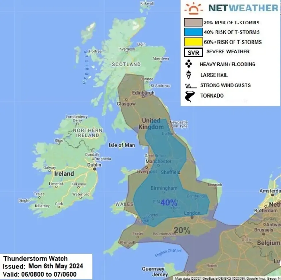
Netweather issued a thunderstorm warning
|Netweather
A thunderstorm alert issued by Netweather suggests there is widespread risk of a slow-moving storm.
Mainly focused on inland England and southern Scotland, Britons are advised that heavy rain could lead to localised flooding and hail could be likely.
According to the Netweather thunderstorm watch: “Upper low will be slow-moving across northern France on Monday, with an upper and surface trough extending north over England and South Scotland and a ridge of high pressure to the west over Ireland.
“Cold mid-level temperatures across much of mainland UK today (-20 to -23C at 500 hPa) will create steep lapse rates, which with surface heating and breeze convergence in slack pressure pattern, will support heavy showers and thunderstorms to develop through the day.
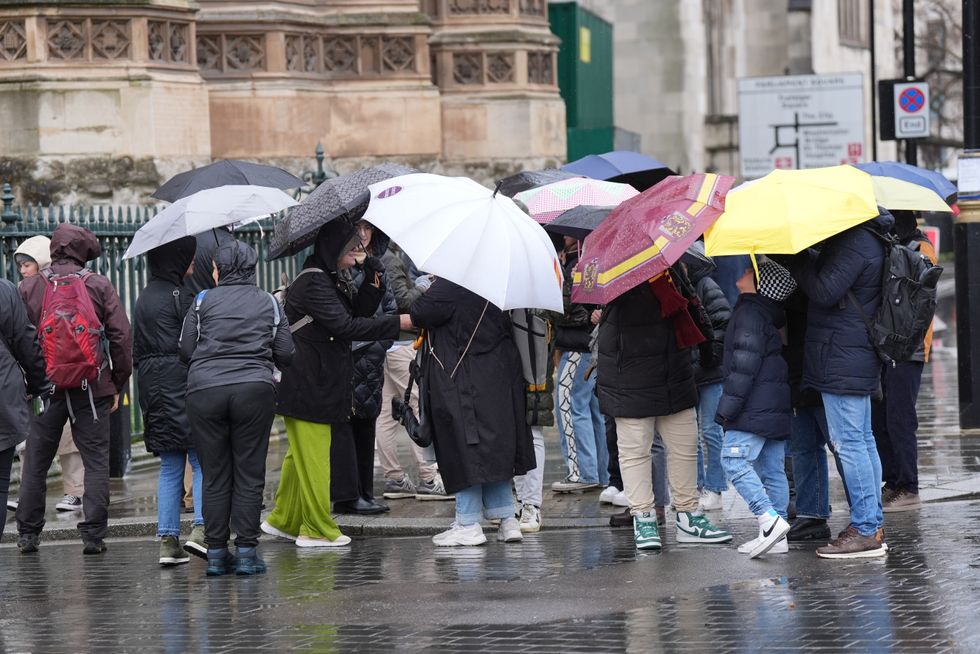
Londoners will feel soaked for 14 hours today
|PA
“Risk of a storm will be fairly widespread but scattered inland across England and south Scotland, more organised rain moving in across south east England this morning may hinder surface heating, but even here, a thunderstorm or two can't be ruled out, as rain turns more showery in nature this afternoon.
“As convective cells will be slow-moving - there is a risk of localised flooding where rainfall is heavy for a prolonged time.
“Storms may produce hail and also funnel clouds along breeze convergence.”
According to the forecaster, the highest risk of storms in London will come at 8pm with a 32 per cent chance.