


A huge 600-mile wide ‘wall of heat’ is set to engulf the UK, bringing relentless hot sunny weather across Britain within weeks.
Britons will first get the opportunity to bask in a mini-heatwave just in time for the next bank holiday weekend, weather maps have revealed.
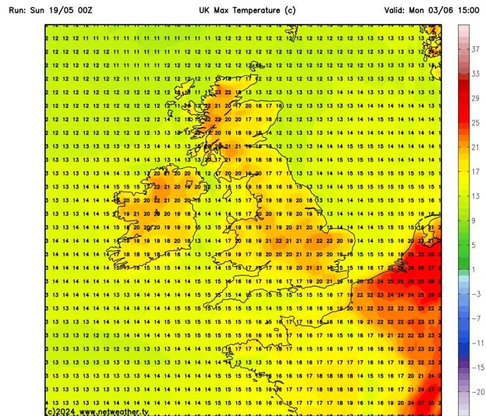
The initial stint of warm weather will last for five days as temperatures in parts of England and Scotland soar past 20C.
London and the East of England could see mercury hit 24C on May 25, weather website NetWeather has forecast.
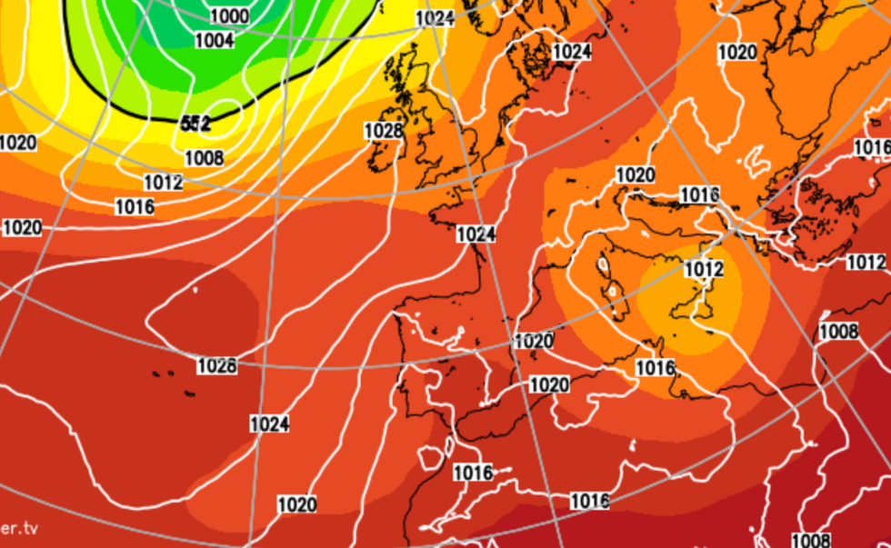
UK weather forecast: New charts show exact date 600-mile wide 'heat wall' will hit Britain
|NETWEATHER
The Midlands is expected to see a spike of 22C and the coast of Scotland could also teeter above 20C.
However, the current forecast puts mercury just below the 25.9C recorded in the village of Herstmonceux in East Sussex last week.
The predicted rise in temperatures comes as the Met Office’s three-month outlook predicts a near double the average chance of ‘hot’ weather until July.
The transition from El Nino to La Nina and changes in stratospheric wind patterns have been identified as driving forces behind the change.
LATEST DEVELOPMENTS: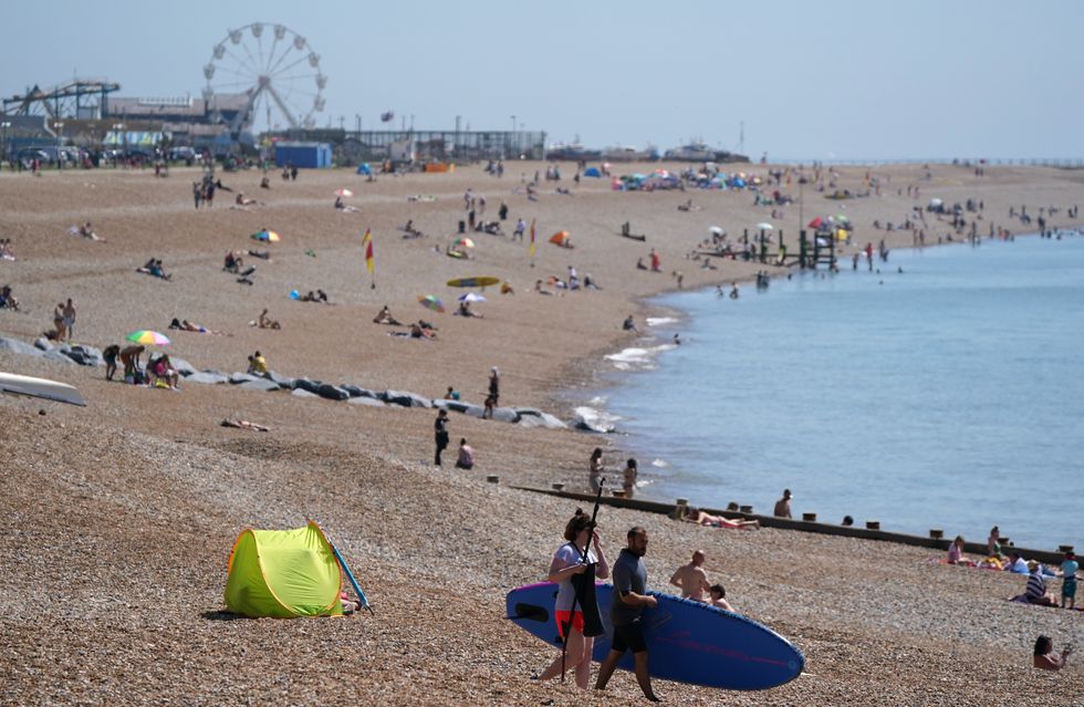 People enjoy the warm weather on Hastings beach in East Sussex. | gbnews
Exacta Weather forecaster James Madden said: “June is likely to start on a decent note for many of us, with warm or potentially hot temperatures spilling over from the end of May.
“Some projections have identified a potentially hot period of weather around mid-July, and this could last for an extended period, and during this time, there is no reason we couldn’t see temperatures in the mid-to high-30Cs.
“Temperatures are likely to be above-average for the month as a whole.”
However, the Met Office’s long-range weather forecast between May 23 and June 1 also suggests showers and rain in parts of the country.
Temperatures will tick up into June
|NETWEATHER
The UK’s national weather service said: “Most likely an unsettled start to the period with western showers and eastern rain, potentially heavy in the northeast, before a transient settled spell late in the week.
“Early in the bank holiday weekend a band of rain, heavy at times moves in from the west, becoming weaker as it moves east becoming more showery in nature with scattered showers also following.
“Into the new week increasingly settled conditions more likely for most, though rain may threaten north-western areas early on whilst some southern or eastern areas occasionally less settled with showers more likely later in the period though there will be some sunshine between times, the best of this in south-western parts.
“Temperatures are likely to be a little above average, but some large spatial differences are likely.”