
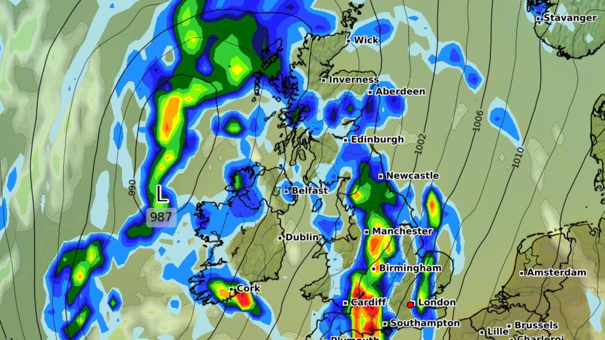


Britons are being warned to brace for a 597-mile "wall of rain" expected to pour down across the UK next week.
Forecasters predict that "widespread" rain and showers will hit Britain this weekend before a band of wet weather is set to stretch from Plymouth to Fort William in Scotland - around 597 miles.
Downpours could see up to 6mm of rain fall per hour in south west England.
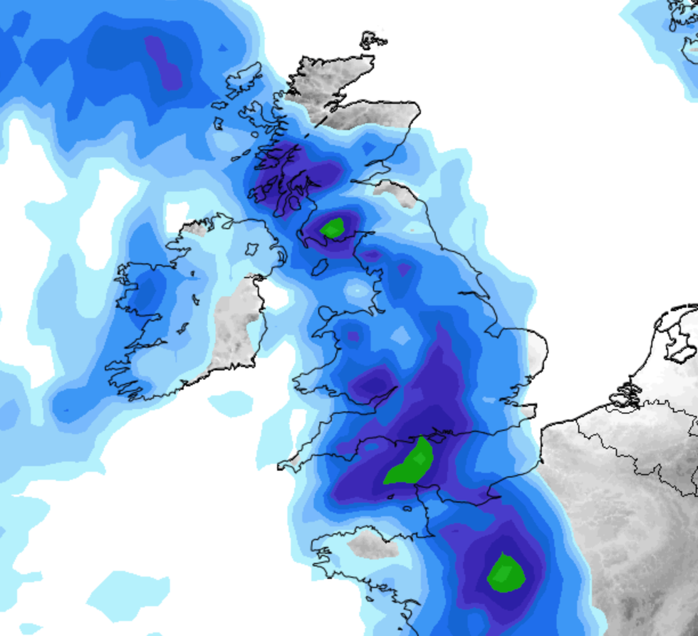
Showers are expected to begin on Thursday with widespread rain affecting most of the UK.
Forecasters predict that 'widespread' rain and showers will hit Britain this weekend before a band of wet weather is set to stretch from Plymouth to Fort William in Scotland
|Net Weather
The huge storm cloud of wet and wintry conditions looks set to hit next Saturday, according to the latest weather maps.
Wet conditions are predicted to push through tomorrow with showers and high winds.
Netweather expert Jo Farrow said: "The forecast isn’t looking great for Sunday morning. The winds will have dropped for southern England but the easterly continues to make its presence felt further north.
"It will feel chilly for Scotland away from sheltered areas and along the North Sea coast of England."
LATEST DEVELOPMENTS:
The Met Office said lower pressure is expected to creep up from the south on Saturday.
A spokesperson said: "Showery rain pushing northwards with a few showers elsewhere and some brighter spells in-between. Remaining windy, making it feel chilly, particularly in the north".
Forecasters suggest Sunday will be "widely unsettled", with frequent outbreaks of heavy rain and some light showers.
Conditions could become colder as forecasters suggest a rare weather phenomenon is underway.
According to meteorologists, Sudden Stratospheric Warming (SSW) could bring bitter wintry conditions across swathes of the country.
The weather event – a disruption of the normal westerly air flow 10-50km above the Earth’s surface – has been observed three times during winter for the first time since records began.
An SSW event can divert the jet stream – the flow of warmer, wetter air from across the Atlantic which ensures Europe enjoys milder weather than other parts of the Northern Hemisphere.
During winter, a disruption to the jet stream can lead to a large area of high pressure over northern Europe – drawing in cold polar air and driving up the risk of heavy snow like 2018’s ‘Beast from the East’.