


An ‘anticyclonic gloom’ will drape Britain with a shroud of low cloud and fog as the country ‘stagnates’ under a creepy pressure dome.
A freakishly stubborn high-pressure system will dominate the weather beyond mid-October.
But instead of driving the usual clear, sunny skies, it will trap Britain under a murky blanket of cloud and fog.
The aptly named ‘anticyclonic gloom’ promises a grim and spooky run-up to the end of the month and Halloween.
TRENDING
Stories
Videos
Your Say
Met Office meteorologist Alex Burkill said: “When you get high pressure, you get air sinking leading to sunny skies, but this looks like quite a cloudy, murky high.
“If we look at the air that is coming towards us, it is going to come from the Atlantic, and this contains moisture.
“This is going to get trapped under the high, and with the light winds, it is going to be quite stagnant, and that is why we are going to get some cloud sticking around.
“Overnight, with the moisture and clear skies and temperatures taking a dip, we are going to get some potentially dense fog at times, and around the outskirts of the high, it could be quite cloudy and quite murky.”
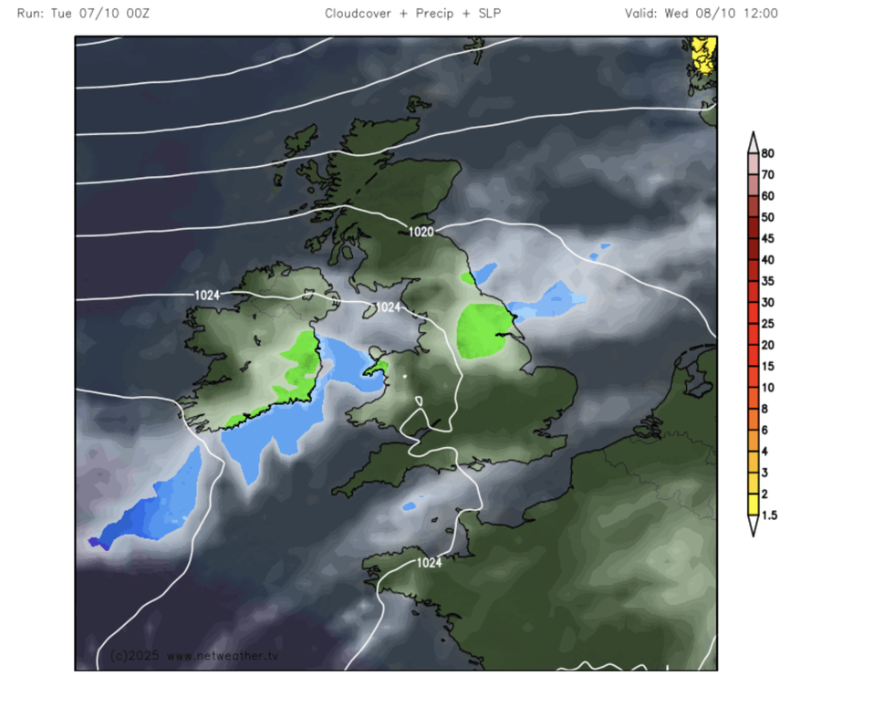
The UK will be trapped under the gloomy anticyclonic dome
|NETWEATHER
Despite cloudy skies, forecasters warn of hardly any rain in the outlook as fears mount for a winter drought.
Apart from the odd shower over the north of the country, the next week is looking bone dry.
Britain will parch into the end of October, with a fortnight ahead of mild, muggy, rainless skies.
Burkill said: “There is a lot of dry weather to come, and it looks like high pressure is going to stick around through next week.
“We will be stuck under this high, which could be largely dry and calm and not too chilly, but by day, feeling relatively warm.
“Even as we go into the following weekend, there is a very high likelihood of high pressure, so a very high likelihood of high pressure sticking around for the next two weeks.”
LATEST DEVELOPMENTS: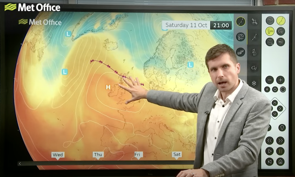
Alex Burkill describes high pressure and mild temperatures over Britain
|MET OFFICE
Stormy weather may return later in the season with hints high pressure, also called an ‘anticyclone’ weakens at the end of October.
This will allow low pressure to return from the Atlantic, putting Britain back in the wet and windy firing line.
The first storm of the season, Amy, hammered parts of the country last week, although the stormy burst was unseasonably short-lived.
Jim Dale, meteorologist for British Weather Services, and co-author of ‘Surviving Extreme Weather’, said: “The storm season may well pick up later in the year, after this period of unusually calm weather.
“Storm Amy was already late to be the first of the season, and for the next ten days at least, there is no sign of anything similar.
“The storm season does, however, run through to the start of next spring, so there is plenty of time for it to make up for lost ground.”
Our Standards: The GB News Editorial Charter