


Summer will vanish in a deluge of rain, thunder and hail as the "gates to the Atlantic" burst to a week of stormy weather.
Autumn will arrive to a gloomy and changeable picture as bands of downpours sweep from the west.
Temperatures through the coming days will plummet from the mid-20C highs in the death throes of Ex-hurricane Erin.
**ARE YOU READING THIS ON OUR APP? DOWNLOAD NOW FOR THE BEST GB NEWS EXPERIENCE**
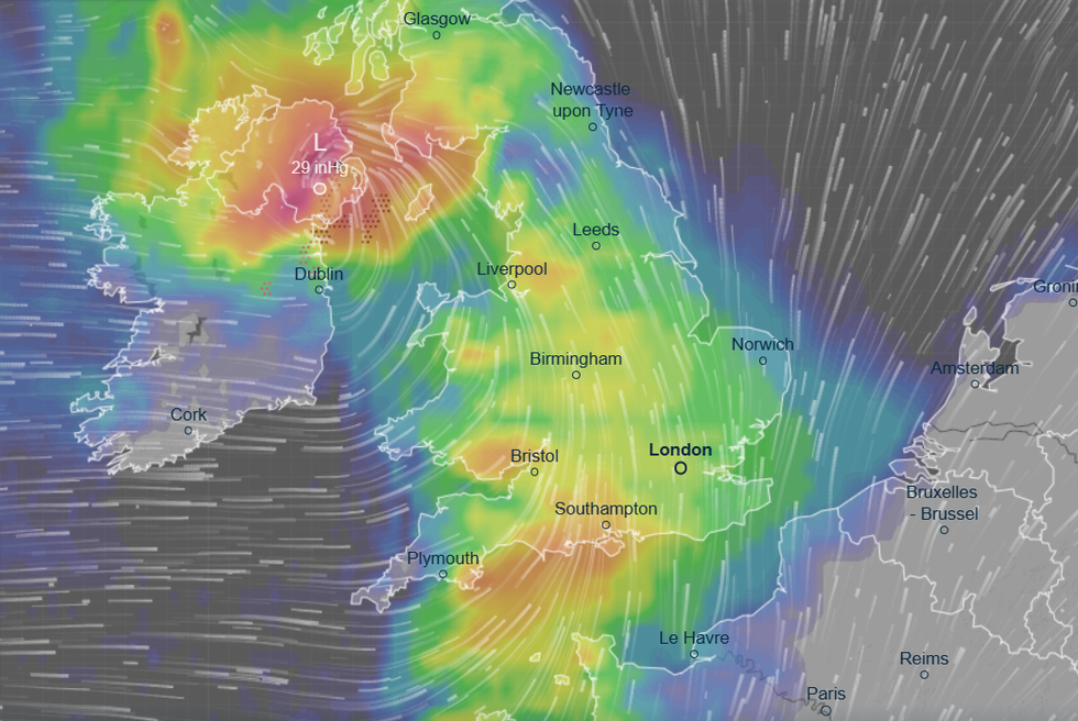
The tropical megastorm’s remains will churn the North Sea jolting the jet stream and steering in low-pressure cyclonic systems.
The tropical megastorm’s remains will churn the North Sea jolting the jet stream and steering in low-pressure cyclonic systems
|VENTUSKY
Met Office meteorologist Kathryn Chalk said: “It is going to be turning changeable as we go through the week, with another system coming through during the early hours of Wednesday across Northern Ireland.
“This band of rain then edges into Wales, the southwest of England and into northern England and Scotland as we head into the afternoon, and this rain could be heavy with the odd rumble of thunder, flash of lightning and hail.
“Temperatures will fall closer to average, down to 21C or 22C.”
Further unsettled weather patterns will blight the outlook through the week and into the weekend, she warned.
LATEST WEATHER NEWS:
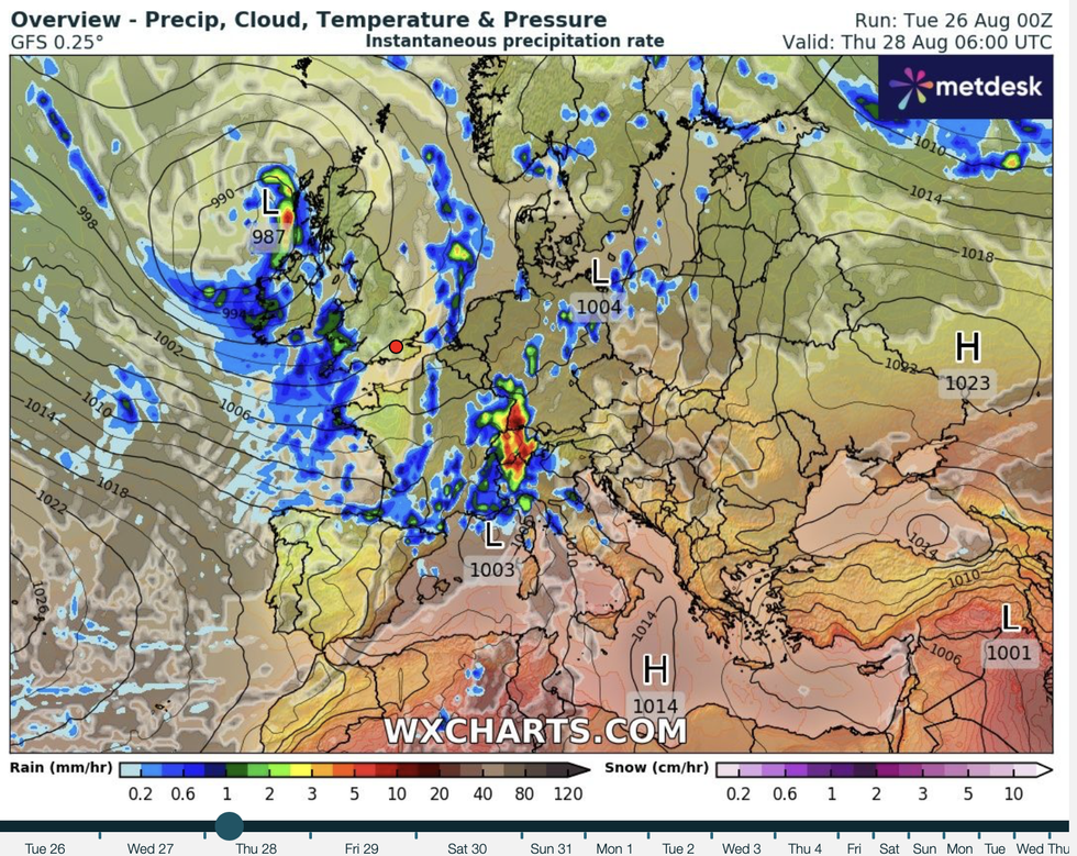
Autumn will arrive to a gloomy and changeable picture as bands of downpours sweep from the west
|WXCHARTS
She said: “As we go into Wednesday night and into Thursday, that system pushes its way in from the west, and it is going to be a rather unsettled start towards the far southeast with brighter spells behind that.
“As we go into Friday, we have another system moving through, and there will be some gusty winds, and if it is rainfall you are after, the southeast is where you are more likely to be impacted by some heavy showers or perhaps even some thunder.”
Western counties will be first in line for rain as it sweeps off the Atlantic in bubbles of low pressure steered on the jet stream.
As cooler air arrives into warmth left from the weekend, it will trigger eruptions of hail, thunder and lightning.
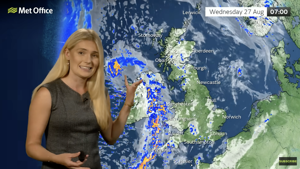
Kathryn Chalk warns of low pressure nearby
|MET OFFICE
Jim Dale, meteorologist for British Weather Services and co-author of ‘Surviving Extreme Weather’, said: “The western flank of the country will get the heaviest downpours as the gates to the Atlantic open allowing low pressure to move across the UK bringing unsettled spells of weather.
“Towards the middle of the week, there will be a risk of thunder as cooler air comes into contact with the warmer air left over the country after the bank holiday.
“The unsettled theme is likely to continue through the end of the month and into the start of September when there may be a return to higher pressure and more settled conditions.”
Autumn may, however, bring a return to sunshine with some forecasters hinting at September warmth.
WeatherOnline’s Simon Keeling said: “Low pressure will be in charge during the coming week, and this will bring unsettled weather with rain, showers and strong winds at times.
“It will be a cooler week, too, although it may become warmer again for some towards the middle of next week.”