


A "major hurricane" threatening "havoc" with Britain’s weather could trigger a Bank Holiday heat surge.
Category-4 Hurricane Erin is forecast to lash the Caribbean with 125mph winds before heading across the Atlantic towards the UK.
She will quickly weaken on the journey through the end of August as her remains sweep into our weather patterns.
A resulting shunt of the jet stream may trigger a sudden build of high pressure – the driver of summer sunshine.
However, the unpredictable nature of ex-hurricanes has meteorologists carefully eyeing her movements as she heads east.
Met Office meteorologist Alex Burkill said: “As Erin is likely to come across the Atlantic there are a few possibilities, because there are always going to be uncertainties with this kind of feature.
“What is likely to happen is Erin is going to push its way across and then we would see high pressure building again as we go towards the Bank Holiday weekend, and so we could have some pretty settled weather and with temperatures rising again.
“The other possibility is that it comes across and we could see some pretty unsettled weather.”
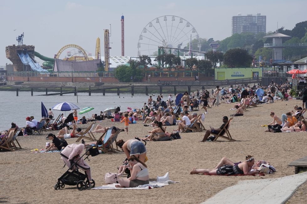
Locals enjoy the sun in Southend-on-Sea
|PA
Erin is currently hurtling towards the Caribbean whipping up winds of 125mph as she rapidly strengthens.
She is the first Atlantic hurricane of the season, over the past 48 hours hitting category-4 status, one level below maximum.
The storm is forecast to move up the west coast of the United States before its remains head towards Britain for the Bank Holiday.
Mr Burkill said: “Erin is expected to become a major hurricane, and this could bring some significant impacts, particularly to northern parts of the Caribbean.
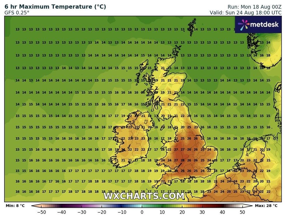
Maximum temperatures on Bank Holiday Monday
|WXCHARTS
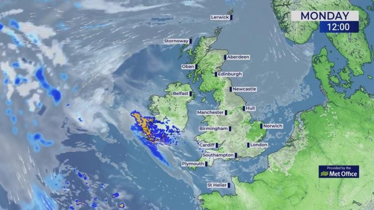
“It is likely to push its way across the Atlantic, and when this happens, a very deep low out in the Atlantic can really play havoc with the forecast as we go through the week in the UK.
“There is another low pressure in between Erin and what we have across the UK, so we could see something a little bit more changeable for a time.”
Met Office meteorologist Honor Criswick added: “It is not untypical for this time of year to get areas of low pressure getting picked up by our jet stream, but the forecast depends on where they sit towards the jet stream.”
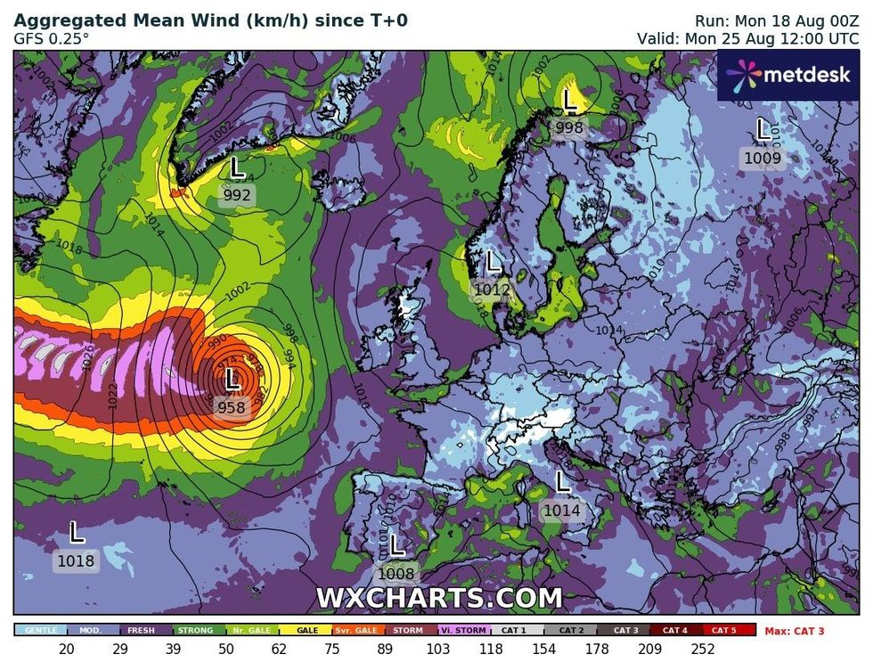
Aggregated mean wind on Bank Holiday Monday
|WXCHARTS
Erin’s dying embers will enter a nationwide split as temperatures rise to the west and fall to the east.
London, southern Britain and the west coast will hit the mid- to high-20Cs this week with a chilly 18C along the North Sea coast.
Met Office meteorologist Greg Dewhurst said: “In the sunshine, temperatures will lift into the mid-20Cs, although it will be cool along the eastern coasts with a breeze coming in off the North Sea and cloud lingering.
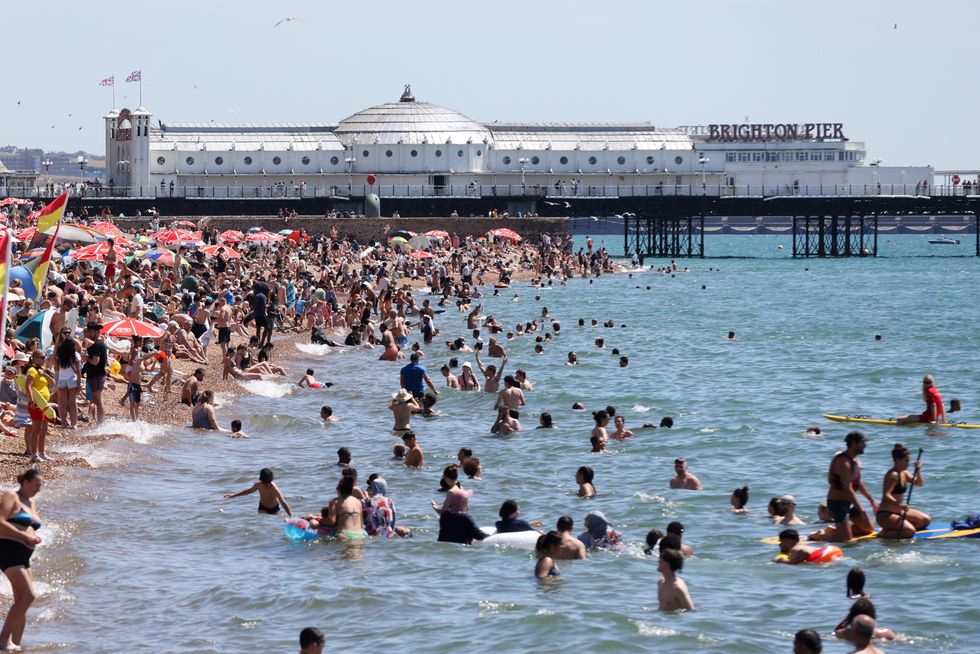
People enjoy a swim in the sea on Brighton coast
| GETTY“Looking at the week ahead, high pressure is generally nearby or over the UK, so there is lots of settled weather to come.”
Jim Dale, meteorologist for British Weather Services an co-author of ‘Surviving Extreme Weather’, said: “For the next few days it is really a picture of pleasant, mostly settled summer weather.
“Next week, although the remains of Erin are not expected to cause any disruptive weather in the UK, they will move to the north of Scotland, and this would cause high pressure to build potentially drawing in some of those high temperatures from Europe.”