


Arctic winds dragged in by Storm Benjamin will plunge the nation with freezing temperatures, ice and snow.
Britain’s weather is about to suffer another jolt as 70mph gusts, rain and thunder give way to frigid Polar gales.
Thermometers will nosedive on Friday as Scotland and parts of northern England brace for ‘widespread’ hilltop snow.
Jim Dale, meteorologist for British Weather Services, said: “We are, again, looking at a significant change in the weather as we get northerlies coming down later this week and into the weekend.
TRENDING
Stories
Videos
Your Say
“Over the tops of the mountains, there will be some widespread snow, which will be the first of the season, and there could be quite a bit of it.
“This is likely to stay for a while with the cold hanging around through the coming days.”
Away from the far north, temperatures will plumet with much of the country sinking close to or below freezing.
Exposed areas will wake to harsh morning frosts and sheet ice as bitter winds make it feel close to minus 5C.
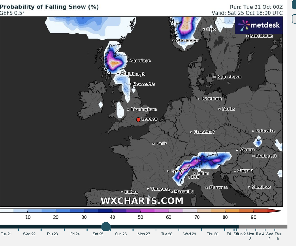
There is a higher probability of snow falling in Scotland
|WXCHARTS
Dale said: “It is going to feel very cold, especially compared to the recent mild weather, and this will bring morning frosts and ice.
“Ice on the roads could be a hazard through the coming days.”
The dramatic U-turn will be driven by an Atlantic storm due to smash the country last night with 70mph winds and torrential downpours.
Driven by a low-pressure system, it will move off to the east changing Britain’s wind flow from westerly to northerly.
LATEST DEVELOPMENTS
Low-pressure spinning either side of the UK will funnel an Arctic channel of bitter gusts, as winter takes its first bite.
Met Office meteorologist Honor Criswick said: “As we head to the weekend, we have low pressure to the east and low pressure to the west, and this will establish a northerly flow.
“There will still be some brisk winds and things will feel that much chillier with perhaps some wintry showers across Scotland.
“There will be a more northerly airflow, and so things will start to feel chiller at the end of the week and into the weekend.
“Across much of England and Wales, it will be a mix of cloud with some bright spells and the risk of some showers.”
Meanwhile, swathes of the country are taking cover for a storm assault which blew in last night.
As winds and rain die down, a brief burst of sunshine will give way to the chilly winter blast.
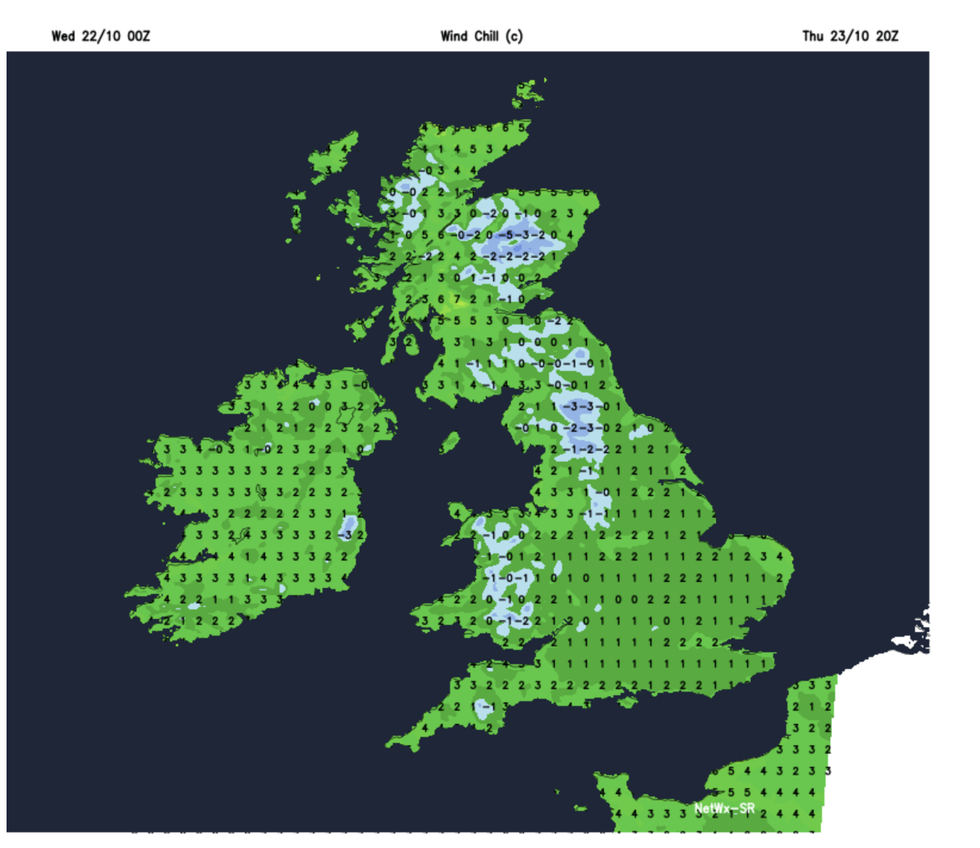
Temperatures will tank to as low as -5C as Storm Benjamin wreaks havoc
|NETWEATHER
Criswick said: “Once the rain clears, it will be brighter for all, but with some showers towards the west, which could be heavy and thundery, and there is the risk of some coastal gales, and where we see a brisk northerly wind, it will be chillier.
“There will be quite a lot of rain, and this rain will be heavy at times, and also some fairly strong and gusty winds.
“It is going to feel chilly, and there will be some longer spells of rain particularly across the east coast.”