


Battered Britain will get a 10-day ‘hint of spring’ as temperatures rocket in the ‘afterburner’ of Storm Jocelyn.
Hurricane-strength winds are whipping up to hammer swaths of the country still reeling from Storm Isha’s weekend assault.
A near-nationwide Government alert for gales and heavy rain is in force from Tuesday night as the tenth tempest of the season roars through.
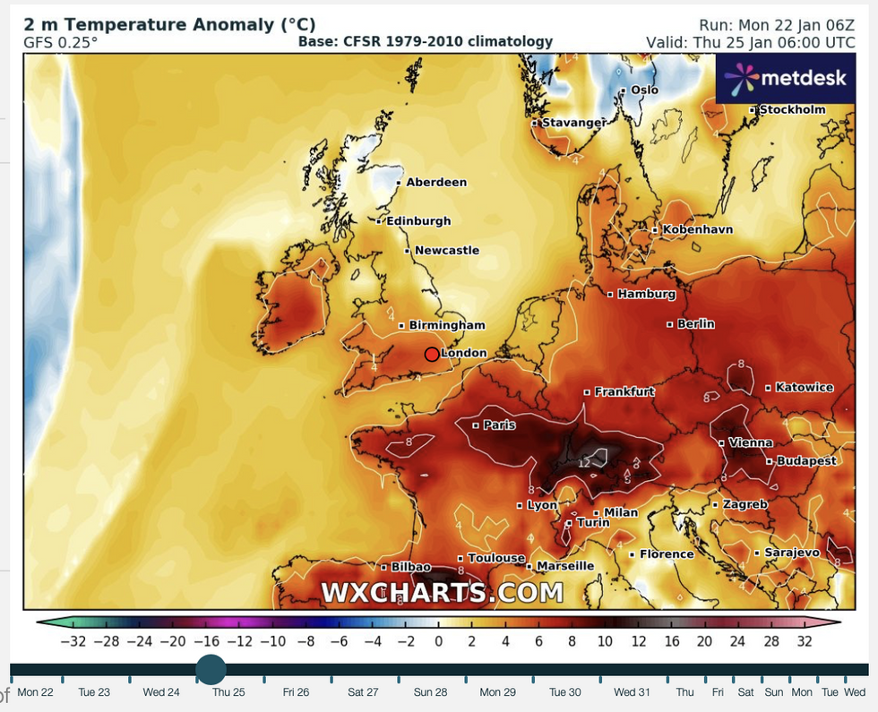
However, Jocelyn’s parting shot will be to push the mercury in parts to 14C, with double figures possible until the end of the month.
Temperatures to surge into rare January 10-day heat wave after 12-hour Jocelyn assault
|WX charts
But forecasters warn Britain is not out of the foul-weather woods, with an ongoing risk of wind, rain and another cold snap on the way in February.
Jim Dale, social commentator and meteorologist for British Weather Services, said: “This is going to be the afterburner of Jocelyn, with much milder air coming in from the west, and will bring a big change from the very cold conditions we had at the start of the month.
“It is likely that in parts of the country, it will stay pretty mild now until the end of the month, although within that period there is always the chance of a cold snap and further bursts of unsettled weather.
“However, these are the sorts of temperatures that will bring the bulbs out, and for some, it might feel like a hint of spring.”
UK LATEST: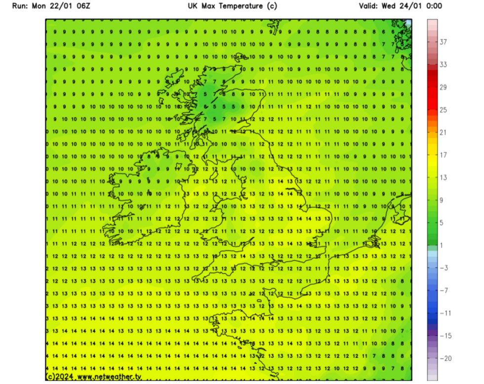
Temperatures hit double figures in parts
|Netweather
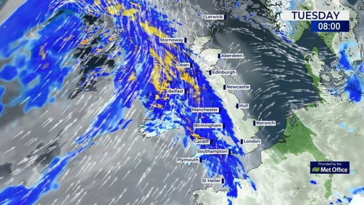
Meanwhile, Britain is braced for another storm hammering with Jocelyn set to unleash a 12-hour assault.
Government forecasters have issued a raft of weather warnings including an amber alert for wind in Scotland.
Further wind alerts are in force across northern and central Britain with parts of the country facing more than two inches of rain.
Storm Jocelyn will be the tenth named storm of the season, following Isha at the weekend and Gerrit and Henk after Christmas.
Isha was the first storm for almost a year to trigger a rare red wind warning from the Met Office, as gusts of almost 100mph hit Scotland.
Northern Ireland will be first in line for the strongest winds, before the storm, named by Met Eireann, hits the rest of the UK through Tuesday night.
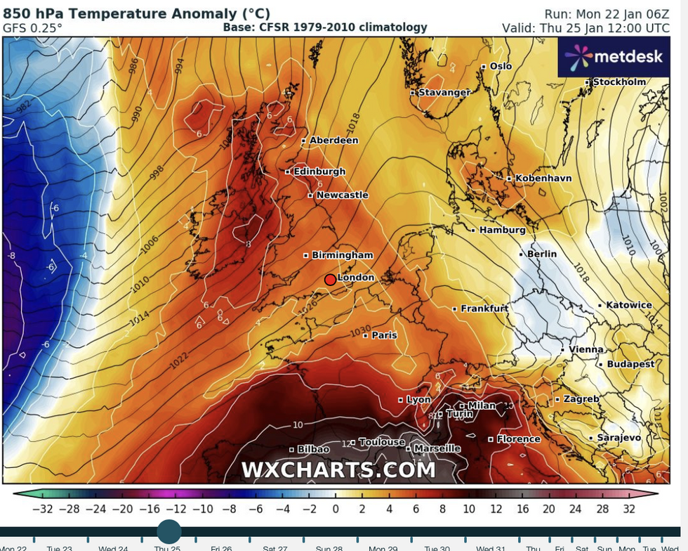
Temperature anomaly map for January 25
|WX Charts
Met Office chief meteorologist, Steve Willington, said: “Although this system will be a step down relative to Storm Isha, with the damage and clean up still underway, we could potentially see more impacts from Storm Jocelyn.
“Outbreaks of heavy rain on Tuesday could bring rainfall accumulations of 15 to 20mm quite widely with 40 to 50mm over higher ground in southwest Scotland, the Scottish Highlands and parts of northwest England.”
Winds could hit 65mph in north-western Scotland and more than 80mph across the exposed western Isles.
Unsettled but milder weather will hold out through the week as temperatures hit double figures widely.
The warm spell has prompted bookies to slash the odds on this January blazing into the record books.
Coral’s John Hill said: “Temperatures are set to climb into the mid-teens this week, so we have slashed the odds on this month ending as a record-hot January.
“Some punters believe 20C or higher could ever be reached before the month is out.”
Unsettled, but milder weather will continue into the weekend before temperatures take a dip, according to the Met Office.
Meteorologist Aidan McGivern said: “It is going to be gloomy in many places by the end of Thursday afternoon, but mild with 12C and 13C generally.
“It is going to be another blustery day on Friday with showers in many places, the rain will clear the south early on with plenty of sunshine for England and Wales.
“It is going to feel colder with temperatures hedging back to average for the time of year.
“Higher pressure to the south keeps things generally dry as we start the weekend.”