


Freezing temperatures and icy conditions are expected to continue into February following an "Atlantic conveyor belt" of storms.
The latest weather maps suggest more cold weather is on the way with a short-lived "icy blast" to unfold at the start of next month.
It comes as an increased likelihood of high pressure could have greater influence on UK weather patterns.
Senior Meteorologist and Social Commentator, Jim Dale told GB News that "winter is not quite finished yet" as "continental air" - dry air near the surface while maritime air masses are moist - is set to dominate in February.
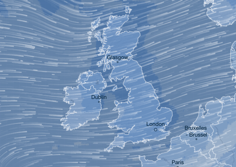
Freezing temperatures and icy conditions are expected to continue into February following an "Atlantic conveyor belt" of storms
|Ventusky
He said: "The way the Arctic is shaping up regarding sudden Stratospheric warming, I would fully expect another relatively short-lived icy blast to unfold as February moves on.
"It’s not that unusual as we tend to see continental air dominating in February, but first we have to rid ourselves of the Atlantic conveyor belt, which will gradually happen as we move into February."
According to the latest WX Charts weather maps, temperatures could plunge to sub-zero from January 31.
More snow could hit parts of Scotland from February 6.
Currently there is an increased chance of cold spells across the UK compared to average temperatures for this time of year.
LATEST DEVELOPMENTS:
It comes as a red wind warning for northern Scotland and UK-wide yellow warning remains in place until Wednesday.
Another storm, named Jocelyn, is forecast to bring windy conditions right across the UK with northern areas likely to be worst affected.
Dale added: "The new ‘Storm Jocelyn’ is arriving later tomorrow andWednesday. But we may have to wait, I don’t think winter has quite finished with us yet!"
The Met Office has also forecast Arctic conditions with a wave of wintry conditions in February.
A forecast from the Met Office from February 4 to February 18 said: "Into early February there is an increased likelihood of high pressure having greater influence on UK weather patterns.
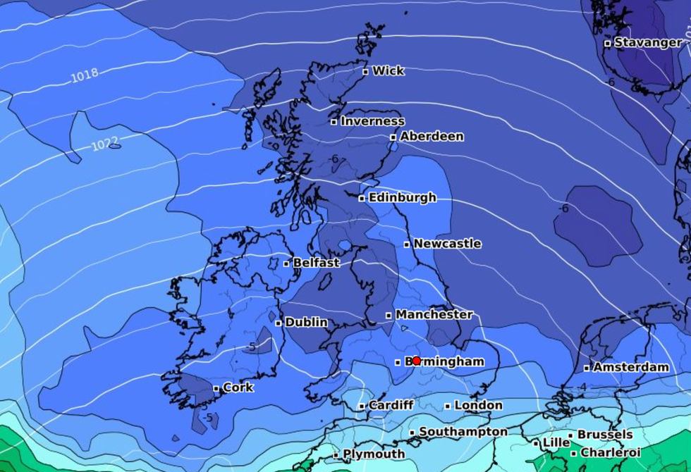
The latest weather maps suggest more cold weather is on the way with a short-lived "icy blast" to unfold at the start of next month
|WXCHARTS
"There is uncertainty in exactly where high pressure will become established but, regardless, this does increases the likelihood of drier conditions.
"There is also a greater than normal likelihood of winds from the north or east leading to an increased chance, compared to normal, of cold spells.
"Colder spells, with hazards such as snow and ice, are more likely towards mid-February, rather than earlier in the month. Whilst a drier and colder scenario is most likely through this period, there remains a chance of milder interludes with spells of rain and strong winds, especially across the north."