


After a reasonably warm weekend to kick off June, Britons have been told to bite their tongues and brace for a colder few weeks before things start heating up again.
Thermometers reached the high teens and low 20s across the UK yesterday, with parts of the Cotswolds, South Coast and South East seeing temperatures as high as 23C.
But over the coming days and weeks, weather forecasts from the Met Office and MetDesk paint a comparatively dour picture.
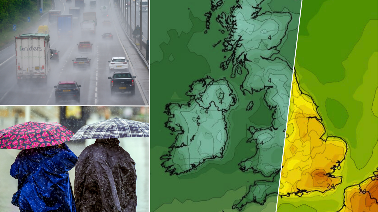
As soon as Friday, temperatures across the UK will languish around a measly 10C, with the South Coast seeing a 10 degree drop-off from Sunday at climes of just 12C - while parts of Scotland are set for a mere 7C, despite meteorological summer having begun.

The Met Office has warned Britons of heavy rain and thunderstorms over the next few weeks, while MetDesk data shows temperatures as low as 4C before conditions improve
|PA/WXCharts
Met Office forecaster Marco Petagna said: "It's been a taste of summer for the first couple of days, but for the week ahead and much of June it’s looking more mixed again.
"But there are signs that towards the end of June we could see something more settled, warmer and drier.
"For the three-month period as a whole, temperatures are likely to be above average overall - so there's a chance we'll see some hot spells at times."
However, speaking to The Telegraph, Petagna added: "The signals on rainfall are quite balanced... There's equal chances of whether it will be wet or dry".
MORE UK WEATHER NEWS:
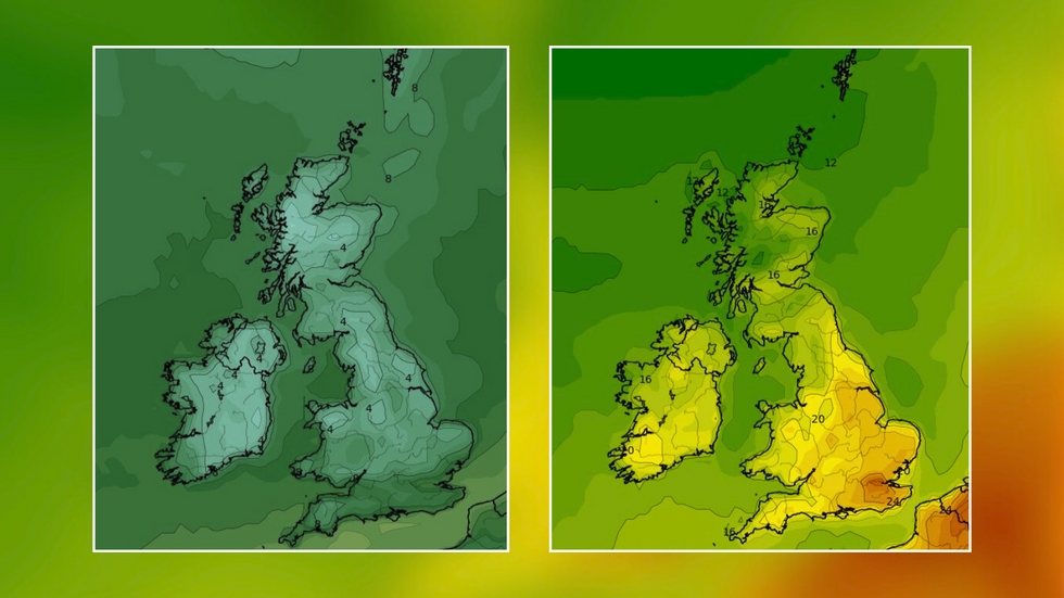
Britons will have to brace for lows of 4C before maps turn orange again
|WXCharts
Data from MetDesk predicts that Britons will have to brace for chilly overnight temperatures of as low as 4C across the country, with images from WXCharts suggesting things won't heat up again for almost two weeks.
WXCharts mapping has the UK and Ireland sat in cool green tones - indicating 10C or lower - until mid-June, with maps finally turning orange as temperatures surge past 24C by June 15.
And rain-wise, the Met Office has warned that Britons may have to endure heavy rain and thunderstorms up until that date.
Their long-range forecast from June 7-16 says: "The first part of the period most likely characterised by showers sometimes blustery, occasionally heavy with thunderstorms, sometimes forming larger bands of rain.
"Showers most often across north-western areas but all areas likely to see some, generally becoming lighter in the south with increasing brighter spells... Temperatures rather cool for most.
"Into the new week the outlook becomes uncertain though most likely an increased potential for periods of rain breaking into showers, sometimes heavy and thundery to spread from the west with fresh or strong winds at times.
"Rainfall likely slightly above average for most, though driest conditions most likely in the northeast. Temperatures mainly around normal, feeling cool in the northwest with best chance of warmer temperatures in the southeast."
Beyond that, the Met Office promises conditions are likely to settle as the UK heads into July, with slow-moving weather patterns heralding the arrival of drier and warmer climes as Britain reaches the height of summer.