


Britain is trapped in a weather ‘Groundhog Day’, holding the nation at the mercy of relentless wind and rain through this week.
Repeating bouts of wind and rain swept in on a misplaced jet stream will keep swathes of the UK submerged beyond mid-February.
Northern regions still shivering under an Arctic airmass could see snow to low levels this weekend, as milder air from the west hits the cold.
Wind, rain and snow will follow weeks of unsettled weather, prompting experts to compare Britain’s weather to Groundhog Day – a North American tradition in which a groundhog’s behaviour is said to predict winter’s early finish.
TRENDING
Stories
Videos
Your Say
Met Office meteorologist Aidan McGivern said: “Groundhog Day is also a film in which a weatherman lives the same day over and over again, and I am starting to know how that feels.
“Our weather patterns are on repeat, because we have stubborn high pressure to the east while a strong jet stream roars across the Atlantic.
“It is south shifted, and that is why we are seeing low pressure come up from the south and bring spells of rain to the south and southwest over and over again.
“We are expecting this repetitious pattern to continue through the week ahead.”
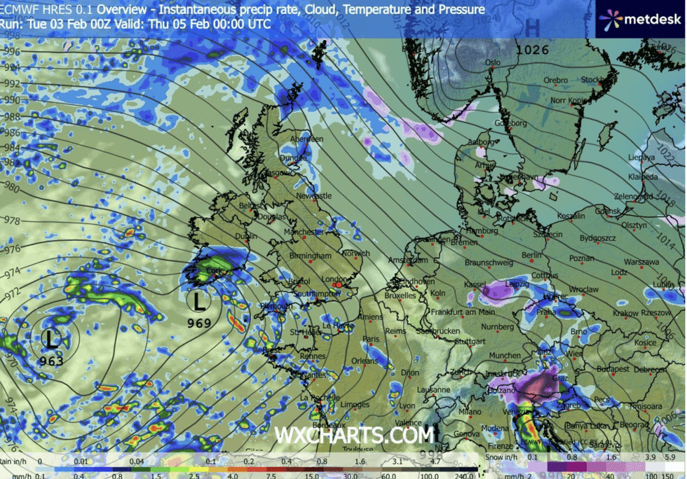
Low pressure after low pressure hits the UK
|WX CHARTS
While rain will be the main irritant, southerly gusts pushing unstable air into the colder north will bring snow.
Several inches could blanket the high ground of Scotland ahead of the weekend, with flurries possible to low ground.
Rising temperatures from the south will then turn the taps back on for further widespread rainfall.
McGivern said: “The most disruptive snow is likely across eastern and northeastern Scotland.
LATEST DEVELOPMENTS:
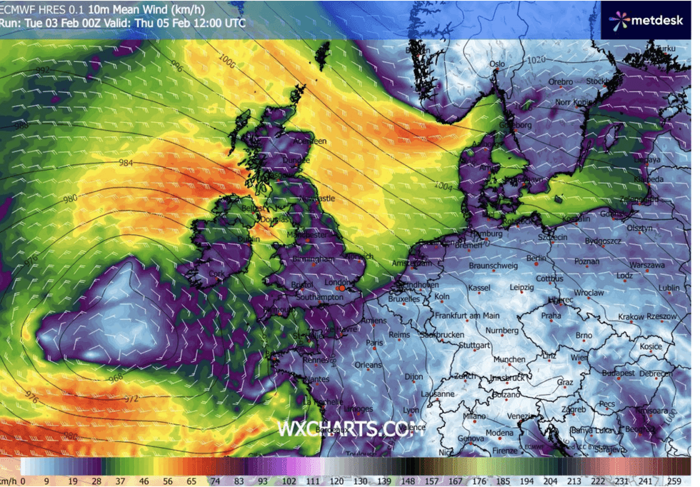
Britain set to be swept with stormy outbursts
|WX CHARTS
“We are back to rain over the hills of northern England, and it is drier across southern parts on Wednesday morning, but a cold start.
“It is turning milder from the south on Wednesday, with 9C to 11C further south and some sunshine.
“Slightly milder air moves north, and Thursday is a drier, brighter day for southern and southwestern parts of the country, with still some rain and sleet to the east and northeast.”
Britain’s weather will stay stuck in the wash cycle for another week before the cold returns, experts warn.
High pressure nudging in next week will plunge temperatures before a significant cold snap grips later in the month.
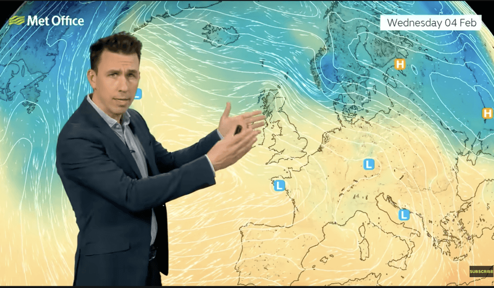
Met Office’s Aidan McGivern says milder air will come in from the south
|MET OFFICE
Jim Dale, meteorologist for British Weather Services and co-author of Surviving Extreme Weather, said: “There is no immediate change to the pattern of wet weather, and this will bring the risk of flooding to parts of the country which have already seen high rainfall totals this month.
“Next week may be drier, but with an easterly, we could see temperatures drop below freezing and the risk of ice and frost.
“But it is around mid-month that we are looking at the possibility of a significant cold event.”
The chilly forecast has spurred bookmakers to slash the odds on the coldest February ever.
Coral spokesman John Hill said: “With temperatures set to fall sharply over the next few days, and snow likely to drop in some parts of the UK, we have slashed the odds in half on this month ending as a record-cold February.”