


A ‘battle’ between pressure systems will fend off the threat of a ‘Beast from the East’ to drive mild but unsettled weather into mid-month.
Low pressure from the west will bump against high pressure to the east steering southerly gusts across the UK.
The so-called Scandinavian high has been the driver of a ‘blocking pattern’ behind this week’s dry but chilly conditions.
Low pressure is almost certain to push it back by the middle of next week, ushering a return, to milder but more unsettled weather.
High and low pressure ’sandwich’ leads to ‘col’ formation
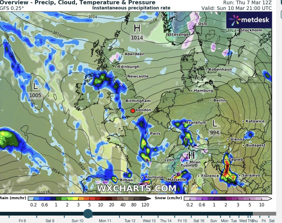
|WXCharts
It will, however, follow a chilly weekend with easterly winds pushing temperatures in parts into low single figures.
Met Office meteorologist Annie Shuttleworth said: “From mid-week onwards, with low pressure returning from the south and west, and Scandinavian high pressure still bringing its influence to more eastern areas, we get into more of a battle ground between high and low pressure.
“It is likely that during the middle part of next week onwards we see that low pressure win out, bringing spells of wetter weather in from the south and the west.
“Whichever one winds out, that will mean that we have a southerly wind direction across the UK.”
This tussle will give rise to a meteorological ‘col’ – a high pressure ridge squeezed between regions of low pressure.
It will bring cooler conditions to parts of the UK through the weekend as winds veer in from the east.
LATEST DEVELOPMENTS:
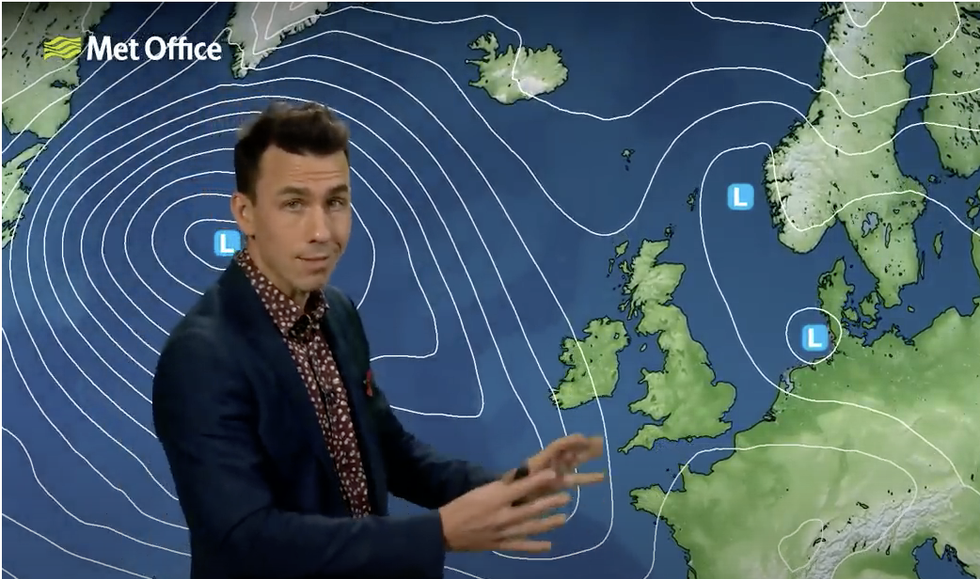
Aidan McGivern describes the set up of a ‘col’ earlier this week
|Met Office
The change in weather after a chilly weekend with the risk of a wintry flurry will also be driven by changes in the shape of the jet stream.
During the past week, the jet has been meandering in a wavy formation across northern Europe, allowing high pressure and colder, drier weather.
It’s strong centre–the jet core–is about to move southwards, allowing low pressure, and rain, into Britain.
Ms Shuttleworth said: “This strong jet core will stay to the south and will drive the development of low pressure and will push it slowly but surely up towards the UK towards the southwest of the UK towards the weekend.
“There will be a bit of a deterioration for southern areas to more unsettled weather through the weekend.
“That area of low pressure will still be with us through the start of next week.
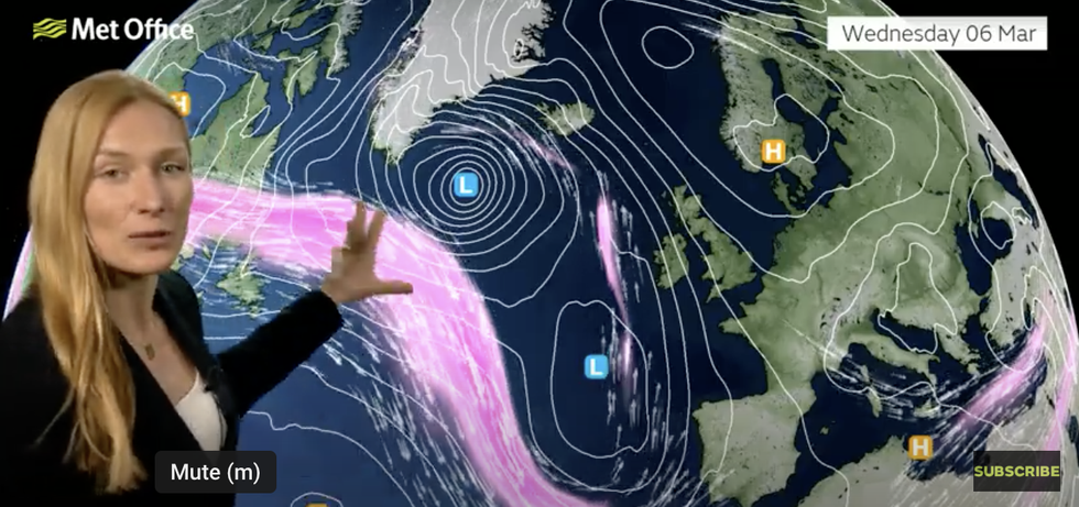
Annie Shuttleworth described the meandering jet stream earlier this week
|Met Office
“It will slowly retreat to the south and the southeast and that will allow that more settled weather to develop again as we see a col in the weather pattern.”
The forecast for milder, unsettled conditions is a stark contrast to some predictions that Britain was facing a late winter blast.
High pressure over Scandinavia which threatened easterly winds and snow will be held at bay by southerly lows.
Jim Dale, meteorologist for British Weather Services and social commentator, said: “The Atlantic is going to come back through the run-up to mid-month, and this is going to bring a further threat of rain and possibly milder temperatures.
“This push from the Atlantic is also going to hold back any threat of a Beast from the East, with nothing really in the forecasts for any sustained, cold, or snowy weather for the UK.
“We may see a day or two of cold weather during the period, but there is nothing more than that on the radar at the moment.”