


Arctic Britain is about to enter the crosshairs of 70mph blizzard-laden Storm Goretti hurled off the Atlantic by a resurgent jet stream.
The storm, named by the French meteorological service, forms a trio of low-pressure cyclones lined up to smash the UK.
Weeks of freezing temperatures are being shaken up by a return of the jet stream after a relatively calm winter.
Storm Goretti will sweep southern counties, unleashing a "multi-hazard" assault of wind, rain and snow.
A Met Office spokesman said: “A deep area of low pressure will move across the south of the UK during Thursday and into Friday bringing a mixture of rain, snow and strong winds.
“This system has been named by Meteo France as the strongest winds associated with Storm Goretti are most likely over northern France.”
As temperatures fix widely at around freezing or just above, Goretti will form a trio of storms crashing into Arctic air smothering Britain.
Steered by the jet stream, the cyclonic lows could prolong Britain’s wintery weather into mid-January.
Meteorologist Aidan McGivern said: “Arctic air surrounds the UK, but the more typical Atlantic driven weather that we often see during the autumn and winter is going to make three attempted comebacks.
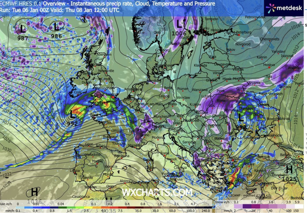
Low-pressure barrels in from the southwest towards the end of the week
|WXCHARTS
“While Arctic air surrounds the UK, the Atlantic jet stream starts to power up and deepen an area of low pressure and send it towards the UK.
“Wednesday begins with the cold feel as Arctic air returns southwards after a first attempted comeback by the Atlantic.
“This low will contain milder air and also a lot of rain and wind, and it will bump into the cold air across the UK, and things will turn very interesting later on Thursday.”
Once again, weather models are quarrelling over the track and impact of Thursday’s hammering.
LATEST DEVELOPMENTS
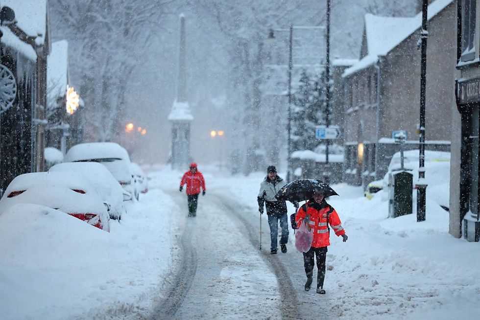
forecasters have their fingers on the klaxon for potentially disruptive conditions.
|GETTY
As Storm Goretti sweeps in from the west, it may pass directly over southern England, or swerve southwards towards France.
Either way, forecasters have their fingers on the klaxon for potentially disruptive conditions.
Ms McGivern said: “There is a very big difference in terms of the weather impacts between the simulations.
“The Met Office model takes a more northerly track, and would lead to widespread disruptive wind and rain, and with some areas seeing disruptive snow.
“Slightly more likely is a track over northern France, and much of the disruption would be taken into northern France with southern UK counties seeing the risk of snow.
“Through the day on Thursday, we are likely to see the cloud increase from the west and the wind pick up as the Atlantic low approaches, and it is going to send its rain in from the southwest.”
The battle between the Arctic and Atlantic has triggered higher-than-normal uncertainty in the forecasts.
High pressure to the north, which drove the cold Christmas, has shifted to allow low pressure to edge in from the west.
However, changing weather models have meteorologists giving different outlooks by the day.
Jim Dale, meteorologist for British Weather Services and co-author of ‘Surviving Extreme Weather’, said: “This is a very complex situation, and with this battle going on between the Arctic and low pressure coming in from the west, there is a lot of uncertainty.
“The cold weather is going to continue, but it is the risk of snow over the next few days that continues to change.
“There is a deep low coming in at the end of the week, and that will be interesting in terms of whether we see more snow, and whether it is heavy and disruptive.”
Our Standards: The GB News Editorial Charter