


Britain is facing the strongest Easter storm ever recorded, whipped up by the jet stream to unleash a hurricane-force deluge.
Storm Dave has meteorologists ‘concerned’ about heavy snow, blizzards and potentially 90mph winds.
Dave, due to hit later Saturday and ferried in by an unusually strong jet stream, could be the strongest ever to hit at this time of year.
Met Office warnings for damaging winds afternoon are in force across northern Britain.
Met Office meteorologist Alex Burkill said: “On Saturday, we can expect very strong winds, and it is looking particularly unsettled and perhaps stormy towards some parts of the northwest as we go through into Sunday.
“This looks like a very deep area of low pressure, particularly for the time of year.
“The record for pressure in the UK in April is only around 961millibars, and it looks like this could get very close to that, and perhaps a little bit lower, so we are going to see some very strong winds in associated with it.”
Behind the assault is the jet stream, fuelled by a battle between cold and warm air over the United States.
Alex Burkill describes how the strong jet stream is whipping up storms
|MET OFFICE
The jet will conveyor belt a trio of storms across the Atlantic through the coming days, although Saturday’s is looking the most disruptive.
The storm will cross the jet stream en route, strengthening in explosive cyclogenesis – the process behind Britain’s most devastating storms.
Its unusual shape has added another spanner in the works for meteorologists plotting its route and strength.
Mr Burkill said: “The jet stream is the driving force for a number of low-pressure systems that are going to arrive over the next few days.
“There is a feature that arrives on Saturday that we are more concerned about, as it comes towards us, it crosses the jet and lands on the left exit side, and that movement leads to it deepening rapidly as it comes towards us.
“It is quite an elongated low, and that makes it more difficult to be precise about where and when we are going to see the strongest winds, but we are going to see a particularly wet and windy spell on Saturday and into Easter Sunday.”
LATEST DEVELOPMENTS:
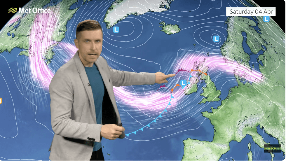
Alex points out Saturday’s big one
|MET OFFICE
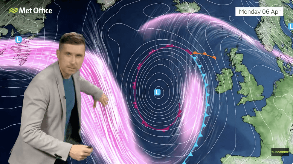
As the storm passes, another is waiting hot on its heels to roll in on Monday to end a four-day storm washout.
Scotland and northern England face the worst from Storm Dave, with southeastern regions escaping less scathed.
The Met Office said gusts around Scottish coasts could hit 90mph, with inland winds of 70mph.
Jim Dale, meteorologist for British Weather Services and co-author of ‘Surviving Extreme Weather’, said: “This is something that we are now concerned about, with gusts hitting gale-force, hurricane-force, or even storm-force in parts of the country.
“This storm has the potential to cause some major disruption over the Easter weekend.
“With the strong winds, there will be heavy rain, hail and the risk of thunder.”
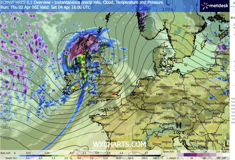
WX Charts map shows Storm Dave over the UK
|WX CHARTS
As temperatures drop, northern regions could be getting ready for a dusting of snow on Good Friday.
Mr Burkill said: “Colder air is digging in on Good Friday, and that means some showers will quite regularly fall as sleet and snow particularly over parts of Scotland.
“We have colder air making its way in, and we do see temperatures dropping as we go through Good Friday into Saturday.
“Most places will wake on Saturday morning to a chilly start, with some wintry showers over parts of Scotland.”