


The Met Office has issued a triple weather warning as Storm Benjamin is set to bring strong winds and heavy downpours to Britain.
The forecaster has released three yellow weather warnings over possible disruption, flooding, power cuts and damage to buildings in a number of regions on Thursday.
The West Midlands, London and the South East and the East of England are among the areas affected.
A weather warning for rain covering most of southern England, the East Midlands, parts of Wales and Yorkshire will be in place until 9pm tomorrow.
TRENDING
Stories
Videos
Your Say
The Met Office said more than 50mm of rain could fall in some areas.
It stated: "An extensive and in places heavy swathe of rain will move into southwestern Britain later Wednesday and spread quickly northeast, with totals by early Thursday morning of widely 20-30mm, and for some places 30-50mm.
"There is a chance a few places could exceed this, most likely over North Devon and Cornwall and also within a broad area encompassing Lincolnshire, Humberside, East Anglia and East Midlands."
A separate warning for wind on Thursday is in place from 9am until just before midnight, covering the east of England from Brighton up to Scarborough.
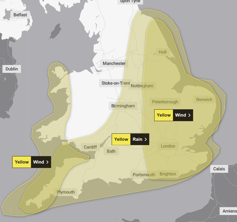
The Met Office has put three weather warnings in place as Storm Benjamin is set to batter Britain
|MET OFFICE
For the majority of the yellow alert area, gusts of up to 55mph are expected with 65mph possible near coasts, the Met Office said.
Strong winds may lead to power cuts, transport disruption and damage to buildings with a small chance of injuries and danger to life caused by large waves and beach material being thrown onto seafronts and coastal roads, the forecaster warned.
Another yellow alert for wind on Thursday covers south-west England and parts of Wales, including Somerset, Devon, Cornwall, Swansea and Pembrokeshire.
Gusts of up to 45mph are expected widely within this area, while winds of up to 60mph could be reached along exposed coasts and headlands, according to the forecaster.
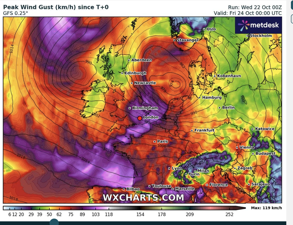
Winds could exceed 70mph in some areas, forecasters warn
| WXCHARTS
Met Office deputy chief meteorologist Dan Harris said: "It is worth noting that there is a greater than usual uncertainty surrounding the track and intensity of this low-pressure system.
"So the public should stay up to date with the latest forecasts and warnings as the situation evolves, with adjustments to the forecasts likely at short notice."
In areas set to be impacted by the heavy rain, the Met Office said motorists should check road conditions before driving.
It advised people to gather essential items such as torches or batteries for use in the event of a power cut.
In regions where strong winds are expected, the forecaster said residents should secure loose items outside of homes, such as bins and garden furniture.
Forecasters have warned that the heavy rain, thunder, and lightning could bring hail in a prelude to plunging temperatures.
Highs of 16C in parts of the next couple of days will give way to lows below freezing and the risk of snow.
Temperatures ahead of the weekend will start to plunge, bringing wintry showers to high ground.
Jim Dale, meteorologist for British Weather Services, said: "There will be a risk of frost and ice, and to the north, over the tops of the mountains, snow.
"Temperatures will fall as northerly winds come in, and for the whole country it is going to feel much colder than it has so far this month."
Our Standards: The GB News Editorial Charter