


A Scandinavian storm will smash Britain with a week of sub-zero temperatures, blizzards and thundersnow.
The freezing start to 2026 is about to get colder as gales and heavy snowfall plough in from the Arctic.
Swathes of the country are under severe weather alerts for snow over the next three days, with extreme weather forecast into next week.
Scotland is in the firing line for the heaviest downpours with almost 20 inches of snow threatening the mountaintops.
TRENDING
Stories
Videos
Your Say
Elsewhere, blizzards and snowdrifts will lead to accumulations of up to a foot, experts warn with volatile storm conditions to add a touch of thundersnow.
Met Office meteorologist Alex Burkill said: “On Friday, there are more snow showers piling in across Scotland and the chance of something coming down across parts of Northern Ireland, Wales and maybe central parts of England.
“It could push eastwards, and then we could start to see something a bit wet and wintry towards London, and there is going to be a potential impact with ice.
“Blustery, gusty winds will lead to drifting snow and blizzard-like conditions, and within these showers there will be some rumbles of thunder, so we could get some thundersnow."
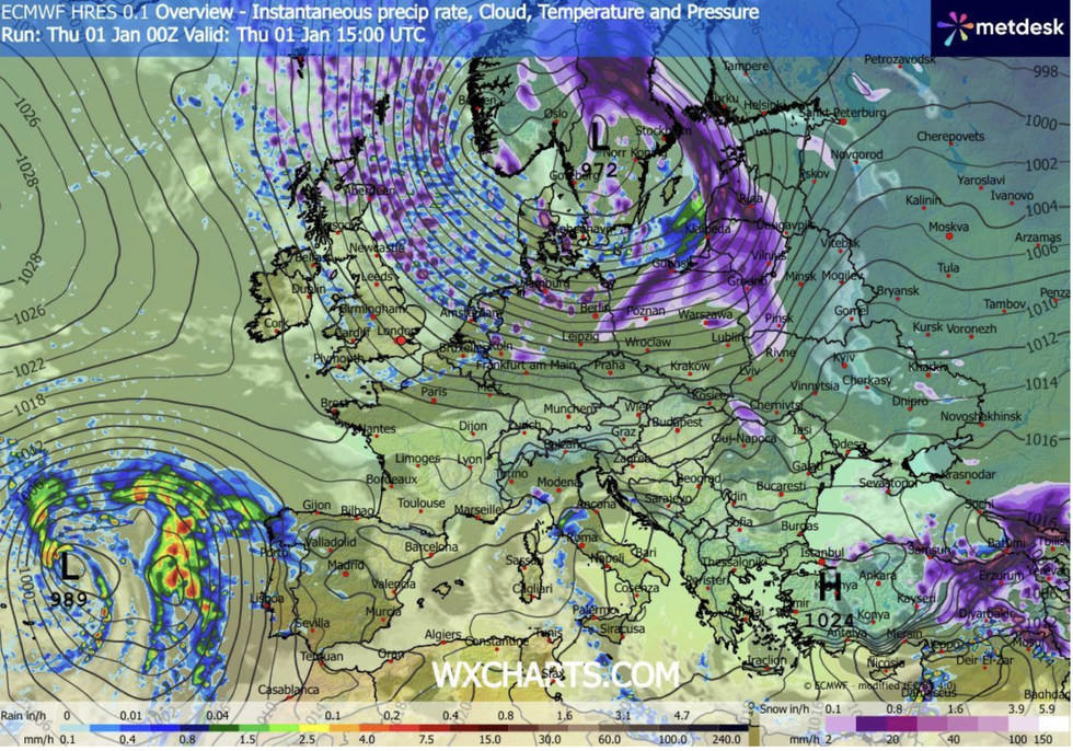
More snow showers are piling in from Scotland
|WX CHARTS
Temperatures will plummet to -10C in Scotland and northern England through the coming days, with elsewhere lows of between freezing and -6C. Northerly blasts from the Arctic driven by a low-pressure storm system over Scandinavia will hold out through the first week of the year, Burkill warned.
He said: “We are feeling the effect of low pressure over Scandinavia, and that is going to become more dominant as we go through the start of 2026.
“Snow is coming in the form of showers through the next few days, and it is in areas exposed to the wind where snow showers are going to be more frequent.
“There is the potential for 30cm over the highest routes in Scotland, and that could cause significant disruption.
LATEST DEVELOPMENTS
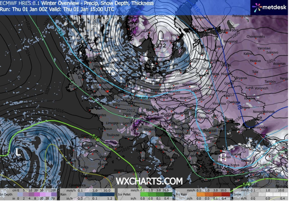
A Scandinavian storm is sweeping in
|WX CHARTS
“We could see up to 50cm over the absolute peaks of the Scottish mountains."
Below-average temperatures are being triggered by a ‘dislocation’ of the Polar vortex – a swirling airmass usually locked over the North Pole.
As the vortex shifts, it sends cold air southwards into Europe and Britain, bringing extreme cold weather and snow.
Jim Dale, meteorologist for British Weather Services and co-author of ‘Surviving Extreme Weather’, said: “There is a low-pressure system over Scandinavia that is driving Polar winds down across Britain, and this is going to continue through the start of the year.
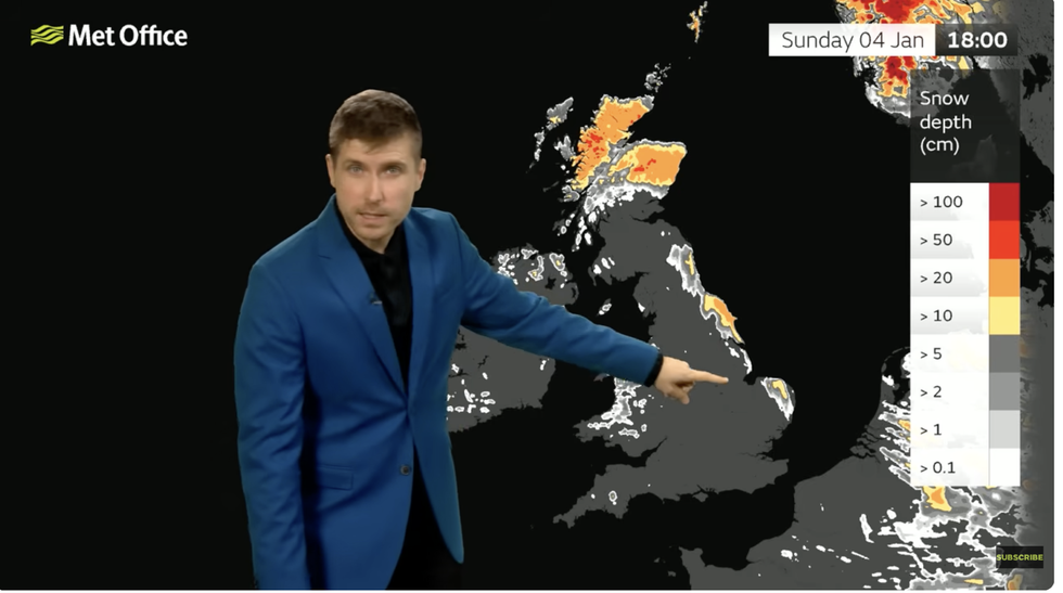
Extreme cold weather warnings have been issued
|MET OFFICE
“We also have a Polar vortex dislocation into northwest Europe, and we are on the edge of this, and we are going to stay on the edge of it through the next week.”
Extreme cold weather risking the health of elderly and vulnerable has triggered a nationwide government Cold Weather Health Alert.
Age Scotland’s policy director, Adam Stachura, said: “With such cold temperatures and icy conditions ahead, try and make sure you have enough food and any important medications at home to reduce the need for unnecessary and potentially risky trips.
“This is particularly important if you have mobility challenges or are unsteady on your feet by avoiding slips, falls and the need for medical attention.”