


Relentless rain into February threatens parts of Britain with some of the worst flooding for more than a decade.
In the wake of Storms Goretti, Ingrid and Chandra, southern and southwestern counties are once again on alert for torrential downpours.
A major incident has been declared in Somerset, reminiscent of the devastating 2013 winter floods which left the region under feet of water.
No respite is expected in the next week with another Met Office warning in force today for up to two inches of rain.
TRENDING
Stories
Videos
Your Say
Met Office meteorologist Clare Nasir said: “Through the next few days we remain unsettled with low pressure never too far away, and on Thursday, a rain warning for the southwest have been issued, and Scotland could see some mountain snow.
“A more persistent band of wet weather will arrive around lunchtime across Cornwall and Devon and moving across southern parts of Wales.
"A yellow warning is here for the risk of flooding as the ground is saturated and we are seeing flooding from Storm Chandra.”
Those hoping for a breather this weekend will be disappointed with more wet weather on the way, she warned.
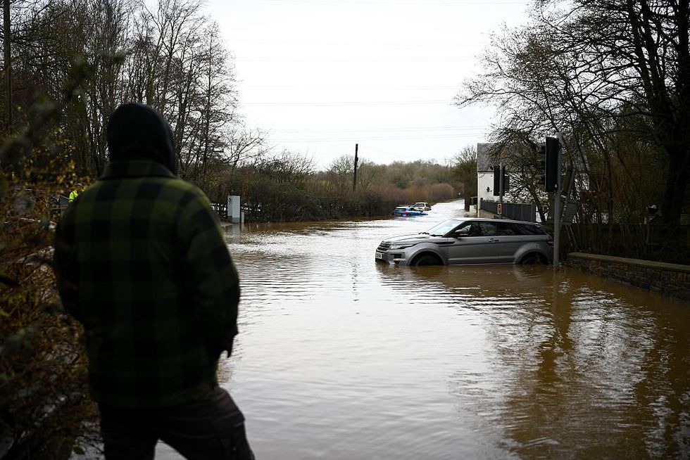
In the wake of Storms Goretti, Ingrid and Chandra, southern and southwestern counties are on alert for torrential downpours
|GETTY
She added: “Low pressure remains in charge through Saturday and into Sunday with showery bursts of rain, so all in all, the weather remains unsettled.”
Weather forecasting models in keeping with the theme through winter are still tussling over when an end is in sight for the wet weather.
The outlook for the next week is for more rain across western regions already saturated from Chandra.
High pressure over Scandinavia could reach in during the start of February to turn off the taps, experts say.
LATEST DEVELOPMENTS
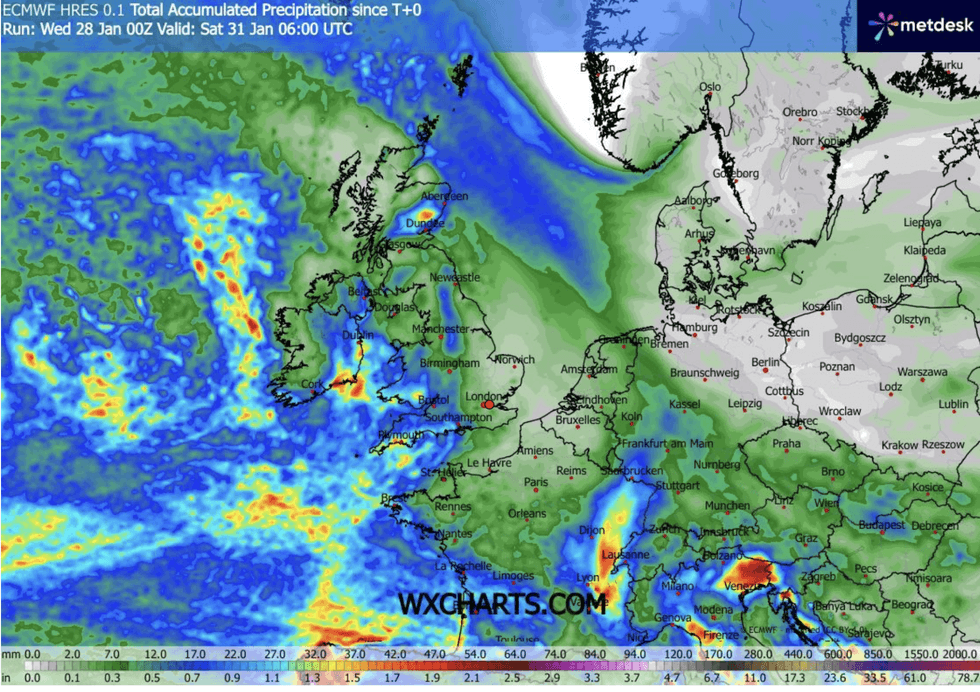
Relentless rain into February threatens parts of Britain with some of the worst flooding for more than a decade
|WXCHARTS
But more likely is for the battle between the east and the west to be won by the Atlantic, bringing more wet and windy weather.
Met Office meteorologist Alex Burkill said: “There are hints as we go through the start of February that we could see something quieter developing.
“There are hints of an easterly developing, so we could see a marked drop in our temperatures, but lower pressure systems look likely.
“Although I am not overly optimistic that we will see a long dry spell even though some models are hinting at it.
“It looks like the generally unsettled theme is going to continue, and that is a problem because it has been very wet recently.”
Britain will remain under the cosh of the Atlantic into February, with rain-laden low pressure hitting the west and the southwest through the end of winter.
As rain hits cold air over the country, heavy snow will fall to higher ground in central and northern regions.
However, despite speculation of a Beast from the East, the west will remain firmly in charge.
Jim Dale, meteorologist for British Weather Services and co-author of "Surviving Extreme Weather", said: “I think the Atlantic is going to keep winning the battle, at least for the next week.
“There are signs that something could change next month, bringing a greater risk of colder weather.
“But as this is still a time away, it is something we are watching.”
Our Standards: The GB News Editorial Charter