


Blizzards and Arctic gales have hit Britain amid fresh warnings a ‘polar vortex collapse’ could trigger another Beast from the East.
The most savage freeze of the season plunged thermometers to minus double figures as parts of Britain shiver under a blanket of snow.
In the past 48 hours, the Met Office has ramped up a raft of winter weather alerts as Scotland and parts of northern England brace for half-foot drifts
As the Arctic bites, long-range forecasters are sounding klaxons for a growing risk of meteorological events similar to those preceding 2018’s Beast from the East.
TRENDING
Stories
Videos
Your Say
A ‘high likelihood’ of a Sudden Stratospheric Warming (SSW) and weakening of the Polar Vortex – air currents circling the North Pole – means this week may be a taster of worse to come.
Dr Todd Crawford, meteorologist for Atmospheric G2, said: “All eyes have been on the stratosphere of late as a distinct and unusually early weakening of the vortex is forecast moving through late November and into December.
“A strong Stratospheric Polar Vortex during winter keeps cold air locked at Arctic latitudes, favouring mild winters in mid latitudes, whereas a weak or disrupted vortex, often due to an SSW event, allows colder air to sink southwards, leading to cold outbreaks, such as the ‘Beast from the East’.
“There is a high likelihood of a late November SSW, but whether this will be a minor or major event remains uncertain.”
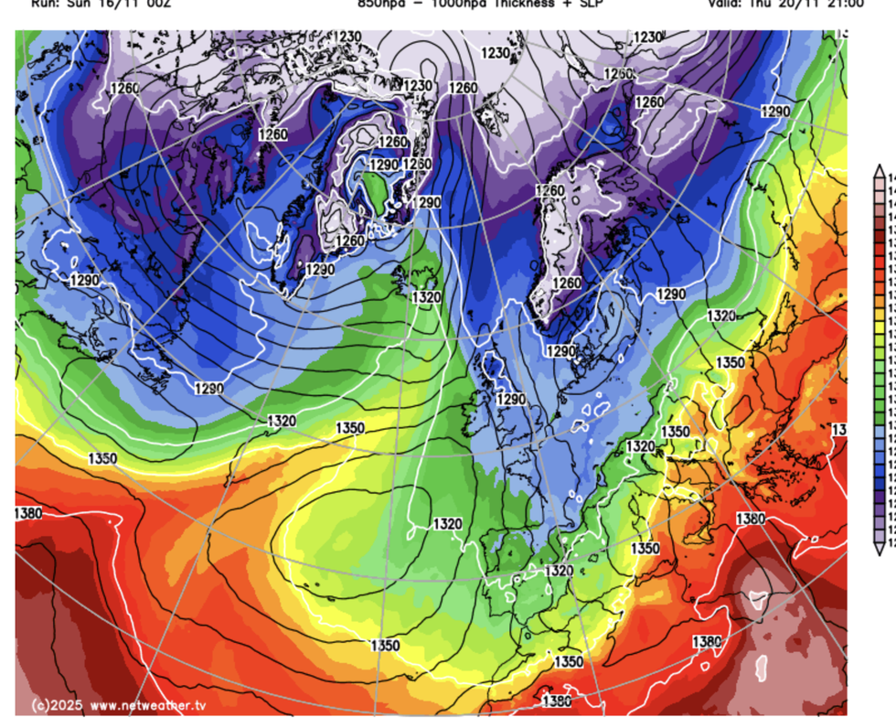
Netweather map shows Arctic winds plunging over Britain
|NETWEATHER
SSW events cause the air above the polar stratosphere to fall, warming and pushing the polar vortex lower into the northern hemisphere – a polar vortex collapse.
They are driven by a slowing or even reversal of winds high in the atmosphere at a pressure level of around 10 hectopascals (hPa).
A mild SSW this month could light the blue touch paper for a stronger event before the end of the year, Dr Crawford warned.
Global weather patterns, including a La Niña cooling of the eastern Pacific, and tropical rainfall currents over the Indian Ocean, could all play into the chilly forecast.
LATEST DEVELOPMENTS:
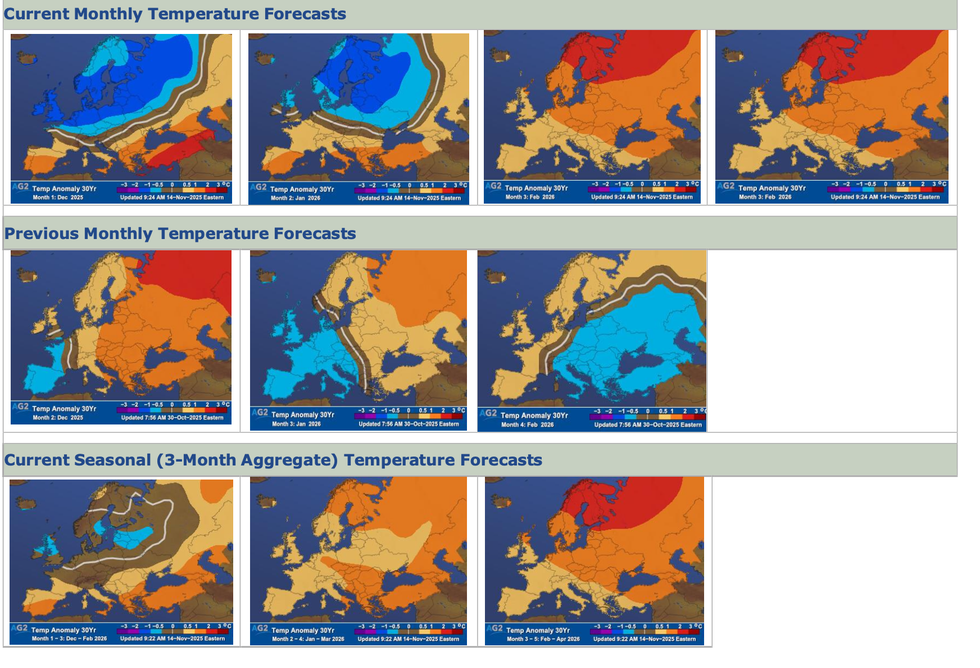
New weather maps show winter long-range forecasts
|ATMOSPHERIC G2
Dr Crawford said: “The stratosphere is currently in an extremely weakened state, with 10hPa winds forecast to drop to very close to complete reversal, but we are not quite there yet.
“The bottom line is a sudden stratospheric warming event is now looking extremely likely by late November.
“The question now is whether it will be a minor or major event.”
Meanwhile, British weather maps have turned yellow and amber under a slew of winter weather warnings.
Yellow Met Office snow and ice warnings are in force across the country, with a more serious amber alert down the northeast coast.
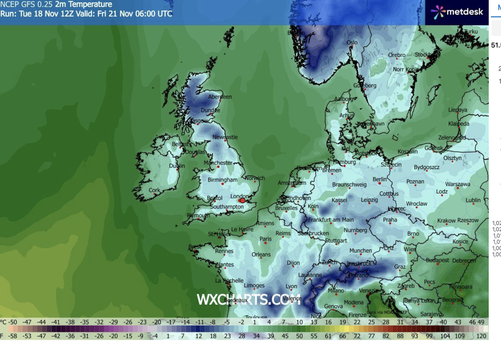
WX Charts map shows Britain will be covered in ice and snow
|WX CHARTS
Met Office chief forecaster Neil Armstrong said: “Cold Arctic air from the north is firmly in charge of the UK’s weather, bringing the first notable cold snap of this autumn and giving an early taste of winter weather.
“As a result, winter hazards are likely through the next few days, with snow and ice a particular hazard.
“Wintry showers will affect areas exposed to the brisk northerly wind, in particular Northern Ireland, southwest Wales, southwest England, northeast England and across the northern half of Scotland.”
British Weather Services’ Jim Dale added: “Parts of the country that see the heaviest snow, and we’re talking Scotland and the Highlands, may stay in the cold after the it has turned milder elsewhere.
“This is the first major winter hit of the season.”
Our Standards: The GB News Editorial Charter