


A duo of ‘dancing’ hurricanes pirouetting across the Atlantic could shake up Britain’s autumn calm.
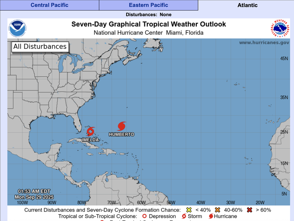
Hurricane Humberto is about to link arms in a rare formation with Tropical Depression Imelda.
While not yet a fully fledged hurricane, Imelda could over the coming hours strengthen into a worthy partner for Humberto.
The pair will link arms in what is known as the ‘Fujiwhara effect’ – two close-by hurricanes that spin together in a meteorological ‘dance’.
TRENDING
Stories
Videos
Your Say
Met Office meteorologist Honor Criswick said: “There are a couple of developments we are keeping an eye on, including Hurricane Humberto, which is an intense area of low pressure to the east of the United States.
“There is another area of low pressure that could potentially become Hurricane Imelda, and this one is a little bit more intense because of its location with regard to land.
“There is a chance that these two developments could dance around each other for a bit, called the Fujiwhara effect.
“Possibly as a result of Hurricane of Humberto drifting across the Atlantic and breaking down high pressure, there is the potential for us to see some unsettled conditions.”
LATEST DEVELOPMENTS: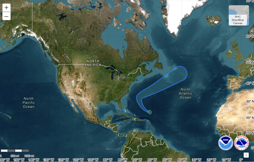
NOAA weather map predicts Hurricane Humberto heading towards UK
|NOAA
If Britain were to face attack from the Atlantic’s stirring, it would be after the calm, settled end of September.
Southern counties will bask under sunny high pressure, with only Scotland and the north facing showers.
High pressure, the driver behind settled weather, is wedged over the country, keeping storm-chasers bored for another week.
Met Office meteorologist Alex Burkill said: “High pressure is the theme as we go through the end of the week, and if this comes off, it will be drier than average and we should start to see temperatures lifting a little bit because we will be dragging our air in from the near Continent.
Ms Criswick warned Hurricane Humberto could 'drift across the Atlantic and break down high pressure'
|NOAA
“There could still be some chilly nights, and there could be some frosts, but the air will be that little bit warmer, and there is more fine weather to come as we go through the end of September.
“High pressure somewhere towards the north east of the UK is more likely, and that could mean it will be a bit drier than average with fine and settled weather.”
Atlantic hurricanes never directly impact the UK as the fierce tropical storms cannot survive cold north Atlantic waters.
Their remains can plough energy into our weather patterns but often throw forecasting models into confusion.
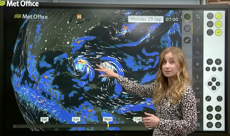
Criswick said that 'because of what’s happening across the Atlantic, there is a lot of uncertainty in our forecast'
|MET OFFICE
Depending on the ex-hurricane’s route, it can bring either stormy conditions or warmth from the south.
Criswick said: “Because of what’s happening across the Atlantic, there is a lot of uncertainty in our forecast.
“The Atlantic could potentially affect the weather in the UK after this week.
“It depends on what happens on Hurricane Humberto and potentially a secondary one, because they could potentially drift towards us in the UK.”
Jim Dale, meteorologist for British Weather Services and co-author of ‘Surviving Extreme Weather’, added: “There will be a front associated with the remains of Humberto and possibly Imelda that could affect the weather after this week.
“It is early days, though, and will be one to watch over the coming days.”