


A fortnight of intense heat could peak in the hottest July ever amid warnings of impending temperatures nudging 40C.
Meteorologists have sounded alarm bells as worrying weather models tout unprecedented hot weather.
Heatwave conditions are about to grip Britain for the third time this summer, with extreme temperatures expected into mid-month.
A sizzling cooking pot of high pressure, strong UV sunlight and warm air from the continent could topple records.
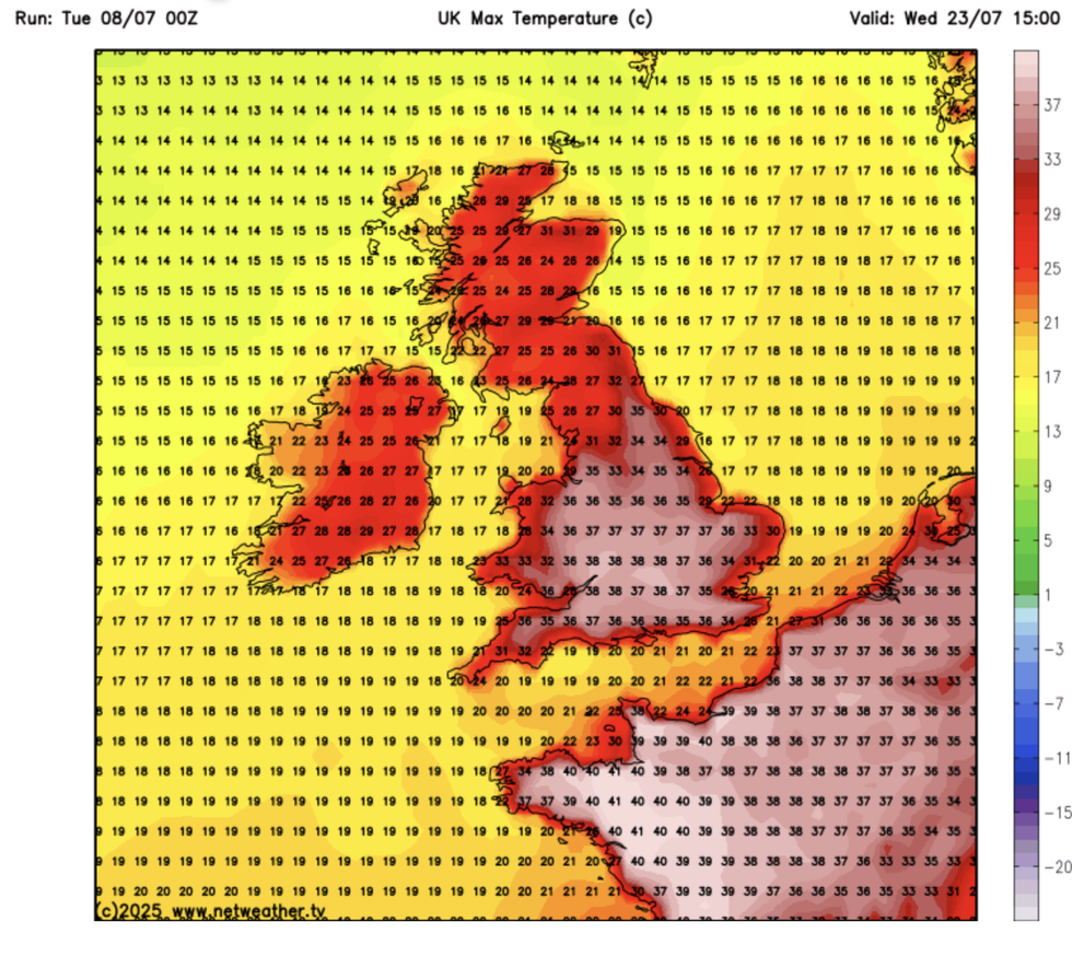
NetWeather is forecasting a temperature surge across the UK
|NETWEATHER
Jim Dale, meteorologist for British Weather Services, said: “It is once again looking very hot for the end of the month, and this is when we could see the 40C, so all eyes are on the second half of July.
“High pressure is back in charge from this week and if we get something out of the Continent temperatures will push even higher, so this needs to be watched.
“In the meantime, although there may be the odd cooler hiccup through the coming fortnight, this hot spell could hold out for the next 10 days to two weeks.”
Britain is about to bake in the return of the Azores High – a tropical high-pressure system sweeping in from the Atlantic.
LATEST DEVELOPMENTS: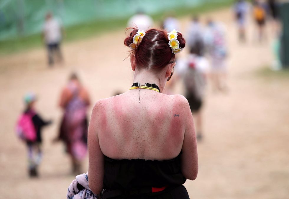
A festivalgoer with a sunburnt back at Glastonbury Festival, at Worthy Farm in Somerset
|PA
The mercury will rocket from today with highs this weekend hitting the low-30Cs, experts warn.
Heatwave criteria – breaching local threshold temperatures for three or more days – have prompted fresh nationwide alerts.
Met Office meteorologist Alex Deakin said: “We are going to see temperatures ticking up under that high pressure, and Thursday will probably be the first day of the week that we get up to 30C.
“It will be 28C across the southeast and many places will be above average.
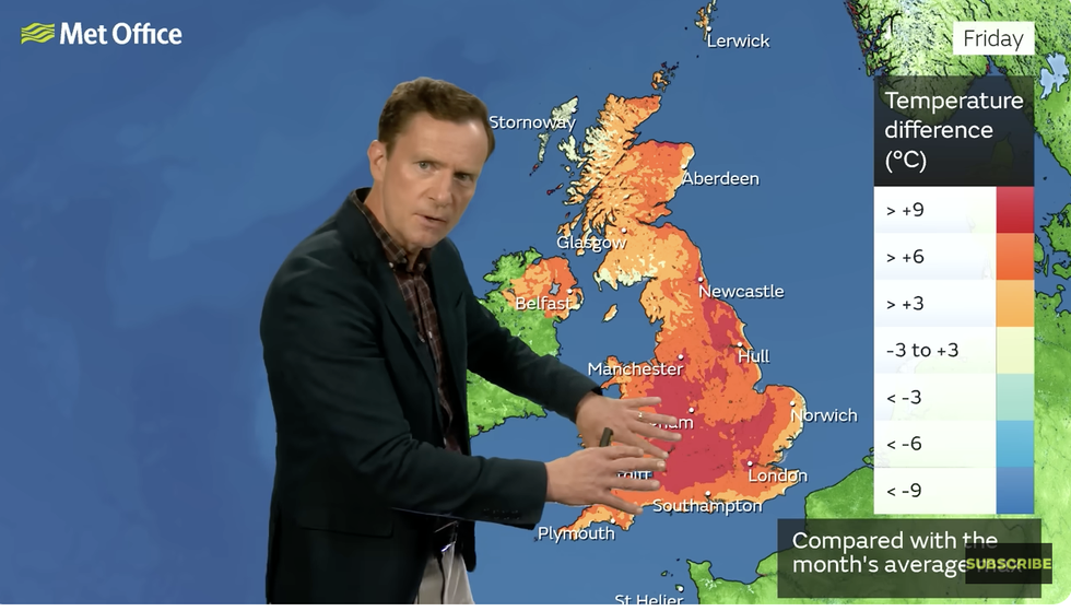
Alex Deakin provides Britons with a weather update
|MET OFFICE
High pressure takes control and pushes weather fronts to the north as we get to Thursday, and under the influence of high pressure, the air is sinking, and there will be a lot of dry and sunny weather.”
Scotland and western coasts will be slower to warm, with showers and sea breezes initially taking the edge of the heat, he said.
But much of Britain will be in heatwave territory by the weekend as the Azores high takes charge, he added.
He said: “High pressure is completely in control by Friday, although an easterly breeze will keep things a little cooler around the coasts of East Anglia and the southeast, but for most places it is dry and sunny.
“The warmth is moving north as we go towards the end of the week, and by the end of the week we will probably get to 32C on Friday.”
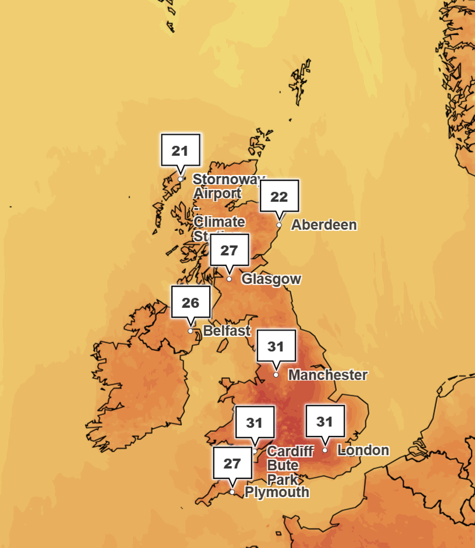
Temperatures will hit 31C this weekend
|MET OFFICE
Jason Nicholls, lead international forecaster for AccuWeather, added: “High pressure is going to build across southern Britain and that will lead to temperatures at the end of the week in the low- to mid-30Cs.”
Weather models for the second half of July show the risk of touching the high-30Cs or even 40C.
While 40C is not unheard of after 2022’s 40.3C, temperatures hitting this mark is still thought unlikely.
However, a changing climate has sparked warnings that unusually high summer temperatures may become more common.
Dale, co-author of ‘Surviving Extreme Weather’, said: “We are seeing the impact of climate change regularly, and it is no longer out of the question to expect 40C during the hottest summer months.”