


A ‘Bermuda’ heat dome about to slide in from the tropics threatens to plunge Britain into a fortnight-long heatwave.
Chilly winds and rain at the start of this week will give way to temperatures back in the mid-30Cs.
Thermometers will climb from today as the Azores High – a blocking dome of high pressure stretching from the tropics – smothers the UK.
Once in place, it threatens to bake the nation through much of the next two weeks, experts warn.
Jim Dale, meteorologist for British Weather Services, said: “We are getting another drag out of the Continent this week as the Azores High builds back, and this could push temperatures by the end of the week back into the low-30Cs.
“It is getting warmer from Wednesday, with temperatures pushing up on Thursday and Friday.
“We are looking, again, at possible heatwave conditions, and this hot spell could hold out largely through the next 12 days or longer, although there may be the odd hiccup as fronts come through.”
The chilly start to the week will give way today to temperatures climbing back into the 20Cs.
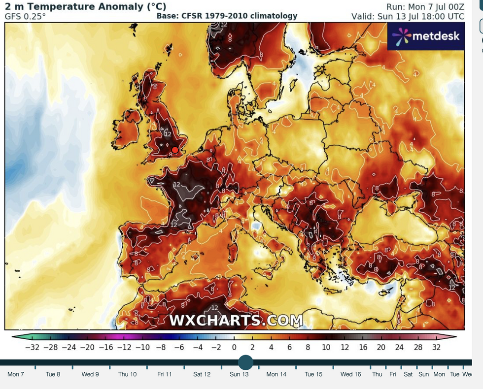
WX Charts map shows likelihood of temperature anomalies this weekend
|WX Charts
Highs of 30C are possible in southern and southeastern Britain by the end of the week.
Met Office meteorologist Jonathan Vautrey said: “Temperatures will be climbing on Tuesday, quite widely to between 20C and 22C, and we are likely to see highs of 24C or 25C across areas of southern England.
“Temperatures are very likely to start climbing even higher as we head through the rest of this week.
“There will be plenty of sunshine, and day-on-day heating could see us reach close to 30C in places.”
The return of hot weather has kept meteorologists glued to their barometers after some models last week touted a weekend high of 40C.
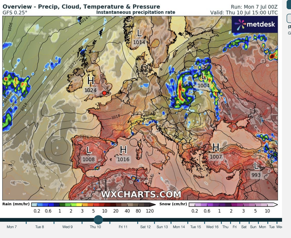
An Azores High is set to return to Britain
|WX Charts
A cold front sweeping from the north tempered the flames, with predictions then dropping into the 20Cs.
Now, another U-turn has turned the burners back up, although experts predict this weekend nudging the mid-30Cs.
Jason Nicholls, lead international forecaster for AccuWeather, said: “It will be dry and sunny on Wednesday and Thursday.
“A cold front had been forecast to come into Scotland, but this has been delayed by high pressure across southern England.
“We are now expecting to see maximum temperatures in the low- to mid-30Cs through the end of this week.”
The Azores High, also called the ‘Bermuda High’, has driven two heatwaves so far this summer.
It was also behind the historic 2022 heatwave, which rocketed temperatures to a record 40.3C.
It has ebbed and flowed into and out of the UK over the last few weeks, with another return due this week.
Met Office meteorologist Aidan McGivern said: “The emerging theme in many of the computer models is for high pressure to become more influential again from the middle of the week.
“As the Azores High builds in from Thursday, we are more likely to see the return to some warmer-than-average weather.
“But there is still some uncertainty as to the extent that the Azores High builds in.
“If that happens, temperatures would climb.”