


Britain is back on heatwave alert with temperatures about to rocket in another 30C-plus fireball blast of summer.
Sun-baked Britons are warned not to be fooled by a cooler start to the week, with the potential for "very hot weather" as soon as this weekend.
Temperature records for the year could be broken once again, with weather models showing highs in the 30Cs and beyond.
Recent weather models had touted 40C as a weekend high - although meteorologists think this is now unlikely.
Met Office deputy chief meteorologist Steven Keates said: "It looks like that through the second half of the week and into the weekend, temperatures are going to build, particularly across parts of the south and the east.
"It looks like typically hot summer weather is quite likely... There is the potential for something very hot to develop, but there is a lot of uncertainty.
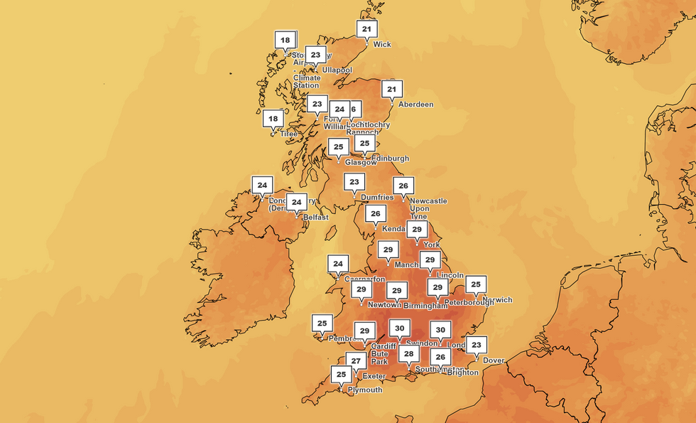
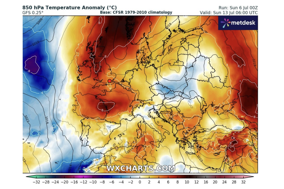
'There is the potential for something very hot to develop,' the Met Office says - with forecasters' maps showing 30C spikes by this weekend
|MET OFFICE
"There is the potential for some further hot weather to come."
Unlike last week's heatwave which was largely confined to southern Britain, the next blast threatens the whole country.
Temperatures will rise from mid-week, with temperatures likely to hit the 30Cs after the weekend.
The Met Office's Honor Criswick said: "Weather models are suggesting that we could potentially see some heatwave conditions on the way, but this time not just across central areas and parts of the southeast, but a bit more widespread, pushing up to the north and into Scotland.
"There is a suggestion that temperatures will climb as we go through the week.
LATEST WEATHER HEADLINES FROM GB NEWS:
- Experts U-turn on 'monster heatwave' warning but 'bursts of heat' remain
- Britain to be hit with THIRD heatwave within a month as temperatures soar to 31C
- Britain just DAYS AWAY from another 30C heatwave as temperatures will rocket 'with a vengeance'
- UK weather: Heatwave swept away by jet stream as thundery downpours batter Britain
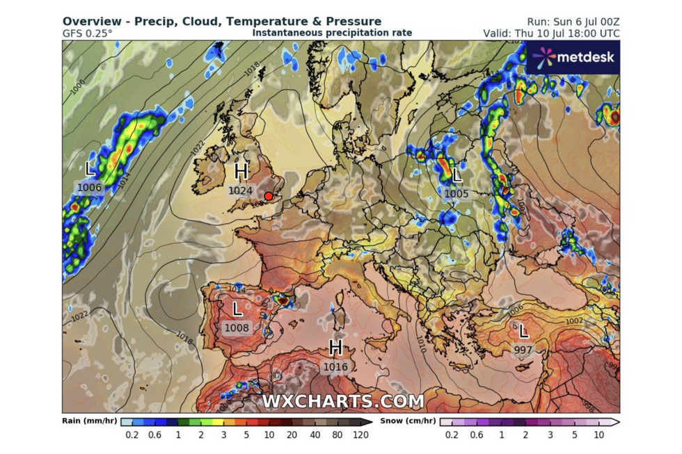
Hot weather this weekend will be boosted by a 'drag out of the continent' drawing in a plume of tropical air
|WXCHARTS
"As we progress further into the week, temperatures begin to climb, and when we get to Sunday, some of the models are suggesting that we could see temperatures in the mid-30Cs, but other models that suggest that temperatures could be in the mid- to low-20Cs."
Hot weather this weekend will be boosted by a "drag out of the continent" drawing in a plume of tropical air.
Southwestern regions including Devon, Cornwall and Somerset are in the firing line for the heat this time.
Jim Dale, meteorologist for British Weather Services and co-author of "Surviving Extreme Weather", said: "We are looking at temperatures rising through the middle of the week, if this next hot spell comes off.
"With this, there will be building humidity with the hottest temperatures the further west and southwest you go.
"We could see highs of 31C to 34C at some point, depending on when a front comes through."
Westerly winds will bring outbreaks of rain to the north and the west throughout the week
|WXCHARTS
Temperatures will rocket after a relatively chilly start to the week with much of the country cooler than average for early July.
Westerly winds will bring outbreaks of rain to the north and the west, while thermometers hover in the mid- to high-teens.
Sunshine and rising temperatures will return by the middle of the week with much of the country turning warmer.
Jason Nicholls, lead international forecaster for AccuWeather, said: "It will be dry and seasonal to start the week, turning warmer on Tuesday.
"Scotland will see isolated showers through the start of the week, and then by Wednesday, much of the country will be warm with sunny spells."