


A Spanish plume is expected to bake Britain as scorching temperatures as high as 35C appear imminent.
An expert has suggested mercury could soar to its highest point since last July’s unprecedented 40C heatwave.
Jim Dale, a senior meteorologist at British Weather Services, told The Daily Express: "There's a big move on the weather models, indicating the middle to end of next week to be hitting 35C here and potentially 45C in Spain, following the hottest start to June globally ever.
"This is all written very large on the can of climate change."
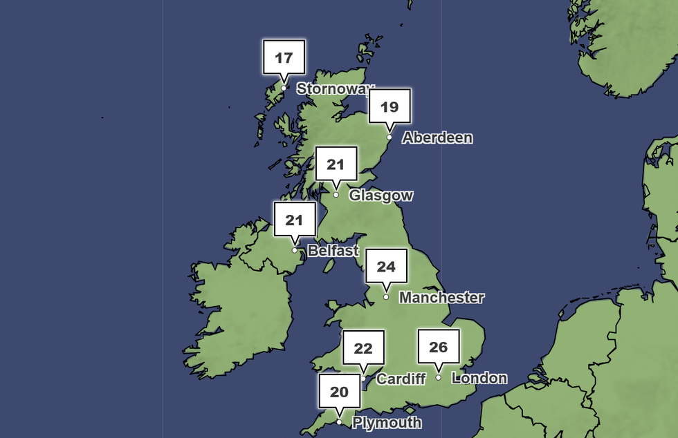
Temperatures could hit 26C by the end of this week, the Met Office has said
|Met Office
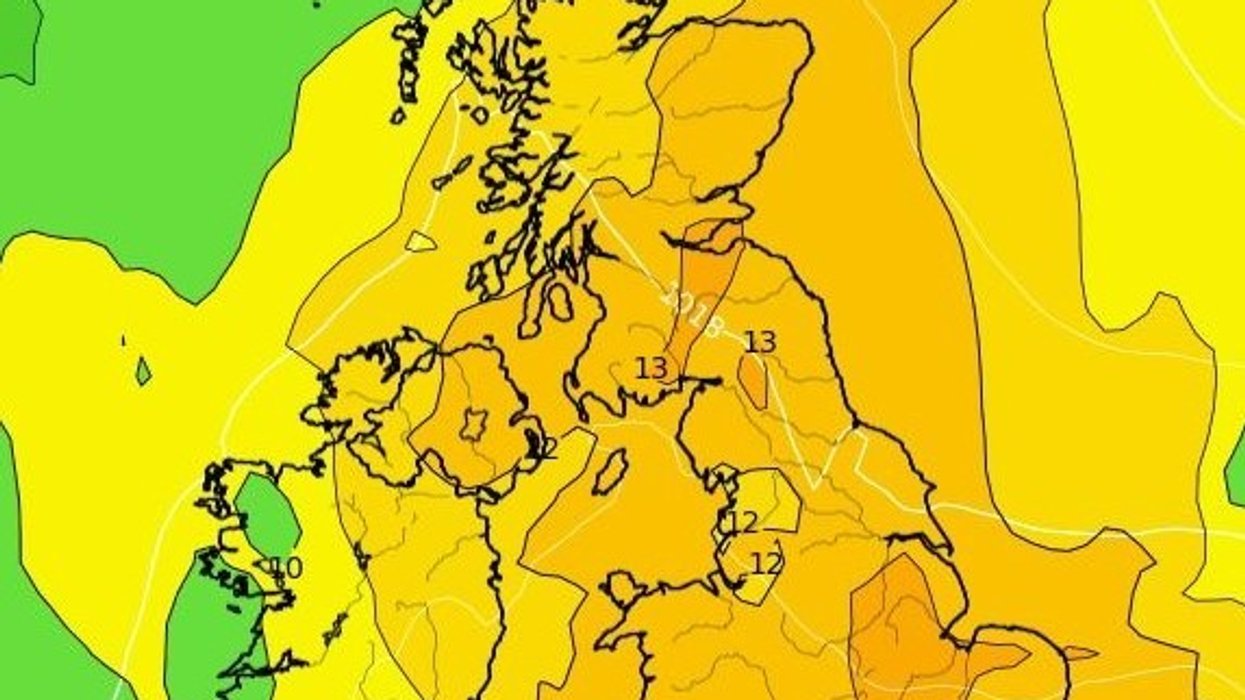
The Met Office also believes temperatures could exceed seasonal averages but appeared reluctant to echo Dale’s forecast.
Looking ahead to June 24 to July 3, the UK’s national weather service said: “Temperatures are likely to be above average for many, and very warm to hot in central, southern and eastern areas.
“Further into this period, it may generally turn slightly more unsettled, however the northwest is likely to continue to see the most unsettled conditions, with rain and stronger winds at times, while the southeast is most likely to see the driest conditions, although the chance of heavy showers or thunderstorms cannot be ruled out here.”
However, experts at Netweather have suggested temperatures could cool over this week.
In its update, Netweather claimed: “Temperatures will cool off next week, though they will remain above average for the time of year, generally peaking in the low to mid-20s Celsius in eastern and central England.
“With shallow low pressure generally close to the UK, we are expecting further showers and thunderstorms for much of the country until Thursday.
“Even though it will generally be cloudier than recently, there will still be plenty of sunshine for much of the time too.
“Tuesday evening looks particularly likely to see some organised rain and thunderstorms heading northwards, most likely through eastern parts of England.
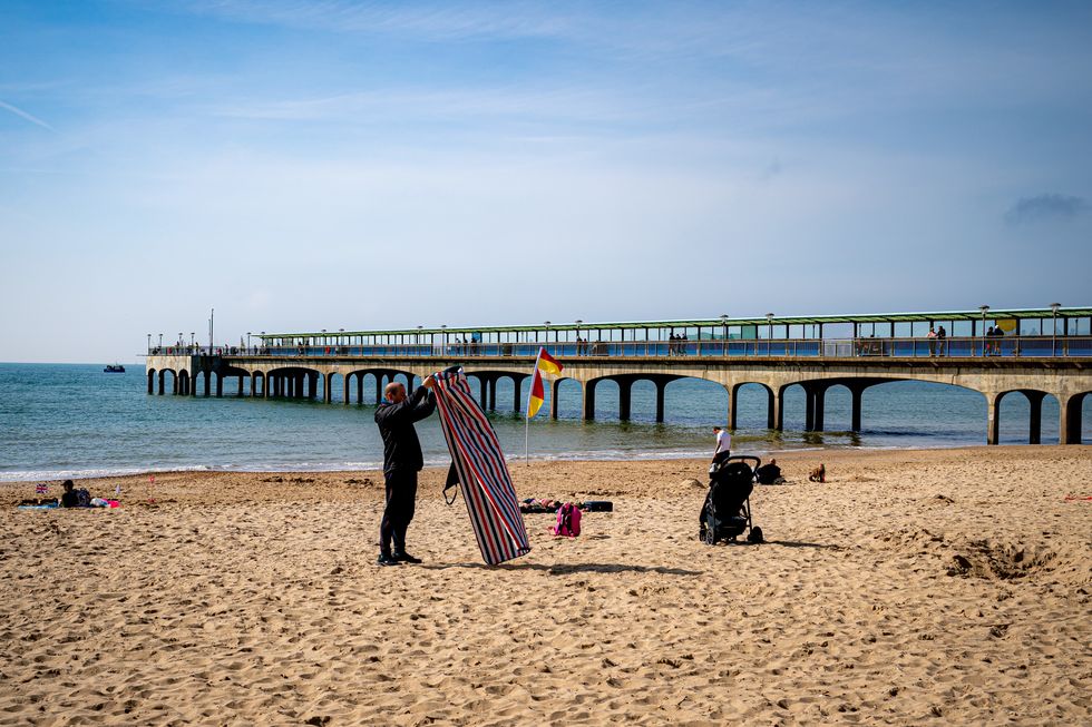 Many people in the UK have been enjoying the hot weather | PA
“For the long term, it looks probable that we will move into more of a westerly regime towards the end of June, which is quite common at this time of year.
“However, it is set to remain mostly on the warm side, particularly in eastern Britain, with winds often blowing from the southwest.”
The risk of thunderstorms means the Met Office kept a yellow warning in place for Northern Ireland for much of today.
There were also six flood warnings and alerts in place across England and Scotland, according to the Environment Agency and Scottish Environment Protection Agency.