


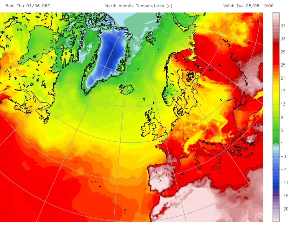
An Azores plume looks set to trigger a scorching heatwave in the United Kingdom as weather maps turn red.
Mercury is forecast to rise rapidly over the next fortnight as Britons prepare to bask in the sunshine.
The shift in weather appears to have come from earlier heatwaves in Portugal and Spain.
Iberia is not the only part of mainland Europe set for an uptick in temperatures, with the warm flow forecast to cross the Pyrenees into France.
Iberia will see temperatures soar earlier than other parts of Europe
|Netweather
Temperatures in France will reach as high as 36C in around a fortnight’s time, leading independent forecaster NetWeather has said.
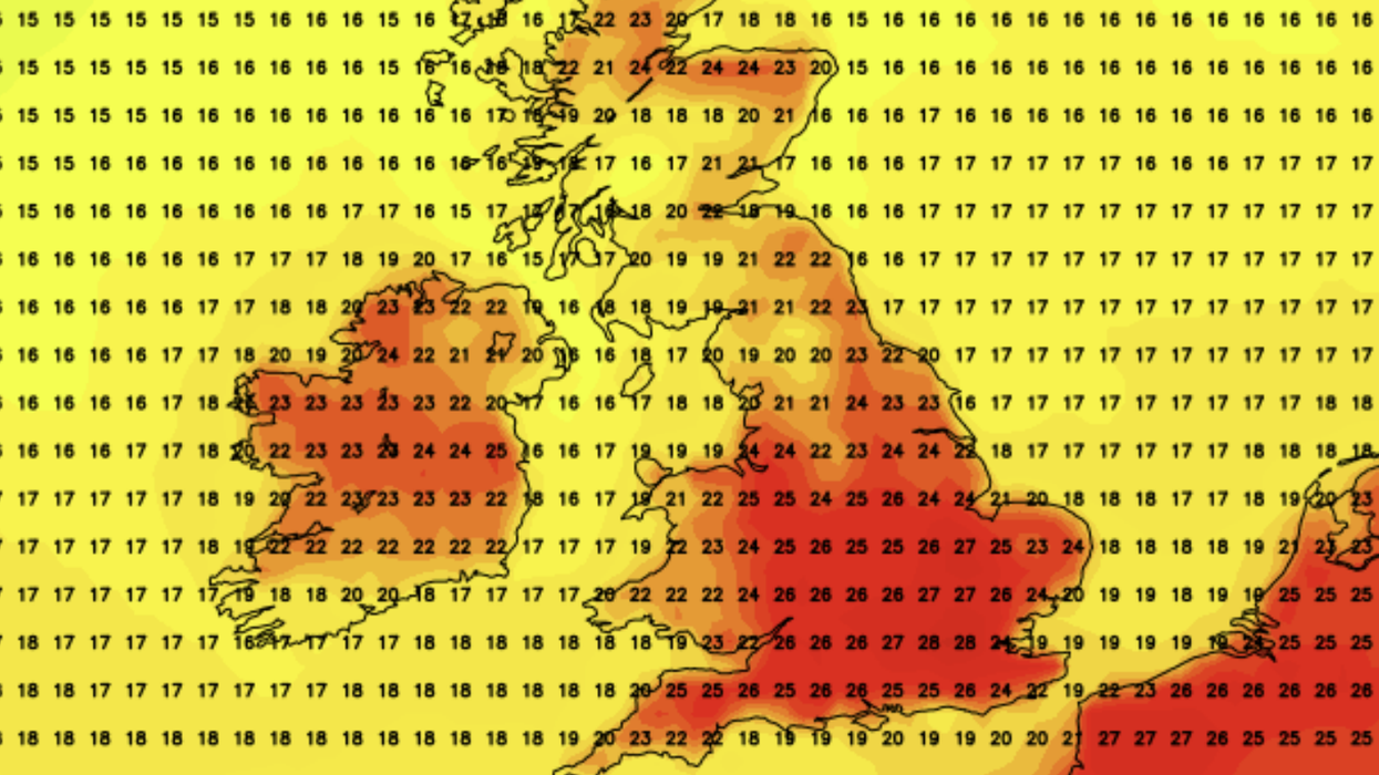
Mercury in the UK will peak at 28C in London but will hover around the mid-to-high twenties in the rest of England and Wales.
Scotland and Northern Ireland look set for notably cooler conditions as temperatures range from just 10C to 20C.
Scorching temperatures come after a torrid few days for Britons during the height of the summer holidays.
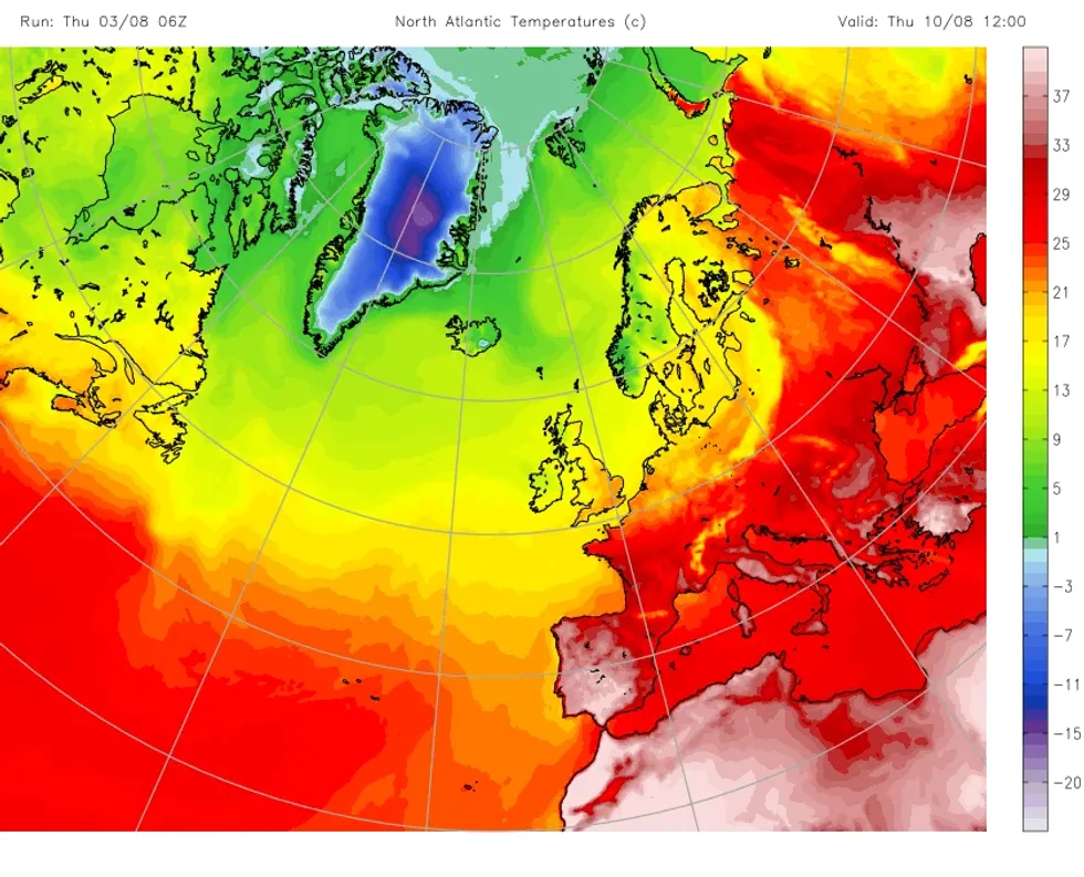
Iberia is not the only part of mainland Europe set for an uptick in temperatures, with the warm flow forecast to cross the Pyrenees into France
|Netweather
The Met Office issued a trio of yellow weather warnings yesterday as England and Wales was left covered in rain, thunderstorm and wind alerts.
Another set of yellow warnings have been issued for Saturday.
A rain warning will hit Northern Ireland from midnight until midday.
Wales and the South West will see “unreasonably windy weather” from 6am to 9pm.
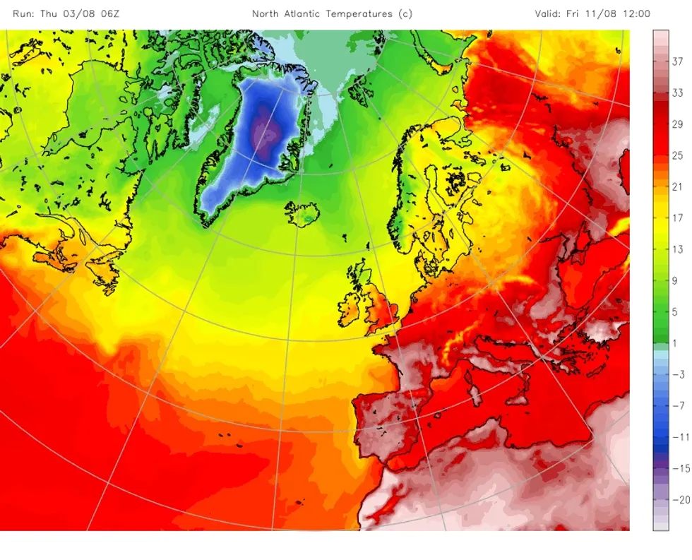
An Azores plume looks set to trigger a scorching heatwave in the United Kingdom as weather maps turn red
|Netweather
A total of 20 flood alerts are also in place today, England’s Environment Agency and Natural Resources Wales have confirmed.
Despite NetWeather’s forecast, the Met Office’s long-range outlook suggested unsettled conditions for the remainder of August.
The UK’s national weather said: “Still fairly unsettled, cool and breezy at the start of this period, with showers and longer spells of rain for most parts of the UK.
“Through the middle of the week, a change in weather pattern looks to occur, with northwest-southeast split developing.
“This means breezy and occasionally wet weather affecting the northwest, courtesy of Atlantic frontal systems, whilst predominantly dry and somewhat warmer weather than of late develops further south and east as pressure rises.
“Towards mid-August, probably remaining changeable overall, though with high pressure perhaps becoming more dominant compared to recent weeks.
“After a cool start, temperatures should recover somewhat to values close to or even a little above average at times, especially in the south.”