


The UK is set for a deluge of swirling wind and rain from the Arctic over the next few days, with cold northerly fronts heading south just as summer gets underway.
Data from weather mapping service Ventusky shows the polar conditions coming down from the far north - with dour, cold weather and rain set to strike by next week.
Ventusky mapping shows spirals of wind and rain circling over the Shetland Islands and the North Sea - with heavy downpours set to pummel North Wales, Northern England, Scotland and Ireland.
As that rain hits, affected parts of the UK should brace for a sharp drop in temperatures; parts of the North West and Scotland are set to average a paltry 8C.
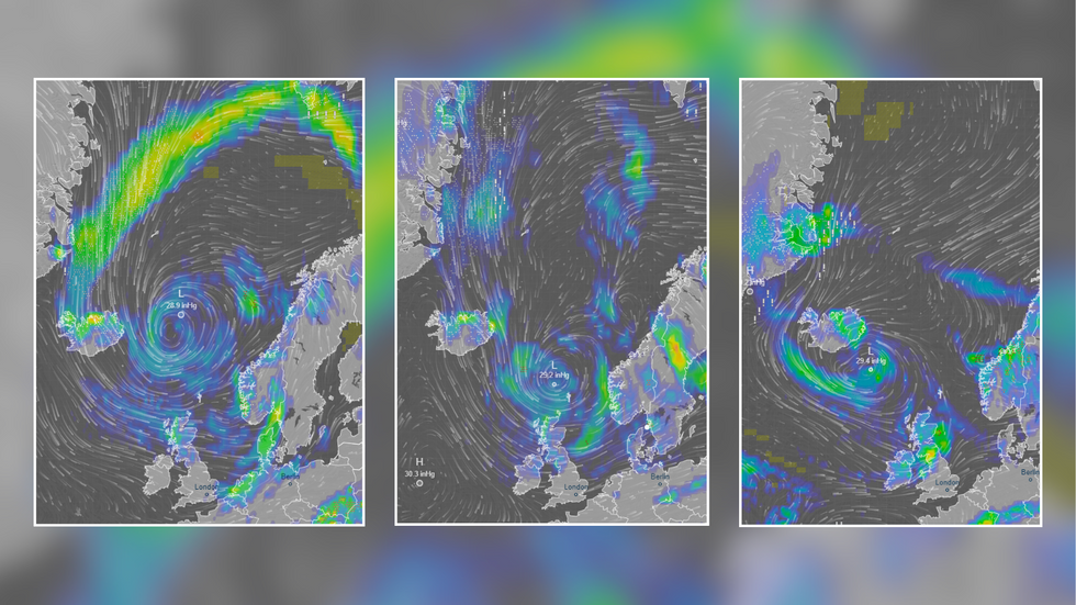
Ventusky data shows rain swirling down from the Arctic to the British Isles
|Ventusky
And it will feel even worse, with Ventusky "feels like" temperature data indicating that factors like wind chill will leave the listed regions languishing as low as 3C.
However, London and the South East will escape the inclement climes, and are set to bask in 18C heat, all while avoiding the rain.
Met Office data also paints a similarly dour picture throughout the start of next week, with bands of rain sweeping across the North Atlantic into the north of the UK, before petering out over the South Coast.
Throughout next week, the Met Office's long-range forecast for June 4-13 says: "It looks likely there will be a split in conditions across the UK.
MORE ON WEATHER:
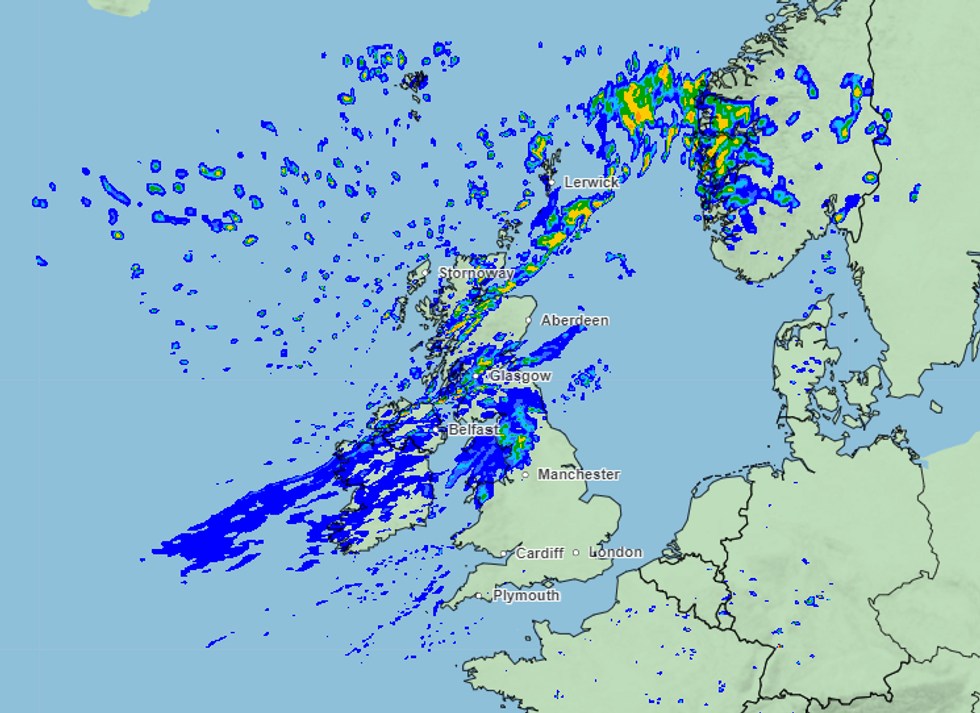
Met Office charts show a similarly dour outlook for next week across the UK
|Met Office
"Further south, higher pressure is likely to continue to dominate, although perhaps with some cloudier interludes and the patchy rain.
"The north is likely to see more in the way of unsettled weather, with a mix of blustery showers and sunny spells.
"Temperatures generally around average in the south, but occasionally rather cool in the north, especially along exposed coasts.
"Thereafter the outlook becomes more uncertain. The south of the UK will probably continue to be drier, although it's not possible to rule out scattered showers at times.
"Cooler and cloudier further northwest, where rain is more likely. Temperatures probably around normal."
While the forecaster's longer-range forecast from June 14-28 says: "Current indications are that the chances of high pressure or low pressure dominating are fairly balanced for this period. There is no strong signal for either dry or wet conditions being the more prominent feature of the weather.
"On balance, it is probable that a continuation of variable, slow moving weather patterns are likely through much of June, similar to that which has been experienced through May.
"However, with potentially slow moving weather systems there is still a chance that longer-lived drier, or even wetter, spells are entirely possible too. Temperatures are most likely to be around or above normal."