


A rollercoaster weather swerve will plunge temperatures before spring warmth returns in time for the Bank Holiday.
Near 30C heat will give way in under 24 hours to chilly winds from the north as a cold front sweeps the nation.
Although temperatures could dip below average for the time of year, sun-loving Britons should not lose hope.
A heat dome of high pressure responsible for this week’s unseasonable warmth is set to return.
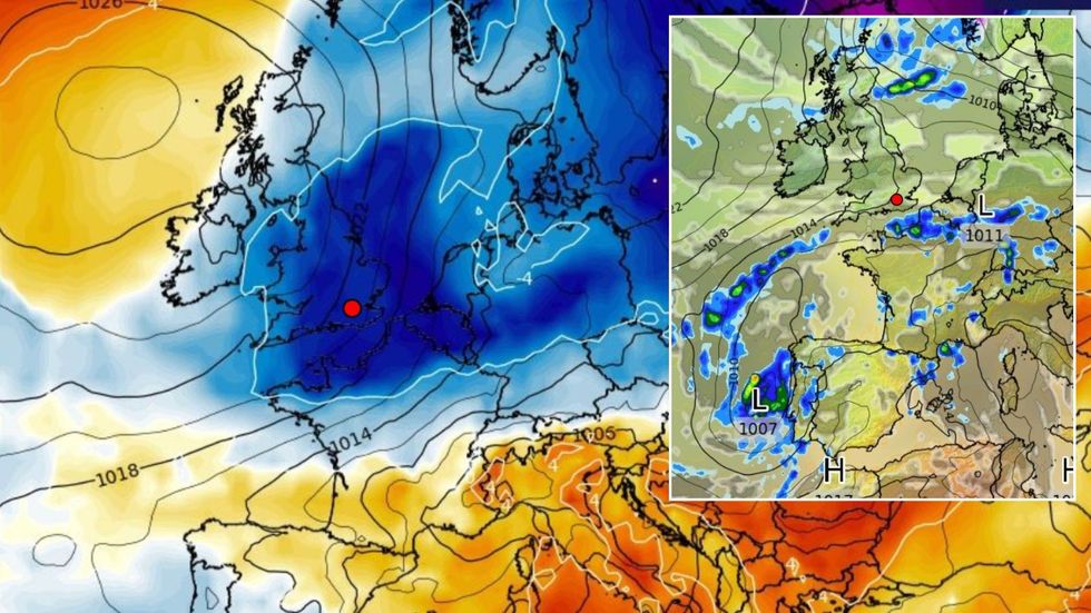
A rollercoaster weather swerve will plunge temperatures before spring warmth returns in time for the Bank Holiday
|WXCHARTS
While temperatures are not expected to reach anywhere near the sizzling heights of yesterday, another week of fine, dry weather is on the menu.
Met Office meteorologist Aidan McGivern said: “On Bank Holiday Monday, we are seeing the trend of high pressure staying with us.
“Although there is some uncertainty where that high pressure is going to sit, it is high pressure sitting close to the UK, maintaining settled weather and for most this weekend is going to be fine.
“In the last few days, there has been a significant trend towards high pressure staying very close to the UK throughout next week.
“Temperatures through next week not far from average, potentially a bit above average, but not remarkable.”
High pressure close to the UK will keep at bay the risk of a post-sunshine deluge, although showers are possible.
As cold air from the north moves into the heat, unstable atmospheric conditions threaten thunderstorms.
Parts of the country could see sporadic downpours, hail and lightning before the next dry spell.
Jim Dale, meteorologist for British Weather Services and social commentator, said: “When you have colder air moving into the warmth, with the pressure patterns set up as they are, there is the risk of atmospheric instability, and this can lead to thunderstorms.
“If these do occur, they will be isolated, but they could be lively.”
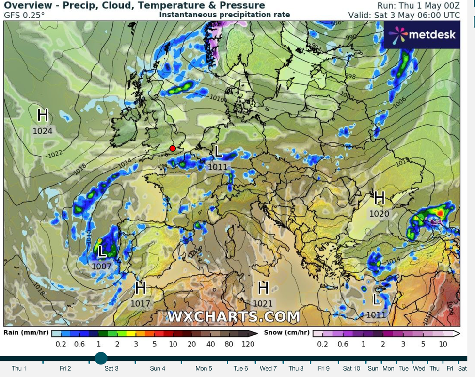
As cold air from the north moves into the heat, unstable atmospheric conditions threaten thunderstorms
|WXCHARTS
A bigger problem, he warned, is continued dry weather through the start of May raising the risk of wildfires.
He said: “The undergrowth is already very dry after the lack of rain so far this spring, and with further dry and potentially warm weather, this will bring the risk of fires.
“Fires are always started by people, or sometimes lightning, but it is the weather conditions that cause them to spread.
“As there is likely to be dry weather through the start of May, this is something we should prepare for.”
Forecasters agree that the hot weather will have peaked and dipped before the weekend.
Temperatures in parts will fall around 10C or more from the mid- to high-20Cs seen widely across the country.
Jason Nicholls, AccuWeather’s lead international forecaster, said: “Later in the week and into the weekend there is the possibility of showers returning even though it will stay mild in parts.
“Into the weekend, there are signs that it will turn cooler, and there will be a greater risk of showers.”