


A topsy-turvy jet stream ‘slicing Britain in two’ will bring a mixed weekend of sunshine and chilly winds before sending the weather ‘into reverse’.
North Sea winds over the next 48 hours will plummet the mercury along eastern coasts while Scotland and the northeast bask in near 20C sunshine.
Then, a jolt in the jet stream will see high pressure responsible for clear skies and spring-like temperatures make a U-turn and head into the Atlantic.
The odd phenomenon, called ‘retrogression’, will keep the UK’s weather yo-yoing into the last week of April.
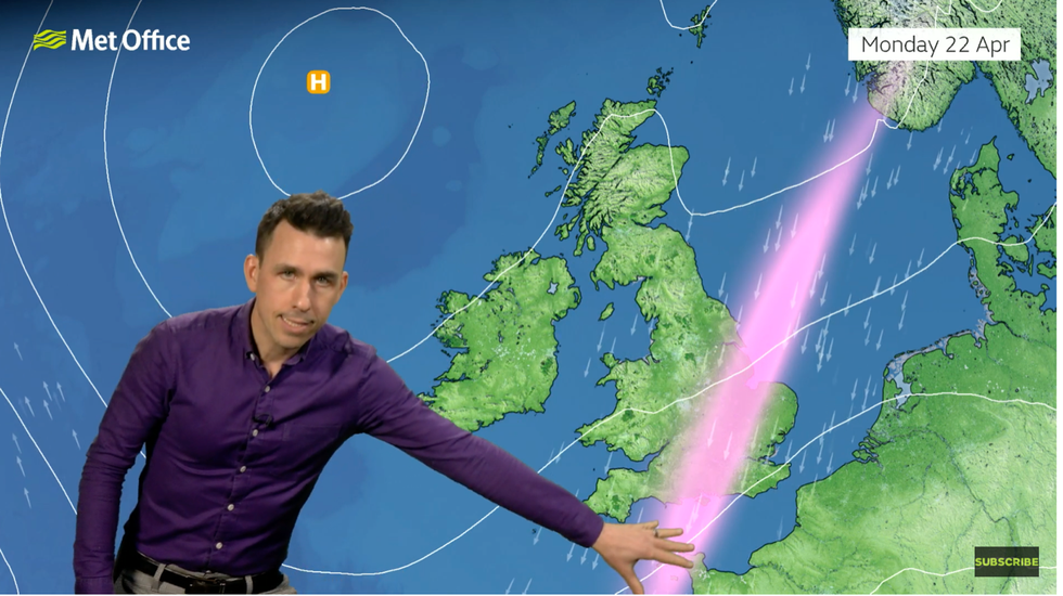
Met Office’s Aidan McGivern shows jet stream slicing the UK in two
|Met Office
Met Office meteorologist Aidan McGivern explained: “At the start of the week, higher pressure is starting to ebb away slightly from the UK and doing what we call retrogression.
“Usually, weather systems move from west to east, but this is moving from east to west.
“On Friday, the high pressure is moving west to east because we have a dip in the jet stream helping to push the western side of the high across the UK.
“By Sunday, with a southerly flow of the jet stream coming out of North America, high pressure will build further west.”
In the meantime, temperatures will rise to 18C or higher in parts of the UK with the northeast in for the best of the weather.
Eastern coasts will be cooler as the jet stream pulls easterly winds in from the North Sea.
LATEST DEVELOPMENTS:
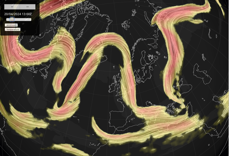
Jet stream swoops over the UK
|Netweather
Mr McGivern said: “There will be an east-west split in temperatures, especially on Sunday with above-average temperatures expected in parts of western and central Scotland, but more than three degrees below average in parts of eastern England.
“The jet stream is slicing central and eastern parts of the UK in two, and it is in this area on Monday that we are likely to see some showers.
“It is feeling cool in the wind off the North Sea in the east, but feeling warm with light winds towards the northwest, and a similar temperature pattern on Monday but that easterly wind picks up a bit more in the east of England.”
Battling pressure patterns have driven Britain’s weather through the past months, unleashing heavy downpours and numerous storms.
Dominant low pressure is eventually expected to give way to high pressure, bringing longer spells of better weather.
However, unpredictable atmospheric patterns threaten to hold out in the run-up to summer with ‘no sign of a heatwave yet’.
Jim Dale, meteorologist for British Weather Services and social commentator, said: “In the long term, the high pressure is likely to collapse and allow a Polar airflow to develop.
“When we do see high pressure, we will get warmer, calmer conditions, but this will home-grown warmth with nothing of any significance coming in from the Continent, so we are not expecting anything exceptional.
“There is no sign of a heatwave yet.”
But with summer on the way, bookmakers are hopeful of a record summer with Coral slashing the odds record May heat from 5-2 to 5-4.
Spokesman John Hill said: “We may have to wait a few more weeks for temperatures to climb, but our betting suggests we are set for a glorious May this year.”