


Christmas-snow hopes are once again melting with Britain’s festive season to be shrouded in a dome of gloom.
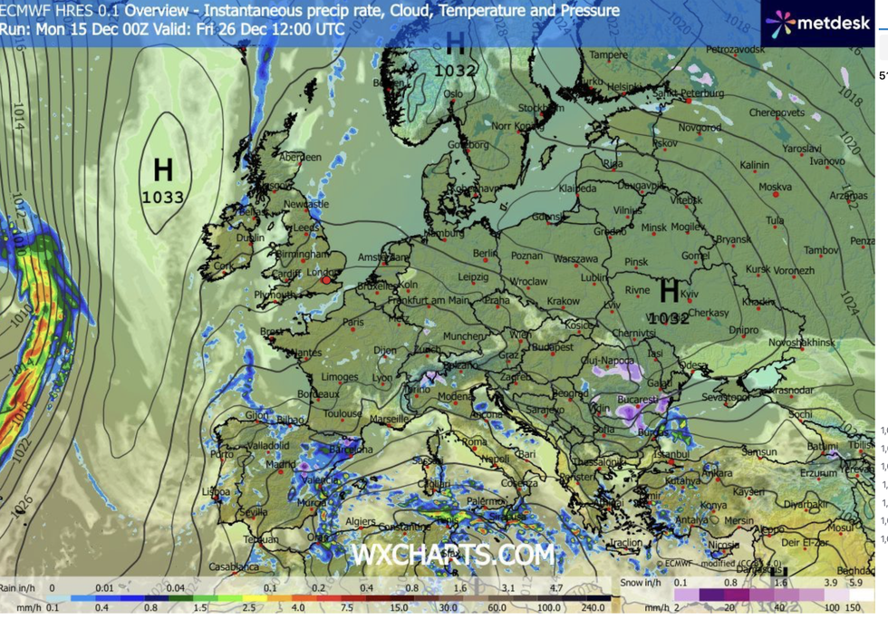
The second half of December will trigger a major change in the weather as the stormy, cyclonic low-pressure pattern retreats.
But instead of crisp mornings, frost or snow, Britain is braced for the return of a melancholy ‘anticyclonic gloom’.
A stubborn high-pressure ‘anticyclone’ will slide over Britain, batting away storms, but trapping a blanket of cloud and fog.
TRENDING
Stories
Videos
Your Say
Jim Dale, meteorologist for British Weather Services, said: “There is a change on the way during the run up to Christmas, with the unsettled weather dying back to something more settled, and potentially colder.
“After the mild temperatures of the past week, we are expecting to see something more usual for the time of year, with a returning risk of frost and cold foggy mornings.
“But instead of rain or snow, it is looking like a settled but grey picture as high pressure settles over the country.”
Torrential rain over the coming days will saturate ground turning swathes of the country into swampland.
The second half of December will trigger a major change in the weather as the stormy, cyclonic low-pressure pattern retreats
|WXCHARTS
Moisture in the ground will steam into the clear skies, Mr Dale explained, hovering in a murky shroud.
He said: “If you put wet ground with high pressure, then you are going to get the risk of mist, fog and low cloud, and this is what we expect.
“This is likely to be a dull and murky high-pressure feature, varying between cloudy and foggy as temperatures drop.
“In terms of snow, although it is too early still to say with certainty, the chances of a White Christmas are now looking very slim.”
LATEST DEVELOPMENTS
Torrential rain over the coming days will saturate ground turning swathes of the country into swampland
|WXCHARTS
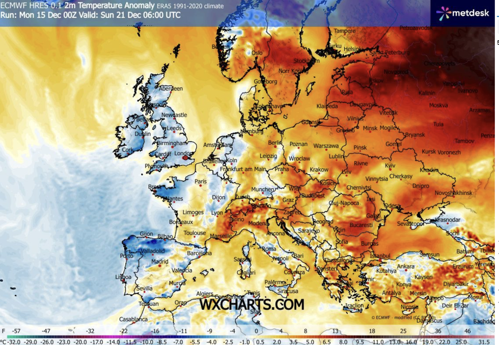
Britain was smothered in anticyclonic gloom through early autumn, driving weeks of grey, dull weather.
High pressure, which blocks stormy low pressure from the Atlantic, acts like a dome, trapping low cloud and mist.
Weather maps show a colossal high smothering Britain on Christmas Day, stretching in from eastern Europe.
Meanwhile, swathes of the country are braced for more torrential rain as alarm bells sound for floods.
As temperatures drop in the run up to mid-week, wintry flurries could dust the tops of the Scottish mountains.
Met Office meteorologist Jonathan Vautrey said: “Tuesday will be quite a chilly start, and with showers shifting to the northwest, there may be a touch of snow over the Scottish mountains.
“Sunshine will gradually start to filter into parts of the country, so it is overall a better day to come.
“We are in a fresher airmass, so temperatures will be more where they should be for December.”
Rain will ease through the middle of the week before the risk returns of another drenching, experts warn.
Netweather’s Terry Scholey said: “Although briefly somewhat finer towards mid-week, the mild and at times wet weather returns, particularly to the north and west.
“It remains unsettled into next weekend, but in the run-up to Christmas there are definite signs of it turning colder.”