


Britain’s weather is under threat from a 62mph major hurricane hurtling across the Atlantic.
Hurricane Gabrielle, currently targeting the east coast of America, is forecast to make a hairpin turn and head towards the UK.
It would not impact until later in the month giving Britain’s weather through the second half of autumn a shake.
If Gabrielle’s remains steer directly across the UK, it could bring stormy weather, while a northerly track would drive settled warmth.
TRENDING
Stories
Videos
Your Say
Jim Dale, meteorologist for British Weather Services, said: “By the time this comes to us, it will be an ex-hurricane, and this may have an influence on our weather later in the month.
“It looks like it will end up between Iceland and Scotland, and if this happens, the most likely outcome is for it to draw air up from the south bringing a warmer spell.
“It is still a way off, though, and something that we will be watching over the next week or so.”
Hurricanes never reach the UK intact, instead they die over the cool waters of the North Atlantic leaving their remains.
LATEST DEVELOPMENTS:
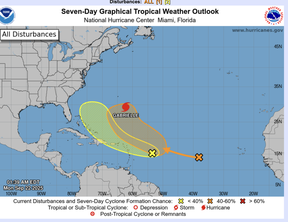
Hurricane Gabrielle is currently targeting the east coast of America
|NOAA
These bubbles of energy can sweep into the jet stream and bring changes to our weather.
Gabrielle is one of two tropical storms currently swirling in the tropics, with more almost certain to follow.
Dale said: “The Atlantic has been quiet so far this season, so Gabrielle is likely to be followed by further systems as the tropics wake up.
“These could bring some changes to the British weather, possibly triggering the first named storm of the year, Amy, which is now overdue.
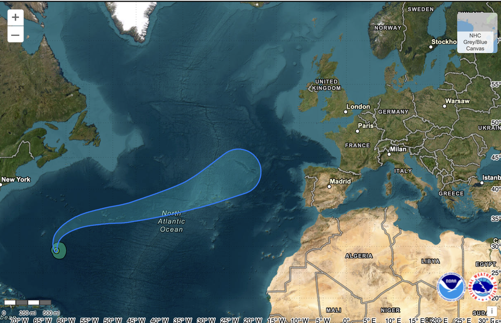
Hurricanes never reach the UK intact, instead they die over the cool waters of the North Atlantic leaving their remains
|NOAA
“I think there will be an uptick in activity in the Atlantic over the coming weeks and through the rest of autumn.”
Meanwhile, Britons braving the dipping and diving weather will be switching between t-shirts and jumpers.
A frenetic jet stream after steering bouts of wind and rain in from the Atlantic will favour calmer periods of high pressure.
Temperatures by day this week will lift into the mid- to high-teens before plunging below freezing overnight.
Met Office meteorologist Alex Deakin said: “There is quite a strong signal for high pressure to be sitting close to the northern half of the UK.
“This will bring something cooler in, but a lot drier compared to September, but it also means there is a good chance of seeing some lengthy spells of sunshine.
“There is a question mark over whether it could stay showery over East Anglia.”
Government meteorologists will be keeping a close eye on Gabrielle as she crosses the Atlantic, he added.
He said: “As it drifts northwards, it can influence our weather by mixing up things with the jet stream and adding more uncertainty as we head towards the back end of the week and into next week.
“So, we will be keeping a close eye on this system.”