


A "messy" jet stream that looks set to join forces with storms over the Bay of Biscay threatens to crash parts of Britain with a bank holiday washout.
Families heading out for the long weekend are warned to prepare for torrential downpours and thunderstorms.
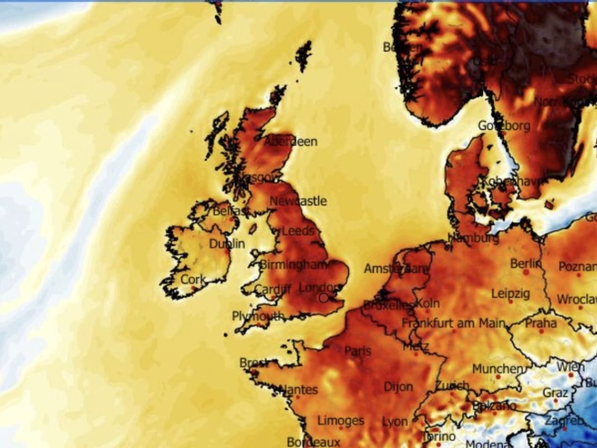
Northerly winds will topple thermometers from their 26C highs as Britain braces for a bank holiday "mish mash".
To blame, in part, is the jet stream, the channel of fast-flowing air in the atmosphere, which has fragmented over the country.
Met Office meteorologist Alex Deakin said: “On Friday, we are going to see higher temperatures, and in the London area it could get to 26C in the sunshine, but then we are definitely in for something of a change.
"The jet stream is in a bit of a mess, with an arch to the north allowing high pressure to sit over us, but other elements of it are in a real mish-mash.
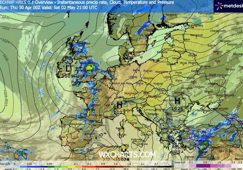
"Low pressure over the Azores gets a push and joins forces with another low in the Bay of Biscay, and this will push up with warmer air and an increasing risk of showers."
The first rattle is forecast into the start of the weekend before downpours turn heavier over the bank holiday.
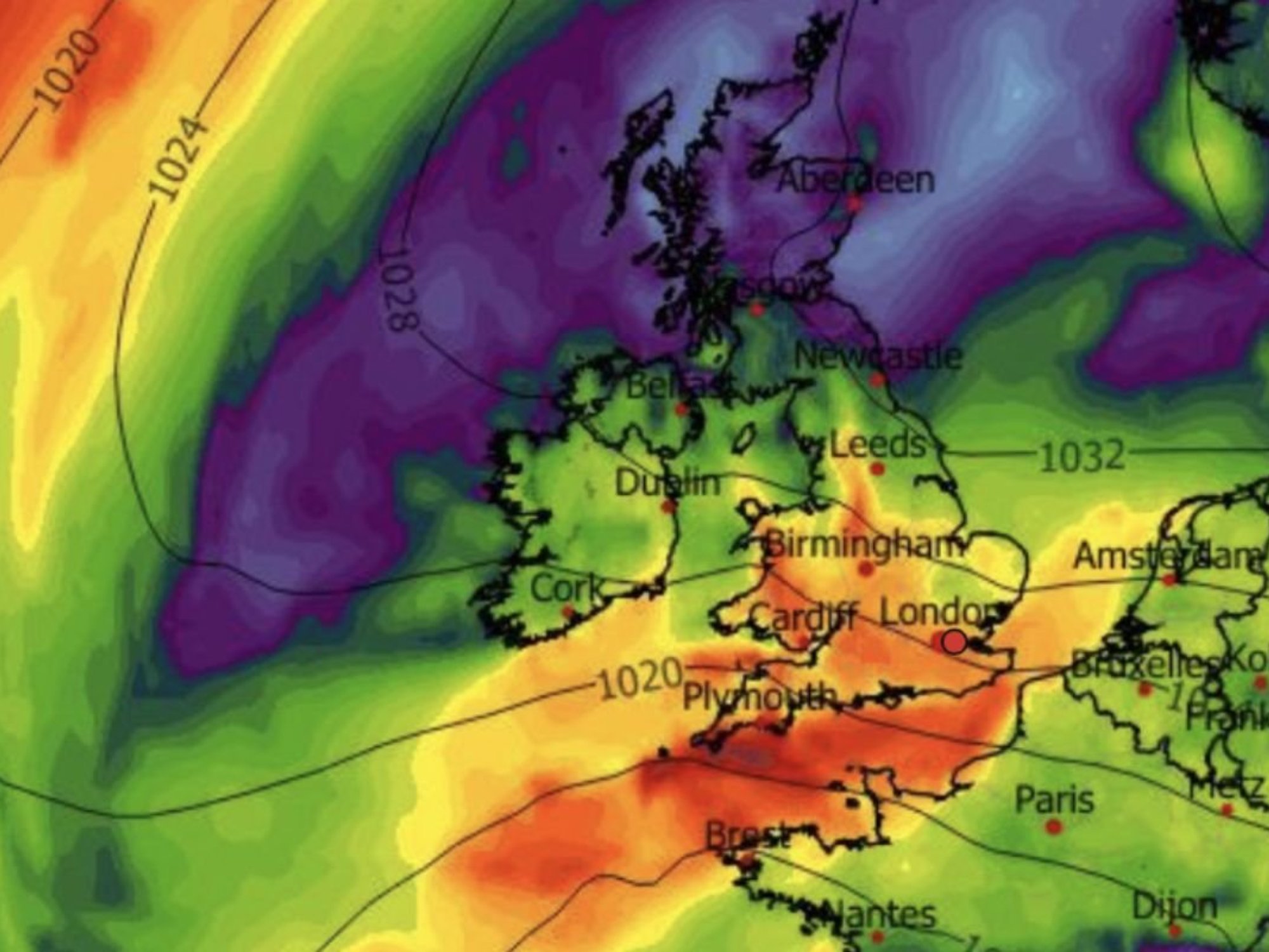
Rain is expected to hit the UK over the weekend
|WXCHARTS
Southern counties will take the brunt of it, while Scotland and the north escape with largely dry sunshine.
As unstable air and humidity sweep in from the continent, it will spark a risk of thunderstorms, Mr Deakin warned.
He said: “On Sunday and Monday, we are expecting showery rain to drift up from the south, and it is likely to be heavy with the potential for some thunderstorms and some intense downpours, but how far north it gets is open to doubt.
“It is going to turn more showery in the south, and more northern areas may be dry with the brightest weather, and it could be one of those cases where some areas get a real soaking and others don’t get any.
LATEST DEVELOPMENTS
“If you have weather-dependent plans, keep up with the forecast.”
Tussling weather patterns will throw chilly gusts into the mix, he added, bringing a brisk start to May.
He said: “We are potentially getting something cooler in from the north, because as the low approaches from the south, there is some colder air trying to come in.
“This pattern is how we are set up into next week with cooler air to the north, low pressure close to the southeast, and high pressure moving in from the west, and it will be a case of which one will win out.”
High pressure, the driver of the fine start to spring, will lose its clout through the last month of the season.
Energy in the atmosphere from humidity and warmth from the tropics will swap blue skies for electrical downpours.

Temperatures will still reach 20C over the bank holiday
|WXCHART
Jim Dale, meteorologist for British Weather Services and co-author of ‘Surviving Extreme Weather’, said: “By the time we get to the end of April, we are going to see a significant change in the weather.
“High pressure is going to lose to low pressure, and this means that the April showers we have not seen so far will arrive in May.
“Because of high humidity, thunderstorms are going to be an ongoing risk.”