


Britons should enjoy the next 48 hours of warm sunshine before a bank holiday weekend U-turn brings gales and torrential rain.
Shifting weather patterns will shunt blue skies and golden rays for thundery downpours, plunging temperatures and frost.
High pressure behind the long, dry start to spring will shift towards Europe, opening the doors to ‘unstable’ winds.
Scotland and the southwest of England are first in line for unsettled weather as ‘subtle changes’ set in tonight.
Met Office meteorologist Clare Nasir said: “Through Wednesday evening, high pressure drifts towards Denmark, and we inherit more of a southeasterly wind.
“The wind will pick up most across eastern Scotland through Thursday, and we see the beginnings of showery rain across the southwest pushing ever northwards.
“The wind will be strong across the southwestern quadrant.”
Daytime temperatures through the middle of the week in parts will hit the mid-20Cs before tumbling overnight, she warned.
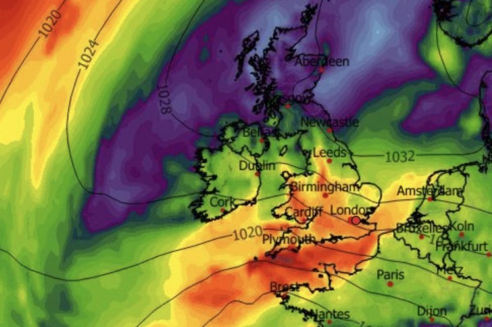
High pressure behind the long, dry start to spring will shift towards Europe, opening the doors to ‘unstable’ winds
|WXCHARTS
While much of the country will bask in mid-spring warmth for the next couple of days, the weekend signals a sharp change, she added.
She said: “Along the south coast, there is a chance we could see the winds touching gale force.
“It will feel warm in the sunshine with 21C or 22C for the Home Counties, and because the breeze is coming in from a southerly direction, there will be a difference along the eastern side with temperatures of 19C and 20C.
“There are some subtle changes Thursday into Friday, and the air will be more humid, and low pressure will bring unstable conditions with the chance of showery bursts which could turn thundery.
LATEST DEVELOPMENTS
“Temperatures on Tuesday evening will be lower than Monday night, and there could be frost across northern areas as the wind picks up across England and Wales.”
Britian’s settled weather since the start of spring is the result of ‘anticyclonic’ high pressure.
High pressure pushes air high in the atmosphere to ground level, driving clear skies and rising temperatures.
As this dome of high pressure shifts, low pressure will get more of a chance to shake up the weather.
Jim Dale, meteorologist for British Weather Services and co-author of ‘Surviving Extreme Weather’, said: “High pressure is going to hold out until Thursday or Friday, and then there is going to be a change.
“There is going to be a risk of heavy rain in parts of the country, and this could be thundery as the atmosphere becomes more unstable.
“By the time we get to the end of April, we are looking at some proper downpours.”
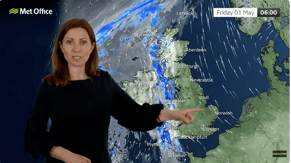
Met Office meteorologist Clare Nasir said: 'Through Wednesday evening, high pressure drifts towards Denmark, and we inherit more of a southeasterly wind'
|MET OFFICE
Rain will be welcome in parts of the country that have seen none in weeks, although it may trigger flooding, he warned.
He said: “The ground is very dry in parts, so while the rain will be welcome, it may run off quickly and this could bring the risk of flooding.”