


Torrential rain forecast for at least another fortnight has sparked fresh warnings for a Christmas flood nightmare.
A relentless "conveyor belt" of Atlantic storms threatens to push rivers and water tables to bursting point.
Instead of crisp cold and snow, forecasts in the run up to Christmas feature persistent rain, thunder and hail.
A weekend deluge could be the tipping point for chaos reminiscent of the 2013 floods, which submerged swathes of southern and southeastern Britain.
TRENDING
Stories
Videos
Your Say
Jim Dale, meteorologist at British Weather Services, said: “During the second week of December, it doesn’t look pretty with more very unsettled weather systems coming into the UK.
“These are going to bring a lot of rain, and the jet stream is not going to give up pulling them in from the Atlantic.
“Some areas are looking at over 100mm of rain [four inches] during the period.”
Torrential downpours will be bridged by long spells of persistent showers as water levels rise.
Around three or four potential storm systems are lined up on a "conveyor belt" to hit Britain, Mr Dale warned.

WXCHARTS is forecasting a particularly damp December
|WXCHARTS
He said: “There are up to four low-pressure systems will associated fronts due to arrive in the next 10 days, and so we are looking at a conveyor belt pulling in more bouts of heavy rain.
“As we get closer to Christmas, we are looking at a serious risk of flooding, and I am expecting warnings for this to be issued.
“There could be snow over high ground where temperatures are lower, but for the next week or more the issue and potential for disruption is going to come from the rain.”
Britain’s miserable weather is being driven in part by a strong jet stream coming out of a big freeze in the US.
LATEST DEVELOPMENTS
Crashing into a huge region of high pressure to the east, the jet will stall, causing stormy weather systems to linger over the UK.
Persistent rain will hold out through the next week at least, according to Government forecasters.
Met Office meteorologist Annie Shuttleworth said: “The jet stream is in full force throughout this week and next week, and that is what is driving the repetitively unsettled weather and a series of low-pressure systems to push across the UK.
“The jet stream is driven by a temperature contrast in the mid-Atlantic, and we have a particularly potent contrast across Canada with cold air from the Arctic and mild air from the south.
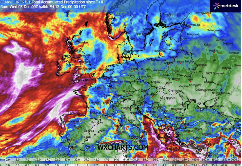
Rainfall totals will mount up in the UK, especially compared to the rest of Europe
|WXCHARTS
“Through this week we will see a series of low-pressure systems up to the north and the northwest of the UK, and they will develop up to the northwest.
“As well as the strong jet, we have high pressure over eastern Europe and Russia, and this is stopping those systems from moving further, and they are not making much progress, so we are going to get persistent rain.”
A Met Office spokesman added: “Showers will be most prevalent in western areas, gradually increasing rainfall totals through the week.
“Most regions will see at least some rain, but the west will bear the brunt, and while no single day is expected to bring exceptional rainfall, the already saturated ground, combined with heavy rain earlier in the week, means there is a continued risk of travel disruption and localised flooding.”