


An Arctic storm smashing into -15C winds sweeping the UK will unleash a torrent of hail, sleet and snow.
As winter’s first bite tightens its icy jaws, temperatures through the next 24 hours will plummet to their lowest in months.
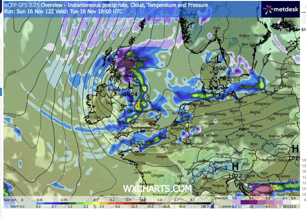
In tandem, a low-pressure cyclone to the northwest will sweep a band of rain in from the Atlantic.
As its moisture meets sub-zero temperatures, ‘battle’ lines will be drawn putting swathes of the country at risk of snowfall.
TRENDING
Stories
Videos
Your Say
Jim Dale, meteorologist for British Weather Services, said: “A low-pressure system is coming in around Wednesday, and I wouldn’t be surprised to see wintry showers of sleet, hail and snow which will be the first of the season in places.
“Further north, over the hills and mountains of Scotland, this could settle and hang around with temperatures probably going to stay below freezing through the week.
“Where the two air masses meet, there is going to be a battle ground, between the first taste of winter and the milder residue of autumn.”
Temperature predictions for this week are falling by the day with latest models predicting minus 11C in the north and elsewhere between freezing and -7C.
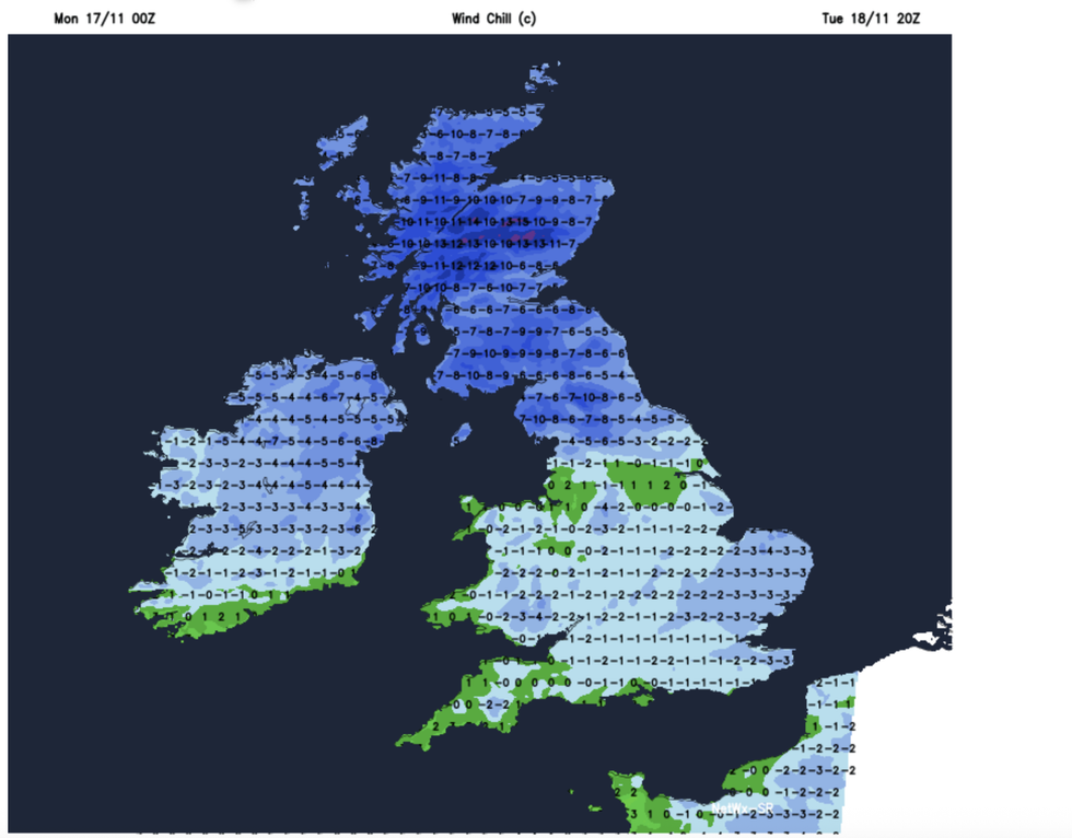
Britons are feeling the pinch of winter
|WX CHARTS
The UK Health Security Agency (UKHSA) has issued warnings across northern and central England for ‘significant impacts’.
A spokesman said: “There could be increased demand for remote healthcare services, impacts on the workforce affecting delivery of services, and challenges keeping indoor temperatures at the recommended 18C leading to more risk to vulnerable people.”
Blustery winds will make it feel close to minus 15C in Scotland with widespread windchills of between minus 2C and minus 10C.
As cold air ‘plunges’ from the Arctic, sweeping Atlantic rain will bring hill snow and possibly flurries to lower ground.
LATEST DEVELOPMENTS:
Temperatures will be sent tumbling
|WX CHARTS
Met Office meteorologist Honor Criswick said “Very cold air is plunging all the way down from the Arctic and spreading down across the country.
“There will be some very blustery winds, possibly adding on to the windchill, and there are perhaps some more organised bands of rain pushing into colder air, so there is a chance we could see some more significant snow across the hills but potential falling to lower levels.”
Met Office warnings for ice and snow are possible through the coming days as the cold snap grips, she warned.
As a low-pressure cyclonic system moves in from the north, the risk will grow of ‘significant snow’, she added.
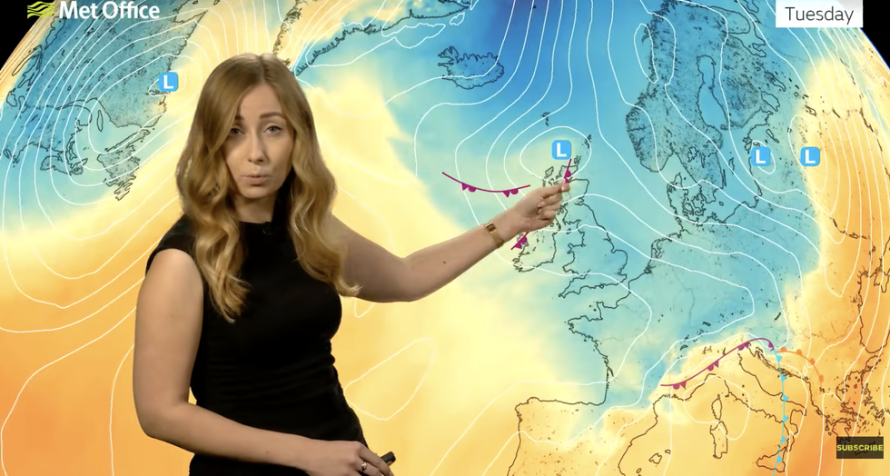
Honor Criswick describes cold air meeting low pressure
|MET OFFICE
She said: “There is a system in the northwest which we need to keep an eye on, showers and longer spells of rain falling into that colder air will bring the chance of more significant snow.
“There is a chance we could see some Met Office warnings.”
A Met Office spokesperson added: “As colder air digs in, there is a reasonable chance of sleet and snow in northern Scotland, with the risk spreading further south into Northern Ireland, northern England, and North Wales by Tuesday.
“The middle and end of the could see a more widespread wintry spell if a weather system moves south, with some models suggesting a 20-per-cent or greater chance of more than a centimetre of snow even in southern parts of the country.”
Our Standards: The GB News Editorial Charter