


The Met Office has issued a 15-hour warning for snow and ice as a cold snap is set to send temperatures plummeting.
The forecaster has warned up to 10cm of snow could fall in some parts of Scotland on Tuesday.
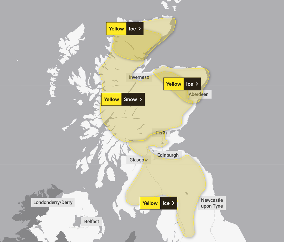
A yellow weather warning for snow is in place from 3am until 6pm on November 18 and affects areas including Central, Tayside and Fife, Grampian, Highlands and Eilean Siar, Strathclyde, parts of the North of England, and Yorkshire.
The Met Office warned the wintry conditions could lead to travel disruption, including on the roads and public transport.
It said: "An area of rain will reach the west of Scotland early on Tuesday, before pushing erratically south and east through the morning, easing and clearing into the afternoon.
"Whilst there is some uncertainty as to the exact track and extent, a period of snow is likely over high ground, with accumulations of two to five cm possible above about 150 metres elevation and as much as five to 10cm above 400m."
Those living in the affected areas have been advised to keep essentials in their cars, such as an ice scraper and water, and follow local weather forecasts.
Additional yellow weather warnings for ice have been put in place on Tuesday affecting areas such as Grampian, Highlands & Eilean Siar, Central, Tayside and Fife, the North East, North West, South West Scotland and the Lothian Borders, Strathclyde and Yorkshire and Humber.
Several yellow weather warnings have been put in place across the country tomorrow
|MET OFFICE
"Scattered showers will feed into the northeast and far north of mainland Scotland, bringing a risk of icy conditions on roads and pavements, resulting in difficult driving conditions," the Met Office stated.
Widespread cold conditions and some wintry hazards are expected across the UK throughout the week.
The coldest night since March was recorded on Saturday, November 15, when temperatures dropped to minus 7C in Tulloch Bridge in the Highlands.
A series of flood alerts and amber weather warnings were put in place last week as Storm Claudia swept across Britain, bringing heavy downpours.
LATEST DEVELOPMENTS:
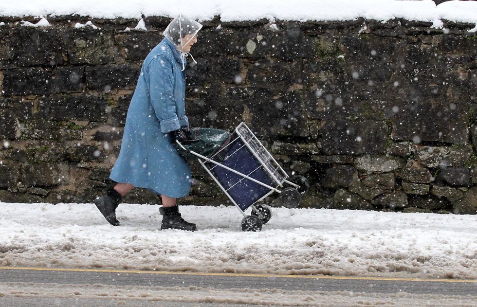
Snow is expected to fall in parts of Scotland tomorrow (file photo)
|PA
Met Office deputy chief meteorologist, Dan Holley, earlier said: "As Storm Claudia retreats to the south, high pressure to the north west will drive a cold northerly flow from the Arctic across the UK.
"This will bring much colder conditions than of late and, whilst generally drier than recent days, there will also be a risk of wintry hazards, such as snow and ice.
"There will be widespread frosts across the UK, with temperatures dipping as low as minus 7C in places next week, and daytime temperatures staying in single figures across the country."
Beyond Tuesday, another snow and ice warning is in place from 6pm on Wednesday until 9pm on Thursday.
The warning stretches across Central, Tayside & Fife, Grampian, Aberdeenshire, Highlands & Eilean Siar, Orkney & Shetland, and Strathclyde.
The Met Office warned: "Snow showers will feed inland on brisk northerly winds from late Tuesday through Wednesday and into Thursday, giving significant accumulations in places.
"Whilst there will be a lot of regional variation in amounts, where showers are most frequent 2-5cm will be possible at low levels, with 5-10cm on hills above about 100m elevation, and potentially as much as 15-20cm above 300m."
Our Standards: The GB News Editorial Charter