


Britons will be able to get the suncream back out as the mid-April chill simmers to a 70F weekend climax.
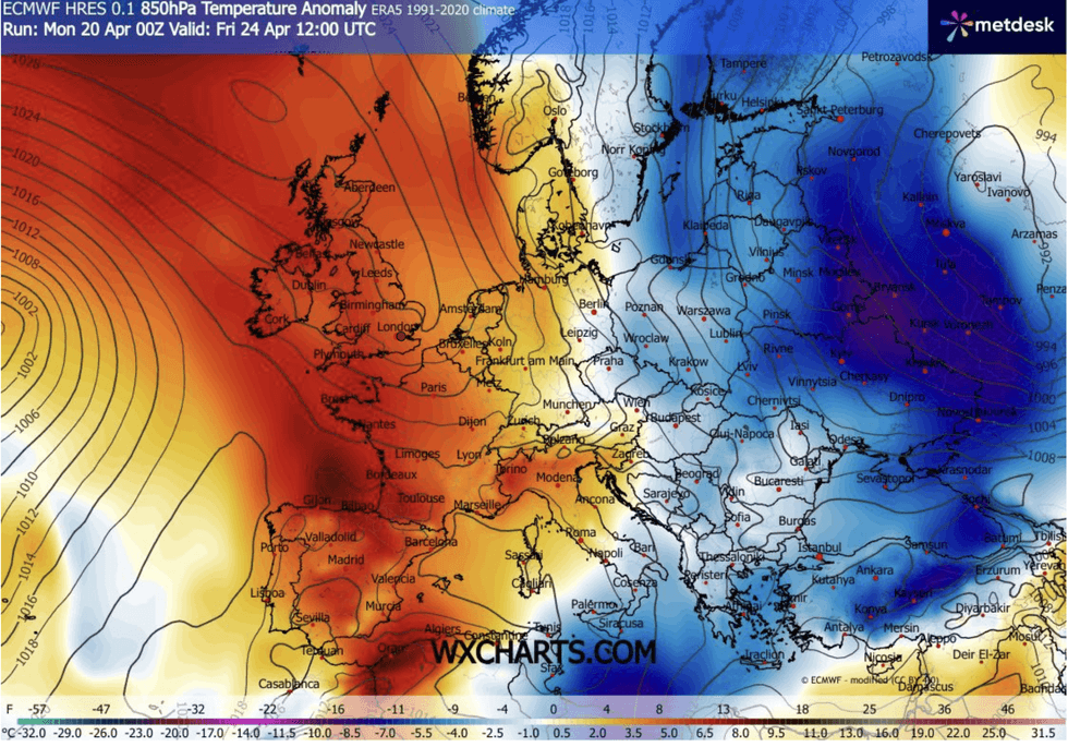
Chilly easterly winds keeping North Sea coasts in the freezer will eventually lose the battle to a high-pressure heat dome.
Clear skies and strong sunshine will rocket the mercury widely with highs of 20C or above forecast for the end of April.
Southern and western regions, under the full glare of the dome, will catch the highest temperatures while chilly winds dog eastern fringes.
TRENDING
Stories
Videos
Your Say
Met Office meteorologist Alex Burkill said: “There is plenty of dry, sunny and rather warm weather to come for many of us this week.
“We have high pressure to the north of us, and it is going to be firmly in control and that is why it is going to be largely dry.
“Temperatures are rising into the mid-teens, a little bit fresher where you are exposed to the breeze from the North Sea, but further west the mid-teens are most likely and it will feel warm in the sunshine”
A cyclonic storm gnashing at the southwest coast threatens to stir things up across the south during the middle of the week.
Mid-April chills will give way to glorious plumes of sun
|WX CHARTS
Gusts of 50mph or more could topple temperatures before the strength of the mid-spring sun turns up the thermostat.
Mr Burkill said: “Towards the southwest, things will turn cloudy, and there will be outbreaks of rain, but elsewhere it is a largely dry day with plenty of sunshine, and we are looking at temperatures of 17C, 18C or 19C across the south east and across some western parts.
“If you are stuck under the cloud towards the North Sea it is going to feel pretty cool or cold, and there are strong g winds to the south and southwest, with gusts around 50mph or stronger.
“Then towards Wednesday night, the high pressure to the north is firmly in control.
LATEST DEVELOPMENTS
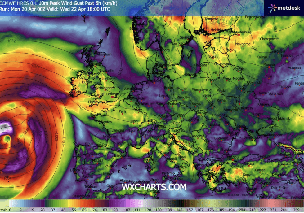
A deepening storm is hovering off the UK coast
|WX CHARTS
"Temperatures day-by-day are going to be rising and more likely to get into the high teens or perhaps the low 20Cs for some parts towards the south and the west.”
Meteorologists are keeping their eyes on a deepening storm system hovering off the UK coast.
While no warnings have been issued, southern regions could be facing a blast of autumnal gales.
The Met Office’s Honor Criswick said: “The main thing we need to watch on Wednesday, is the speed of the wind particularly across the southwest.
“In many areas it is going to be warm, but across the east it is going to be mostly cloudy and feeling a lot cooler.”
Britan has turned into a battleground between high pressure to the north and low pressure close by in the Atlantic.
Typically, during the run into summer, high pressure grows to the south, drawing tropical winds.
However, with the high to the north, temperatures chilly gusts from the east could blunt temperatures.
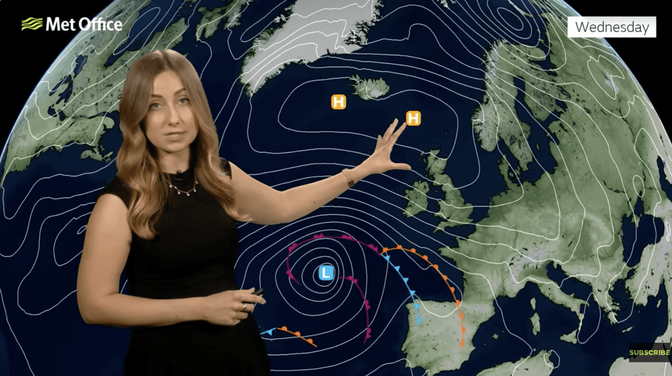
A week dominated by high pressure is on the way
|MET OFFICE
Met Office meteorologist Tom Morgan said: “We are expecting the week ahead to be dominated by high pressure.
“It is not going to be entirely dry, and there will be one or two showers, perhaps, at times.
“And it is not going to be wall-to-wall sunshine either, but where we do see the sunshine in the west, it will feel pleasantly warm.”
Jim Dale, meteorologist for British Weather Services, and co-author of ‘Surviving Extreme Weather’, said: “The sun at this time of year is starting to get stronger, so there will be high levels of UV, meaning if temperatures are not that high, there is still a risk of sunburn.
“It will feel pleasant under clear skies, but there could be some very wide swings in temperature from overnight and morning into the day.”