


The UK looks set for warmer weather in just a few days time after Britons were battered by torrential downpours.
Hotter temperatures will coincide with increased sunshine later this week amid fears summer has been and gone.
Forecasters at NetWeather have dated when to expect the change in temperatures.
In its forecast, NetWeather said: “Next weekend looks like settling down for all, as high pressure builds in, with increasing sunshine and warmth, though there could still be a few isolated showers.
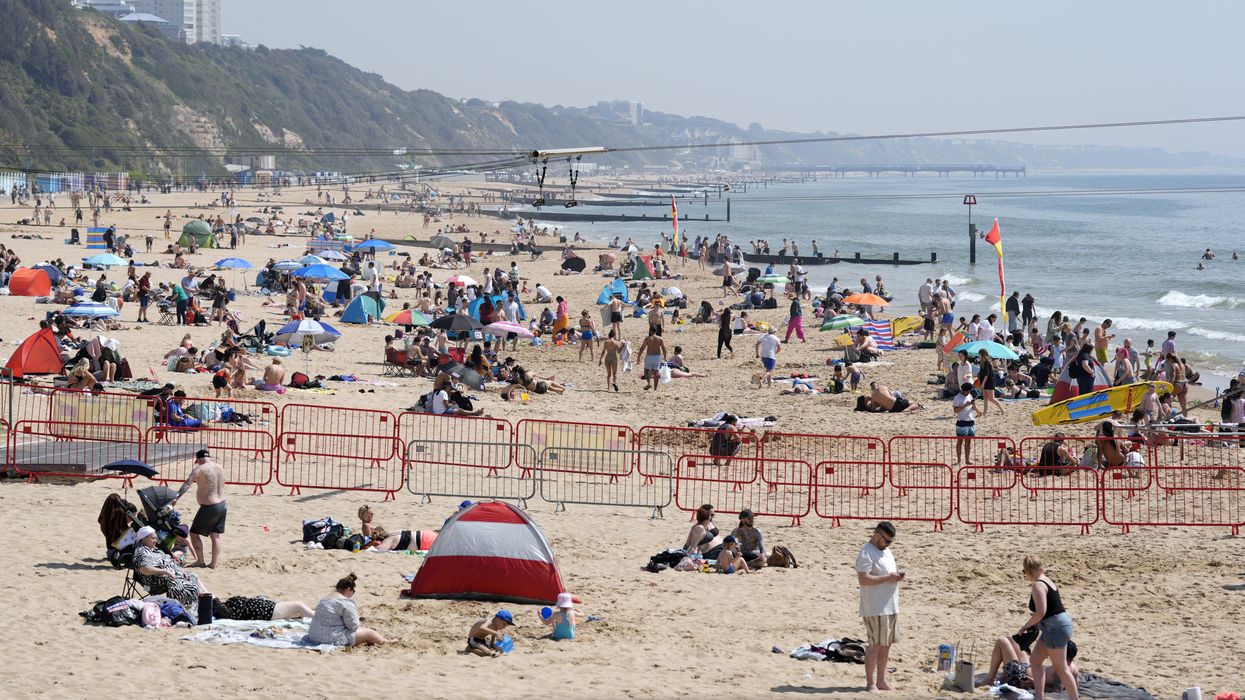
 People enjoying the sunny weather on Bournemouth Beach in Dorset | PA
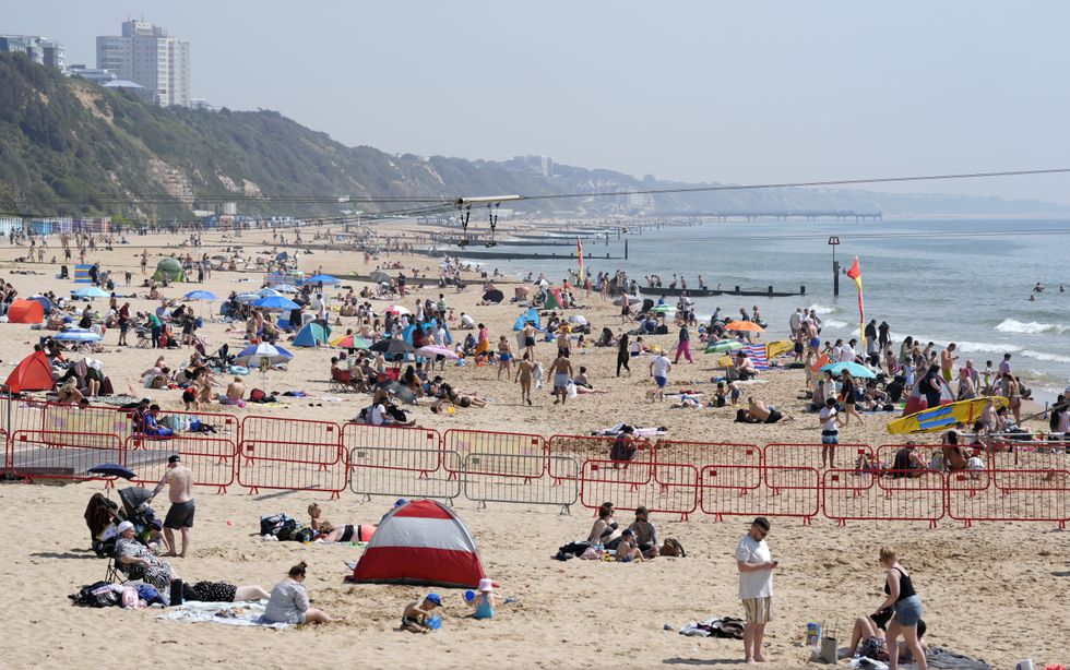
“High pressure may not last into next week though, with signs from ensembles for low pressure to return from the west.”
NetWeather is forecasting temperatures of around 22C in the East of England on July 14.
London, which is currently hosting Wimbledon, will also likely see temperatures hit 22C.
However, Wales, Scotland and Northern Ireland will struggle to see mercury exceed 20C.
LATEST DEVELOPMENTS: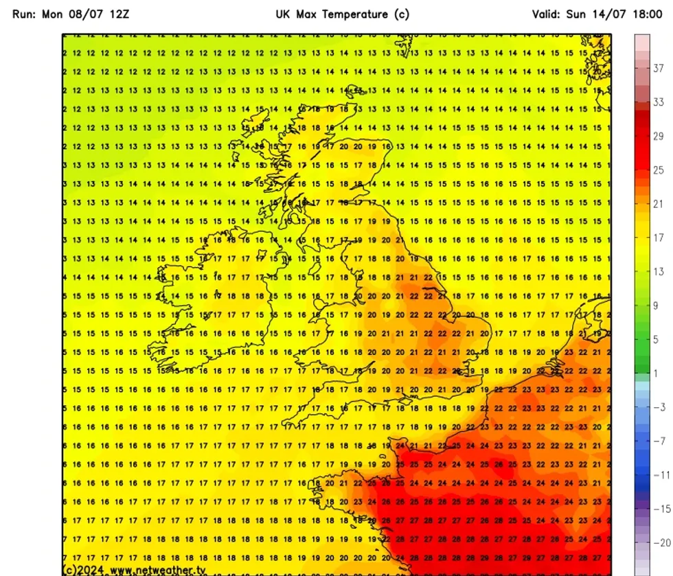
NetWeather's forecast for July 14
|NETWEATHER
Despite the expected rise in mercury, the UK is currently facing yellow weather warnings.
Yellow rain warnings have been issued across Wales, Scotland and the South West of England on Tuesday.
The warning remains in place in North East Scotland on Wednesday.
The Met Office’s Wales and South West warning said: “After a generally cloudy day with showers, more persistent rain will push north this evening and overnight.
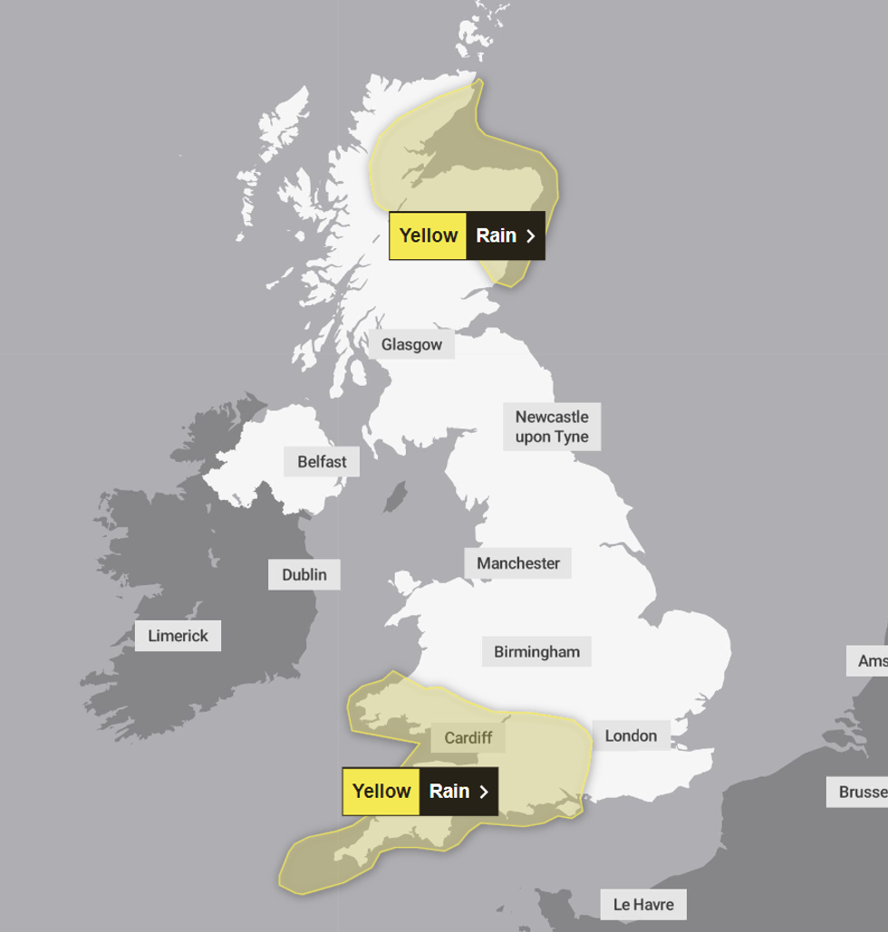
Met Office's weather warnings for Tuesday
|MET OFFICE
“Rain will be persistent and heavy at times, particularly so for hills, moors and headlands exposed to brisk winds.
“Most of the warning area will see 20-40 mm of rain, with as much as 60-70 mm possible for some areas, for example Dartmoor and Exmoor.
“Rain should ease from the south during the night, clearing to scattered showers by morning.”
The warning facing Scotland added: “Areas of rain moving into northern Scotland from late Tuesday into Wednesday are expected to become heavy with some embedded showery outbreaks as the band slows down and focusses across the east coast and Moray Firth.
“20-30mm through the period is expected quite widely, however, localised heavier bursts of rain likely to build totals toward 50-75mm with up to 90mm possible across the Grampians and Northwest Highlands.”